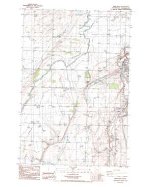
Mesa West Topo Map Washington
To zoom in, hover over the map of Mesa West
USGS Topo Quad 46119e1 - 1:24,000 scale
| Topo Map Name: | Mesa West |
| USGS Topo Quad ID: | 46119e1 |
| Print Size: | ca. 21 1/4" wide x 27" high |
| Southeast Coordinates: | 46.5° N latitude / 119° W longitude |
| Map Center Coordinates: | 46.5625° N latitude / 119.0625° W longitude |
| U.S. State: | WA |
| Filename: | o46119e1.jpg |
| Download Map JPG Image: | Mesa West topo map 1:24,000 scale |
| Map Type: | Topographic |
| Topo Series: | 7.5´ |
| Map Scale: | 1:24,000 |
| Source of Map Images: | United States Geological Survey (USGS) |
| Alternate Map Versions: |
Mesa West WA 1986, updated 1986 Download PDF Buy paper map Mesa West WA 2011 Download PDF Buy paper map Mesa West WA 2014 Download PDF Buy paper map |
1:24,000 Topo Quads surrounding Mesa West
> Back to 46119e1 at 1:100,000 scale
> Back to 46118a1 at 1:250,000 scale
> Back to U.S. Topo Maps home
Mesa West topo map: Gazetteer
Mesa West: Airports
Hathaway Ranch Airport elevation 242m 793′Slinkard Airfield elevation 273m 895′
Mesa West: Canals
DPE Thirtynine elevation 226m 741′Mesa West: Dams
Bernsens 810 Reservoir Dam Number One elevation 235m 770′Bernsens 810 Reservoir Dam Number Three elevation 248m 813′
Bernsens 810 Reservoir Dam Number Two elevation 247m 810′
Bernsens Duck Pond Dam elevation 247m 810′
Mesa West: Lakes
Bailie Pond elevation 267m 875′Clark Pond elevation 231m 757′
Mesa Lake elevation 228m 748′
Worth Lake elevation 237m 777′
Mesa West: Parks
Poe Park elevation 209m 685′Mesa West: Populated Places
Edwards elevation 208m 682′Mesa elevation 210m 688′
Mesa West: Reservoirs
Bernsens 810 Reservoir elevation 235m 770′Duck Pond elevation 247m 810′
Mesa West: Valleys
Old Maid Coulee elevation 209m 685′Mesa West digital topo map on disk
Buy this Mesa West topo map showing relief, roads, GPS coordinates and other geographical features, as a high-resolution digital map file on DVD:


