Riverland Topo Map Washington
To zoom in, hover over the map of Riverland
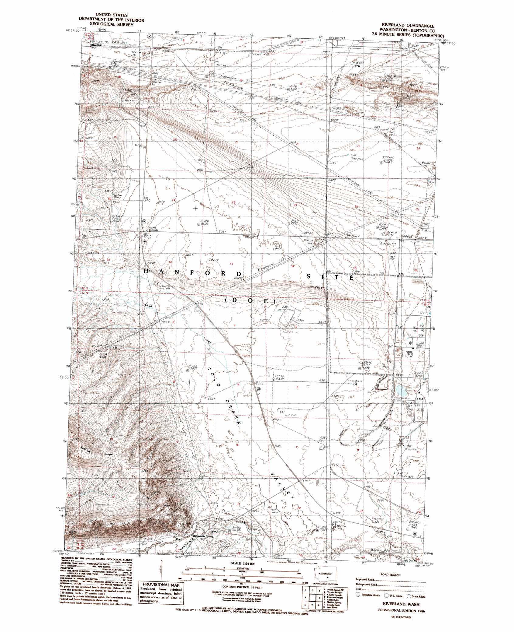
USGS Topo Quad 46119e6 - 1:24,000 scale
| Topo Map Name: | Riverland |
| USGS Topo Quad ID: | 46119e6 |
| Print Size: | ca. 21 1/4" wide x 27" high |
| Southeast Coordinates: | 46.5° N latitude / 119.625° W longitude |
| Map Center Coordinates: | 46.5625° N latitude / 119.6875° W longitude |
| U.S. State: | WA |
| Filename: | o46119e6.jpg |
| Download Map JPG Image: | Riverland topo map 1:24,000 scale |
| Map Type: | Topographic |
| Topo Series: | 7.5´ |
| Map Scale: | 1:24,000 |
| Source of Map Images: | United States Geological Survey (USGS) |
| Alternate Map Versions: |
Riverland WA 1986, updated 1986 Download PDF Buy paper map Riverland WA 2011 Download PDF Buy paper map Riverland WA 2013 Download PDF Buy paper map |
1:24,000 Topo Quads surrounding Riverland
Beverly |
Beverly Se |
Smyrna |
Wahatis Peak |
Corfu |
Priest Rapids |
Priest Rapids Ne |
Vernita Bridge |
Coyote Rapids |
Locke Island |
Cairn Hope Peak |
Emerson Nipple |
Riverland |
Gable Butte |
Hanford |
Sulphur Spring |
Maiden Spring |
Snively Basin |
Iowa Flats |
Horn Rapids Dam |
Grandview |
Sagebrush Ridge |
Snipes Creek |
Corral Canyon |
Benton City |
> Back to 46119e1 at 1:100,000 scale
> Back to 46118a1 at 1:250,000 scale
> Back to U.S. Topo Maps home
Riverland topo map: Gazetteer
Riverland: Springs
Rattlesnake Spring elevation 221m 725′Riverland: Streams
Dry Creek elevation 177m 580′Rattlesnake Creek elevation 227m 744′
Riverland: Wells
McGee Well elevation 249m 816′Riverland digital topo map on disk
Buy this Riverland topo map showing relief, roads, GPS coordinates and other geographical features, as a high-resolution digital map file on DVD: