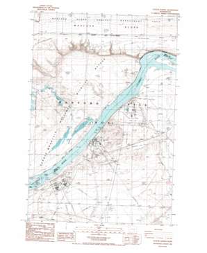
Coyote Rapids Topo Map Washington

To zoom in, hover over the map of Coyote Rapids

USGS Topo Quad 46119f5 - 1:24,000 scale

Topo Map Name: Coyote Rapids
USGS Topo Quad ID: 46119f5
Print Size: ca. 21 1/4" wide x 27" high
Southeast Coordinates: 46.625° N latitude / 119.5° W longitude
Map Center Coordinates: 46.6875° N latitude / 119.5625° W longitude
U.S. State: WA
Filename: o46119f5.jpg
Download Map JPG Image: Coyote Rapids topo map 1:24,000 scale
Map Type: Topographic
Topo Series: 7.5´
Map Scale: 1:24,000
Source of Map Images: United States Geological Survey (USGS)
Alternate Map Versions: Coyote Rapids WA 1986, updated 1986 Download PDF Buy paper map
Coyote Rapids WA 2011 Download PDF Buy paper map
Coyote Rapids WA 2014 Download PDF Buy paper map

1:24,000 Topo Quads surrounding Coyote Rapids

Beverly Ne
Beverly Ne USGS topographic map 46119h7
Royal City
Royal City USGS topographic map 46119h6
Frenchman Hills Lake
Frenchman Hills Lake USGS topographic map 46119h5
Royal Camp
Royal Camp USGS topographic map 46119h4
O'Sullivan Dam
O'Sullivan Dam USGS topographic map 46119h3
Beverly Se
Beverly Se USGS topographic map 46119g7
Smyrna
Smyrna USGS topographic map 46119g6
Wahatis Peak
Wahatis Peak USGS topographic map 46119g5
Corfu
Corfu USGS topographic map 46119g4
Taunton
Taunton USGS topographic map 46119g3
Priest Rapids Ne
Priest Rapids Ne USGS topographic map 46119f7
Vernita Bridge
Vernita Bridge USGS topographic map 46119f6
Coyote Rapids
Coyote Rapids USGS topographic map 46119f5
Locke Island
Locke Island USGS topographic map 46119f4
Hanford Ne
Hanford Ne USGS topographic map 46119f3
Emerson Nipple
Emerson Nipple USGS topographic map 46119e7
Riverland
Riverland USGS topographic map 46119e6
Gable Butte
Gable Butte USGS topographic map 46119e5
Hanford
Hanford USGS topographic map 46119e4
Savage Island
Savage Island USGS topographic map 46119e3
Maiden Spring
Maiden Spring USGS topographic map 46119d7
Snively Basin
Snively Basin USGS topographic map 46119d6
Iowa Flats
Iowa Flats USGS topographic map 46119d5
Horn Rapids Dam
Horn Rapids Dam USGS topographic map 46119d4
Wooded Island
Wooded Island USGS topographic map 46119d3

> Back to 46119e1 at 1:100,000 scale
> Back to 46118a1 at 1:250,000 scale
> Back to U.S. Topo Maps home

Coyote Rapids topo map: Gazetteer

Coyote Rapids: Populated Places

Audrey elevation 155m 508′
Bettie elevation 135m 442′
Ginger elevation 129m 423′
Helen elevation 159m 521′
Nancy elevation 140m 459′
Wahluke elevation 131m 429′

Coyote Rapids: Rapids

Coyote Rapids elevation 122m 400′

Coyote Rapids digital topo map on disk

Buy this Coyote Rapids topo map showing relief, roads, GPS coordinates and other geographical features, as a high-resolution digital map file on DVD:

Coyote Rapids topo map