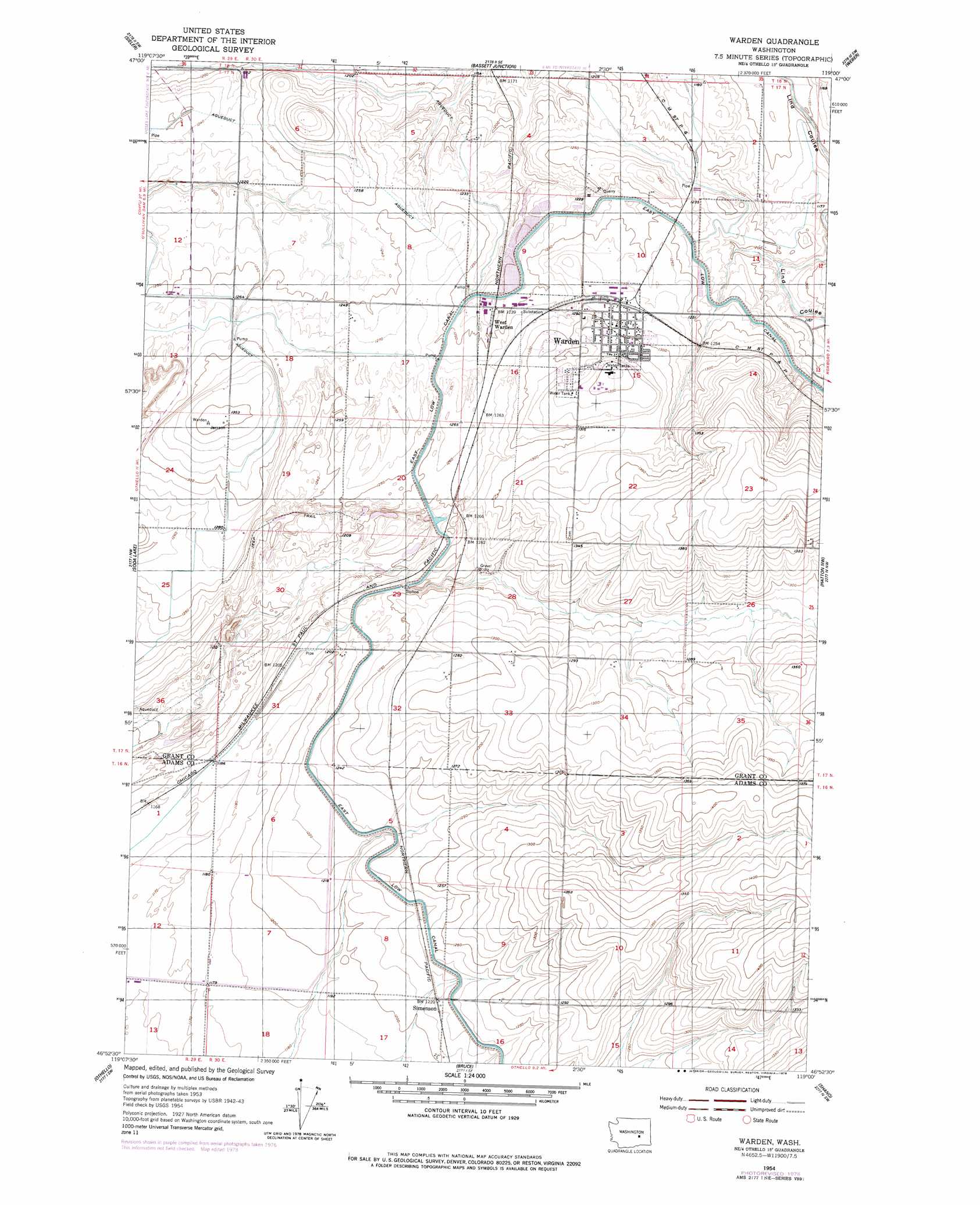
Warden Topo Map Washington
To zoom in, hover over the map of Warden
USGS Topo Quad 46119h1 - 1:24,000 scale
| Topo Map Name: | Warden |
| USGS Topo Quad ID: | 46119h1 |
| Print Size: | ca. 21 1/4" wide x 27" high |
| Southeast Coordinates: | 46.875° N latitude / 119° W longitude |
| Map Center Coordinates: | 46.9375° N latitude / 119.0625° W longitude |
| U.S. State: | WA |
| Filename: | o46119h1.jpg |
| Download Map JPG Image: | Warden topo map 1:24,000 scale |
| Map Type: | Topographic |
| Topo Series: | 7.5´ |
| Map Scale: | 1:24,000 |
| Source of Map Images: | United States Geological Survey (USGS) |
| Alternate Map Versions: |
Warden WA 1954, updated 1956 Download PDF Buy paper map Warden WA 1954, updated 1978 Download PDF Buy paper map Warden WA 2011 Download PDF Buy paper map Warden WA 2014 Download PDF Buy paper map |
1:24,000 Topo Quads surrounding Warden
Moses Lake North |
Wheeler |
Wheeler Ne |
Ruff |
Batum |
Moses Lake South |
Sieler |
Bassett Junction |
Weber |
Schrag |
O'Sullivan Dam |
Soda Lake |
Warden |
Hatton Nw |
Roxboro |
Taunton |
Othello |
Bruce |
Shano |
Hatton |
Hanford Ne |
Eagle Lakes |
Scooteney Reservoir |
Frischknecht |
Connell |
> Back to 46119e1 at 1:100,000 scale
> Back to 46118a1 at 1:250,000 scale
> Back to U.S. Topo Maps home
Warden topo map: Gazetteer
Warden: Airports
New Warden Airport elevation 382m 1253′Warden: Populated Places
Warden elevation 397m 1302′West Warden elevation 381m 1250′
Warden digital topo map on disk
Buy this Warden topo map showing relief, roads, GPS coordinates and other geographical features, as a high-resolution digital map file on DVD: