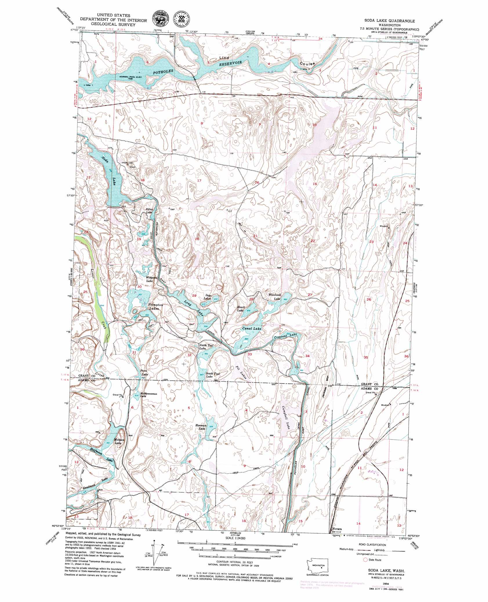
Soda Lake Topo Map Washington
To zoom in, hover over the map of Soda Lake
USGS Topo Quad 46119h2 - 1:24,000 scale
| Topo Map Name: | Soda Lake |
| USGS Topo Quad ID: | 46119h2 |
| Print Size: | ca. 21 1/4" wide x 27" high |
| Southeast Coordinates: | 46.875° N latitude / 119.125° W longitude |
| Map Center Coordinates: | 46.9375° N latitude / 119.1875° W longitude |
| U.S. State: | WA |
| Filename: | o46119h2.jpg |
| Download Map JPG Image: | Soda Lake topo map 1:24,000 scale |
| Map Type: | Topographic |
| Topo Series: | 7.5´ |
| Map Scale: | 1:24,000 |
| Source of Map Images: | United States Geological Survey (USGS) |
| Alternate Map Versions: |
Soda Lake WA 1954, updated 1956 Download PDF Buy paper map Soda Lake WA 1954, updated 1963 Download PDF Buy paper map Soda Lake WA 2011 Download PDF Buy paper map Soda Lake WA 2013 Download PDF Buy paper map |
1:24,000 Topo Quads surrounding Soda Lake
Moses Lake Nw |
Moses Lake North |
Wheeler |
Wheeler Ne |
Ruff |
Mae |
Moses Lake South |
Sieler |
Bassett Junction |
Weber |
Royal Camp |
O'Sullivan Dam |
Soda Lake |
Warden |
Hatton Nw |
Corfu |
Taunton |
Othello |
Bruce |
Shano |
Locke Island |
Hanford Ne |
Eagle Lakes |
Scooteney Reservoir |
Frischknecht |
> Back to 46119e1 at 1:100,000 scale
> Back to 46118a1 at 1:250,000 scale
> Back to U.S. Topo Maps home
Soda Lake topo map: Gazetteer
Soda Lake: Dams
Rock Check IV-14 Dam elevation 252m 826′Soda Lake Dike Dam elevation 308m 1010′
Soda Lake: Lakes
Campbell Lake elevation 297m 974′Canal Lake elevation 301m 987′
Crescent Lake elevation 304m 997′
Halfmoon Lake elevation 251m 823′
Hampton Lake elevation 278m 912′
Heart Lake elevation 299m 980′
Herman Lake elevation 286m 938′
Long Lake elevation 305m 1000′
McMannaman Lake elevation 254m 833′
Morgan Lake elevation 251m 823′
North Teal Lake elevation 292m 958′
Para Lake elevation 255m 836′
Pillar Lake elevation 306m 1003′
Pit Lakes elevation 303m 994′
Sage Lakes elevation 299m 980′
Soda Lake elevation 305m 1000′
South Teal Lake elevation 290m 951′
Widgeon Lake elevation 288m 944′
Windmill Lake elevation 301m 987′
Soda Lake: Populated Places
Novara elevation 338m 1108′Soda Lake: Reservoirs
Deadman Lake elevation 252m 826′Soda Lake: Summits
Jackass Mountain elevation 357m 1171′Soda Lake digital topo map on disk
Buy this Soda Lake topo map showing relief, roads, GPS coordinates and other geographical features, as a high-resolution digital map file on DVD: