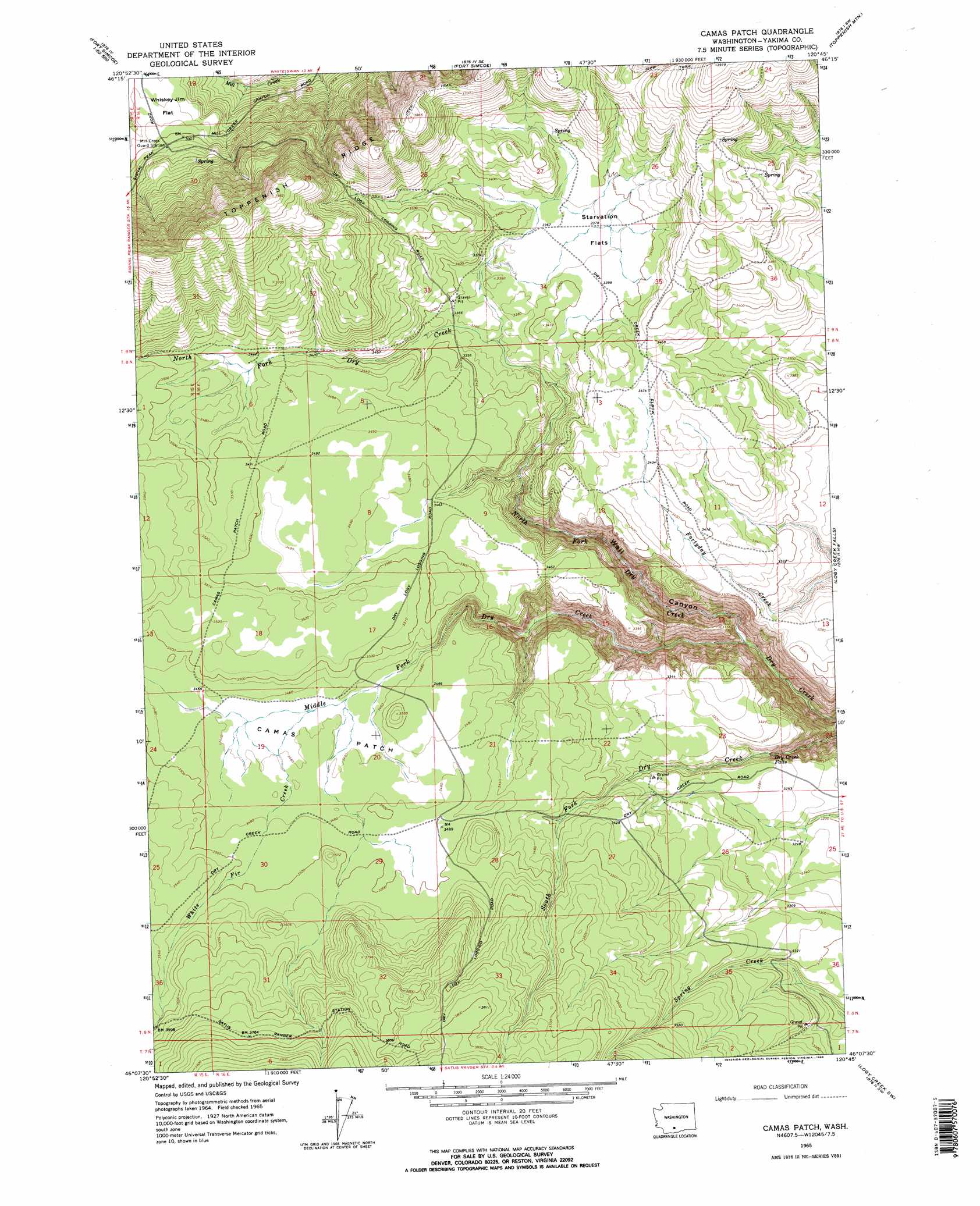
Camas Patch Topo Map Washington
To zoom in, hover over the map of Camas Patch
USGS Topo Quad 46120b7 - 1:24,000 scale
| Topo Map Name: | Camas Patch |
| USGS Topo Quad ID: | 46120b7 |
| Print Size: | ca. 21 1/4" wide x 27" high |
| Southeast Coordinates: | 46.125° N latitude / 120.75° W longitude |
| Map Center Coordinates: | 46.1875° N latitude / 120.8125° W longitude |
| U.S. State: | WA |
| Filename: | o46120b7.jpg |
| Download Map JPG Image: | Camas Patch topo map 1:24,000 scale |
| Map Type: | Topographic |
| Topo Series: | 7.5´ |
| Map Scale: | 1:24,000 |
| Source of Map Images: | United States Geological Survey (USGS) |
| Alternate Map Versions: |
Camas Patch WA 1965, updated 1966 Download PDF Buy paper map Camas Patch WA 1965, updated 1966 Download PDF Buy paper map Camas Patch WA 2011 Download PDF Buy paper map Camas Patch WA 2013 Download PDF Buy paper map |
1:24,000 Topo Quads surrounding Camas Patch
Piscoe Meadow |
Yesmowit Canyon |
Medicine Valley |
White Swan |
Harrah |
Lost Horse Plateau |
Willy Dick Canyon |
Fort Simcoe |
Toppenish Mountain |
Harrah Se |
Poland Butte |
Mckays Butte |
Camas Patch |
Logy Creek Falls |
Logy Creek Ne |
Twin Buttes |
Hagerty Butte |
Stagman Butte |
Logy Creek Sw |
Kusshi Creek |
Grayback Mountain |
White Pine Buttes |
Indian Rock |
Status Pass |
Lone Pine Butte |
> Back to 46120a1 at 1:100,000 scale
> Back to 46120a1 at 1:250,000 scale
> Back to U.S. Topo Maps home
Camas Patch topo map: Gazetteer
Camas Patch: Falls
Dry Creek Falls elevation 901m 2956′Camas Patch: Flats
Camas Patch elevation 1056m 3464′Starvation Flats elevation 1030m 3379′
Whiskey Jim Flat elevation 904m 2965′
Camas Patch: Streams
Middle Fork Dry Creek elevation 811m 2660′North Fork Dry Creek elevation 813m 2667′
South Fork Dry Creek elevation 800m 2624′
White Fir Creek elevation 1053m 3454′
Camas Patch: Valleys
Wall Canyon elevation 811m 2660′Camas Patch digital topo map on disk
Buy this Camas Patch topo map showing relief, roads, GPS coordinates and other geographical features, as a high-resolution digital map file on DVD: