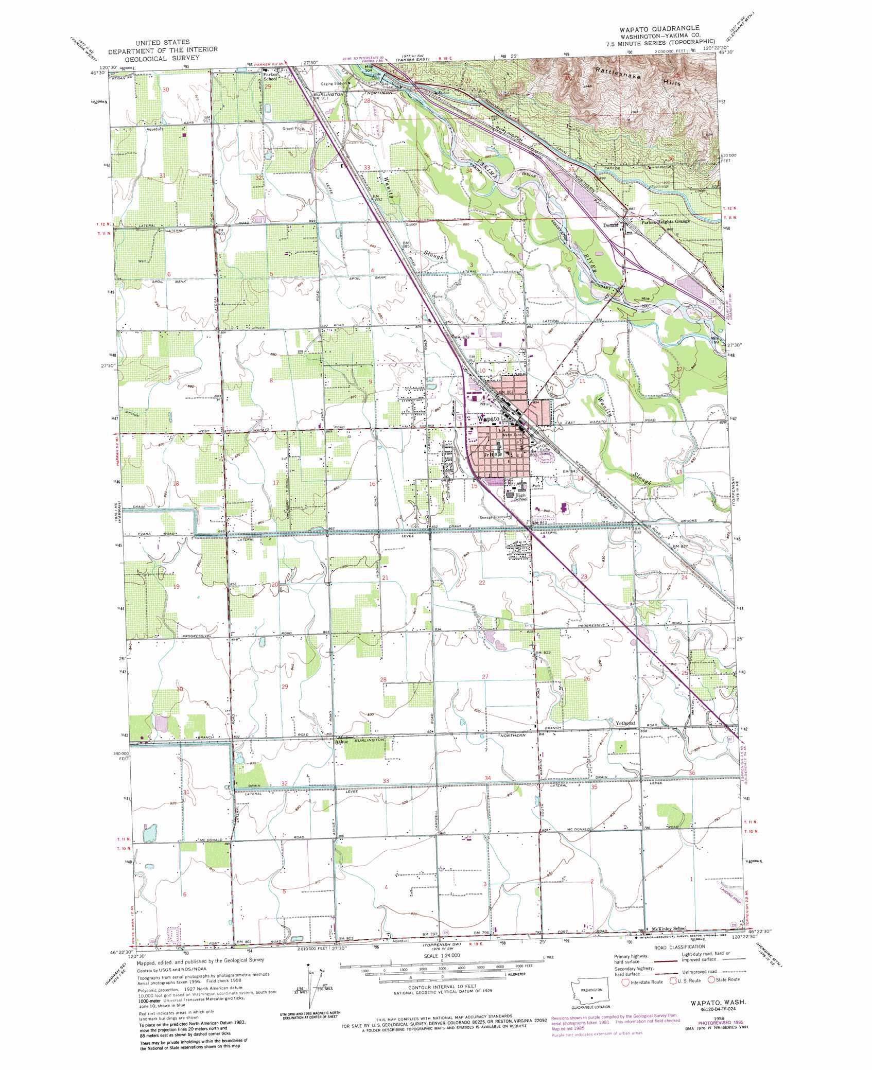
Wapato Topo Map Washington
To zoom in, hover over the map of Wapato
USGS Topo Quad 46120d4 - 1:24,000 scale
| Topo Map Name: | Wapato |
| USGS Topo Quad ID: | 46120d4 |
| Print Size: | ca. 21 1/4" wide x 27" high |
| Southeast Coordinates: | 46.375° N latitude / 120.375° W longitude |
| Map Center Coordinates: | 46.4375° N latitude / 120.4375° W longitude |
| U.S. State: | WA |
| Filename: | o46120d4.jpg |
| Download Map JPG Image: | Wapato topo map 1:24,000 scale |
| Map Type: | Topographic |
| Topo Series: | 7.5´ |
| Map Scale: | 1:24,000 |
| Source of Map Images: | United States Geological Survey (USGS) |
| Alternate Map Versions: |
Wapato WA 1958, updated 1960 Download PDF Buy paper map Wapato WA 1958, updated 1975 Download PDF Buy paper map Wapato WA 1958, updated 1975 Download PDF Buy paper map Wapato WA 1958, updated 1985 Download PDF Buy paper map Wapato WA 2011 Download PDF Buy paper map Wapato WA 2013 Download PDF Buy paper map |
1:24,000 Topo Quads surrounding Wapato
Naches |
Selah |
Pomona |
Selah Springs |
Black Rock Spring Nw |
Wiley City |
Yakima West |
Yakima East |
Elephant Mountain |
Black Rock Spring Sw |
White Swan |
Harrah |
Wapato |
Toppenish |
Granger Nw |
Toppenish Mountain |
Harrah Se |
Toppenish Sw |
Hembre Mountain |
Granger |
Logy Creek Falls |
Logy Creek Ne |
Poisel Butte Nw |
Poisel Butte |
Bluelight Nw |
> Back to 46120a1 at 1:100,000 scale
> Back to 46120a1 at 1:250,000 scale
> Back to U.S. Topo Maps home
Wapato topo map: Gazetteer
Wapato: Canals
Drain 2 elevation 263m 862′Drain 3 elevation 252m 826′
Lateral 2 elevation 260m 853′
Lateral 3 elevation 251m 823′
Union Gap Canal elevation 300m 984′
Wapato: Dams
Sunnyside Dam elevation 278m 912′Wapato: Populated Places
Ashue elevation 254m 833′Donald elevation 265m 869′
Wapato elevation 261m 856′
Yethonat elevation 247m 810′
Wapato digital topo map on disk
Buy this Wapato topo map showing relief, roads, GPS coordinates and other geographical features, as a high-resolution digital map file on DVD: