Ginkgo Topo Map Washington
To zoom in, hover over the map of Ginkgo
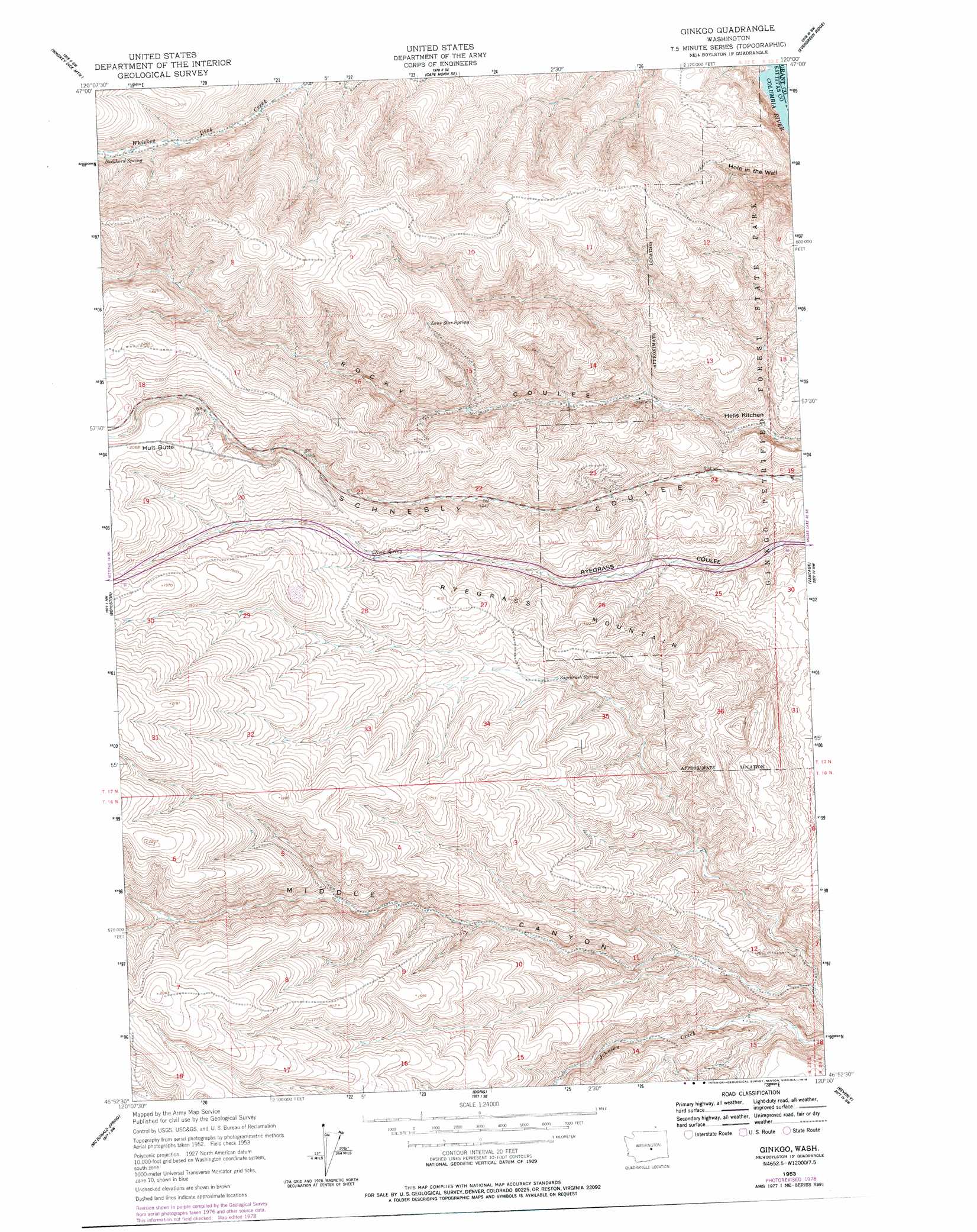
USGS Topo Quad 46120h1 - 1:24,000 scale
| Topo Map Name: | Ginkgo |
| USGS Topo Quad ID: | 46120h1 |
| Print Size: | ca. 21 1/4" wide x 27" high |
| Southeast Coordinates: | 46.875° N latitude / 120° W longitude |
| Map Center Coordinates: | 46.9375° N latitude / 120.0625° W longitude |
| U.S. State: | WA |
| Filename: | o46120h1.jpg |
| Download Map JPG Image: | Ginkgo topo map 1:24,000 scale |
| Map Type: | Topographic |
| Topo Series: | 7.5´ |
| Map Scale: | 1:24,000 |
| Source of Map Images: | United States Geological Survey (USGS) |
| Alternate Map Versions: |
Ginkgo WA 1953, updated 1957 Download PDF Buy paper map Ginkgo WA 1953, updated 1978 Download PDF Buy paper map Ginkgo WA 1953, updated 1978 Download PDF Buy paper map Ginkgo WA 2011 Download PDF Buy paper map Ginkgo WA 2014 Download PDF Buy paper map |
1:24,000 Topo Quads surrounding Ginkgo
Colockum Pass |
Stray Gulch |
West Bar |
Babcock Ridge |
Quincy |
Colockum Pass Se |
Whiskey Dick Mountain |
Cape Horn Se |
Evergreen Ridge |
George |
East Kittitas |
Boylston |
Ginkgo |
Vantage |
Beverly Ne |
Badger Gap |
Mcdonald Spring |
Doris |
Beverly |
Beverly Se |
Selah Springs |
Black Rock Spring Nw |
Black Rock Spring Ne |
Priest Rapids |
Priest Rapids Ne |
> Back to 46120e1 at 1:100,000 scale
> Back to 46120a1 at 1:250,000 scale
> Back to U.S. Topo Maps home
Ginkgo topo map: Gazetteer
Ginkgo: Areas
Hells Kitchen elevation 254m 833′Ginkgo: Parks
Ginkgo Petrified Forest State Park elevation 241m 790′Ginkgo: Springs
Buckhorn Spring elevation 559m 1833′Lone Star Spring elevation 564m 1850′
Rock Spring elevation 467m 1532′
Sagebrush Spring elevation 405m 1328′
Ginkgo: Summits
Hult Butte elevation 642m 2106′Ryegrass Mountain elevation 466m 1528′
Ginkgo digital topo map on disk
Buy this Ginkgo topo map showing relief, roads, GPS coordinates and other geographical features, as a high-resolution digital map file on DVD: