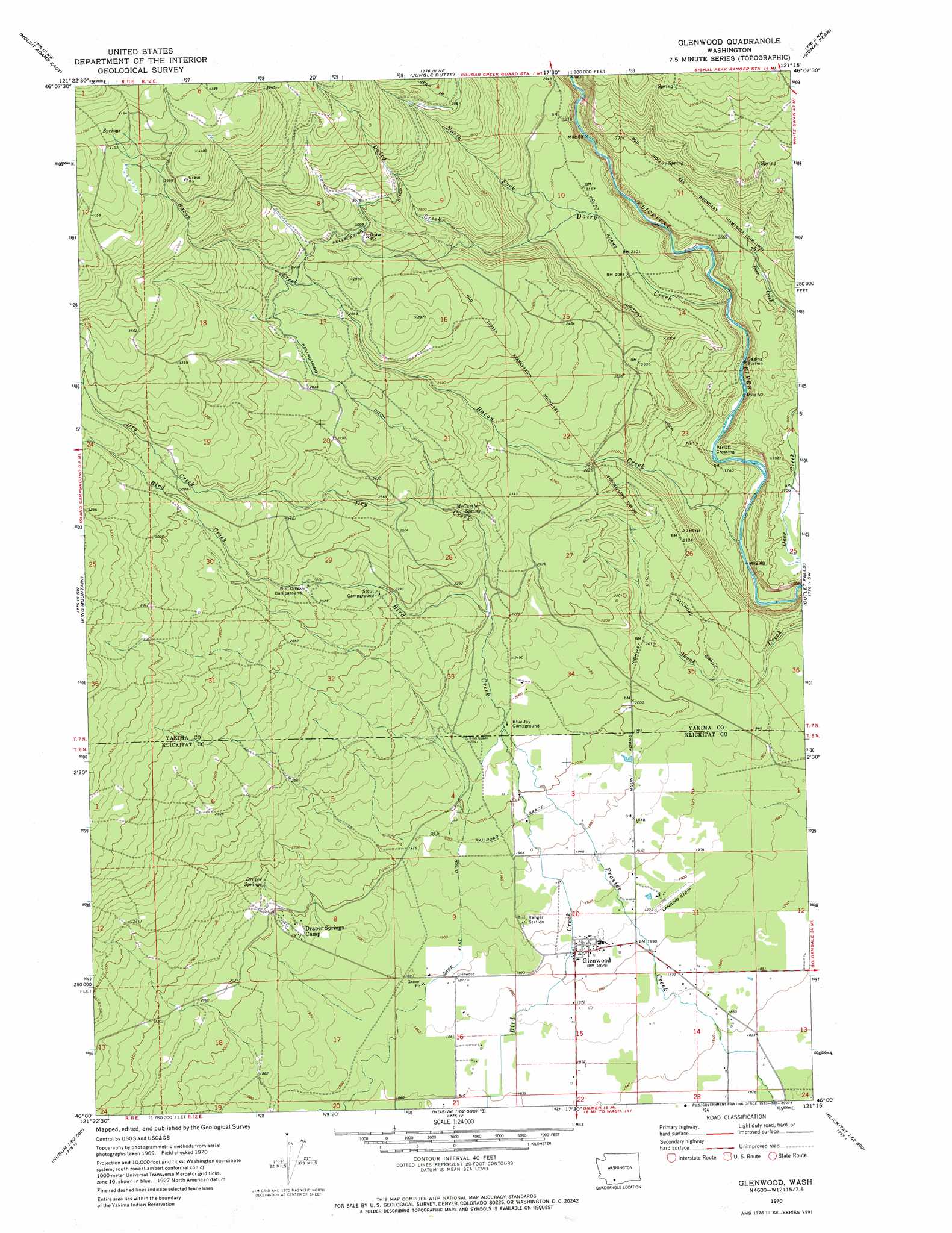
Glenwood Topo Map Washington
To zoom in, hover over the map of Glenwood
USGS Topo Quad 46121a3 - 1:24,000 scale
| Topo Map Name: | Glenwood |
| USGS Topo Quad ID: | 46121a3 |
| Print Size: | ca. 21 1/4" wide x 27" high |
| Southeast Coordinates: | 46° N latitude / 121.25° W longitude |
| Map Center Coordinates: | 46.0625° N latitude / 121.3125° W longitude |
| U.S. State: | WA |
| Filename: | o46121a3.jpg |
| Download Map JPG Image: | Glenwood topo map 1:24,000 scale |
| Map Type: | Topographic |
| Topo Series: | 7.5´ |
| Map Scale: | 1:24,000 |
| Source of Map Images: | United States Geological Survey (USGS) |
| Alternate Map Versions: |
Glenwood WA 1970, updated 1973 Download PDF Buy paper map Glenwood WA 2011 Download PDF Buy paper map Glenwood WA 2014 Download PDF Buy paper map |
1:24,000 Topo Quads surrounding Glenwood
Green Mountain |
Glaciate Butte |
Windy Point |
Castile Falls |
Lost Horse Plateau |
Mount Adams West |
Mount Adams East |
Jungle Butte |
Signal Peak |
Poland Butte |
Trout Lake |
King Mountain |
Glenwood |
Outlet Falls |
Twin Buttes |
Guler Mountain |
Quigley Butte |
Camas Prairie |
Dead Canyon |
Grayback Mountain |
Northwestern Lake |
Husum |
Appleton |
Klickitat |
Wahkiacus |
> Back to 46121a1 at 1:100,000 scale
> Back to 46120a1 at 1:250,000 scale
> Back to U.S. Topo Maps home
Glenwood topo map: Gazetteer
Glenwood: Airports
Flying L Ranch Airport elevation 565m 1853′Glenwood: Canals
Sage Flat Ditch elevation 584m 1916′Glenwood: Populated Places
Glenwood elevation 579m 1899′Parrott Crossing elevation 504m 1653′
Glenwood: Springs
Draper Springs elevation 639m 2096′McCumber Spring elevation 720m 2362′
Glenwood: Streams
Bacon Creek elevation 485m 1591′Big Muddy Creek elevation 603m 1978′
Dairy Creek elevation 534m 1751′
Dry Creek elevation 667m 2188′
North Fork Dairy Creek elevation 655m 2148′
Glenwood digital topo map on disk
Buy this Glenwood topo map showing relief, roads, GPS coordinates and other geographical features, as a high-resolution digital map file on DVD: