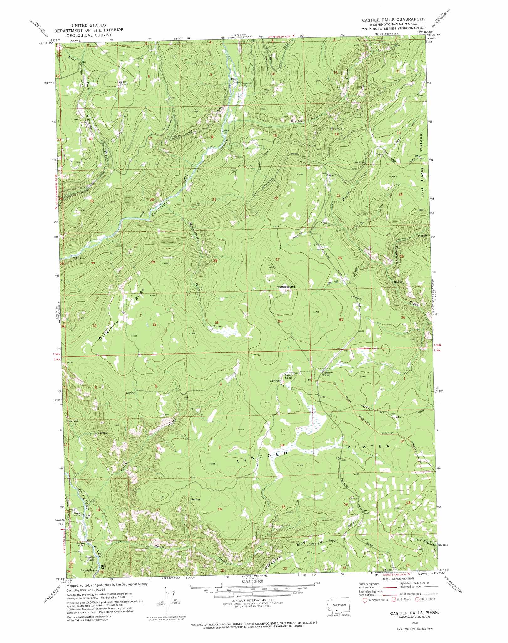
Castile Falls Topo Map Washington
To zoom in, hover over the map of Castile Falls
USGS Topo Quad 46121c2 - 1:24,000 scale
| Topo Map Name: | Castile Falls |
| USGS Topo Quad ID: | 46121c2 |
| Print Size: | ca. 21 1/4" wide x 27" high |
| Southeast Coordinates: | 46.25° N latitude / 121.125° W longitude |
| Map Center Coordinates: | 46.3125° N latitude / 121.1875° W longitude |
| U.S. State: | WA |
| Filename: | o46121c2.jpg |
| Download Map JPG Image: | Castile Falls topo map 1:24,000 scale |
| Map Type: | Topographic |
| Topo Series: | 7.5´ |
| Map Scale: | 1:24,000 |
| Source of Map Images: | United States Geological Survey (USGS) |
| Alternate Map Versions: |
Castile Falls WA 1969, updated 1973 Download PDF Buy paper map Castile Falls WA 1970, updated 1973 Download PDF Buy paper map Castile Falls WA 2011 Download PDF Buy paper map Castile Falls WA 2014 Download PDF Buy paper map |
1:24,000 Topo Quads surrounding Castile Falls
Old Snowy Mountain |
Pinegrass Ridge |
Darland Mountain |
Foundation Ridge |
Pine Mountain |
Walupt Lake |
Jennies Butte |
Fairview Ridge |
Piscoe Meadow |
Yesmowit Canyon |
Glaciate Butte |
Windy Point |
Castile Falls |
Lost Horse Plateau |
Willy Dick Canyon |
Mount Adams East |
Jungle Butte |
Signal Peak |
Poland Butte |
Mckays Butte |
King Mountain |
Glenwood |
Outlet Falls |
Twin Buttes |
Hagerty Butte |
> Back to 46121a1 at 1:100,000 scale
> Back to 46120a1 at 1:250,000 scale
> Back to U.S. Topo Maps home
Castile Falls topo map: Gazetteer
Castile Falls: Falls
Castile Falls elevation 809m 2654′Castile Falls: Plains
Lincoln Plateau elevation 1326m 4350′Castile Falls: Ridges
Bullgrouse Ridge elevation 1408m 4619′Castile Falls: Springs
Coffeepot Spring elevation 1357m 4452′Castile Falls: Streams
Diamond Fork elevation 1022m 3353′Huckleberry Creek elevation 951m 3120′
Mosquito Creek elevation 1326m 4350′
Panther Creek elevation 1225m 4019′
Pile Up Creek elevation 1250m 4101′
Piscoe Creek elevation 1024m 3359′
Swamp Creek elevation 808m 2650′
Yedlick Creek elevation 833m 2732′
Castile Falls: Summits
Panther Butte elevation 1507m 4944′Panther Creek Lookout elevation 1515m 4970′
Castile Falls digital topo map on disk
Buy this Castile Falls topo map showing relief, roads, GPS coordinates and other geographical features, as a high-resolution digital map file on DVD: