Glaciate Butte Topo Map Washington
To zoom in, hover over the map of Glaciate Butte
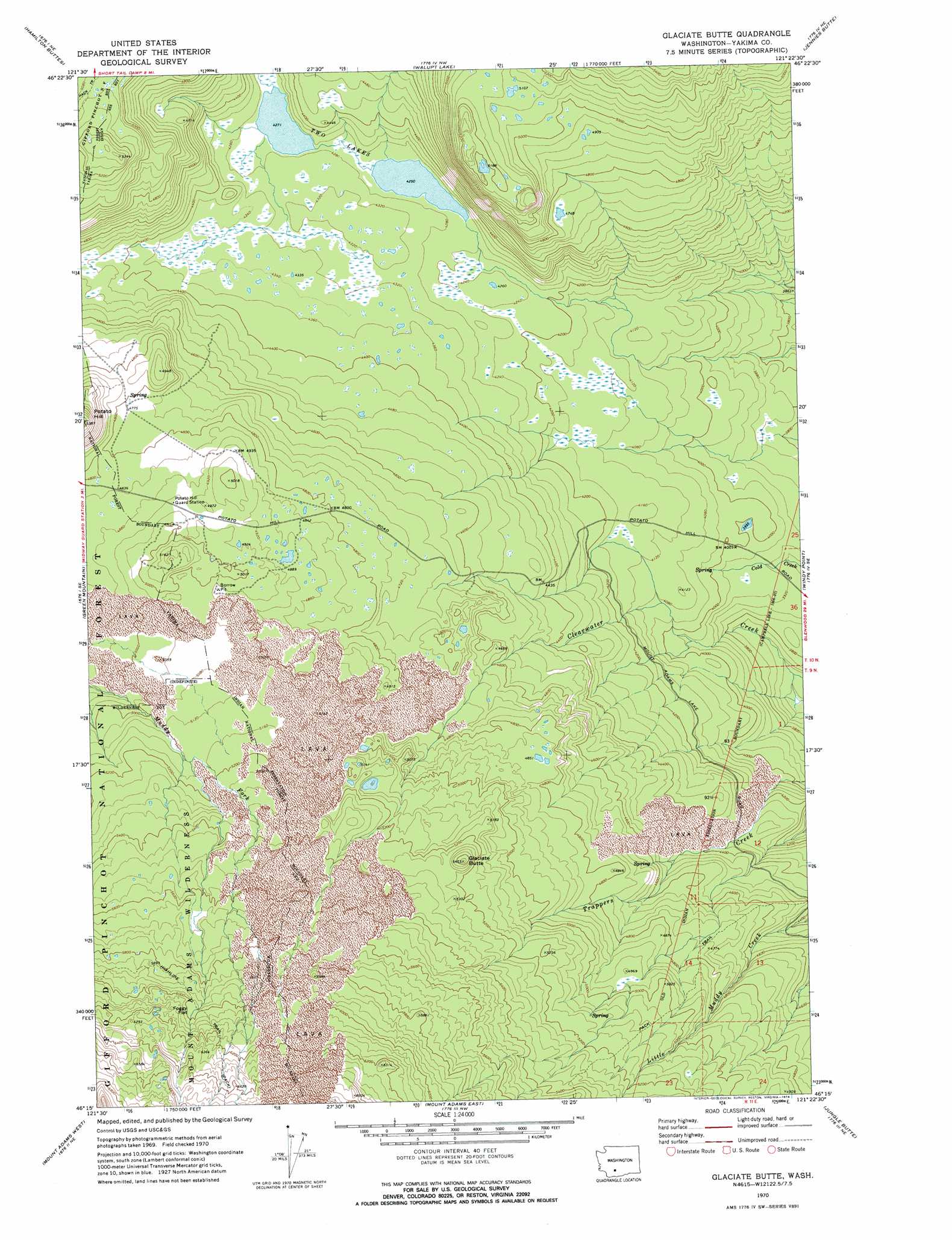
USGS Topo Quad 46121c4 - 1:24,000 scale
| Topo Map Name: | Glaciate Butte |
| USGS Topo Quad ID: | 46121c4 |
| Print Size: | ca. 21 1/4" wide x 27" high |
| Southeast Coordinates: | 46.25° N latitude / 121.375° W longitude |
| Map Center Coordinates: | 46.3125° N latitude / 121.4375° W longitude |
| U.S. State: | WA |
| Filename: | o46121c4.jpg |
| Download Map JPG Image: | Glaciate Butte topo map 1:24,000 scale |
| Map Type: | Topographic |
| Topo Series: | 7.5´ |
| Map Scale: | 1:24,000 |
| Source of Map Images: | United States Geological Survey (USGS) |
| Alternate Map Versions: |
Glaciate Butte WA 1970, updated 1974 Download PDF Buy paper map Glaciate Butte WA 1970, updated 1974 Download PDF Buy paper map Glaciate Butte WA 1998, updated 2003 Download PDF Buy paper map Glaciate Butte WA 2011 Download PDF Buy paper map Glaciate Butte WA 2014 Download PDF Buy paper map |
| FStopo: | US Forest Service topo Glaciate Butte is available: Download FStopo PDF Download FStopo TIF |
1:24,000 Topo Quads surrounding Glaciate Butte
Packwood |
Packwood Lake |
Old Snowy Mountain |
Pinegrass Ridge |
Darland Mountain |
Blue Lake |
Hamilton Buttes |
Walupt Lake |
Jennies Butte |
Fairview Ridge |
East Canyon Ridge |
Green Mountain |
Glaciate Butte |
Windy Point |
Castile Falls |
Steamboat Mountain |
Mount Adams West |
Mount Adams East |
Jungle Butte |
Signal Peak |
Sleeping Beauty |
Trout Lake |
King Mountain |
Glenwood |
Outlet Falls |
> Back to 46121a1 at 1:100,000 scale
> Back to 46120a1 at 1:250,000 scale
> Back to U.S. Topo Maps home
Glaciate Butte topo map: Gazetteer
Glaciate Butte: Flats
Foggy Flat elevation 1826m 5990′Glaciate Butte: Lakes
Two Lakes elevation 1297m 4255′Glaciate Butte: Summits
Glaciate Butte elevation 1660m 5446′Glaciate Butte: Trails
Highline Trail elevation 1798m 5898′Glaciate Butte digital topo map on disk
Buy this Glaciate Butte topo map showing relief, roads, GPS coordinates and other geographical features, as a high-resolution digital map file on DVD: