French Butte Topo Map Washington
To zoom in, hover over the map of French Butte
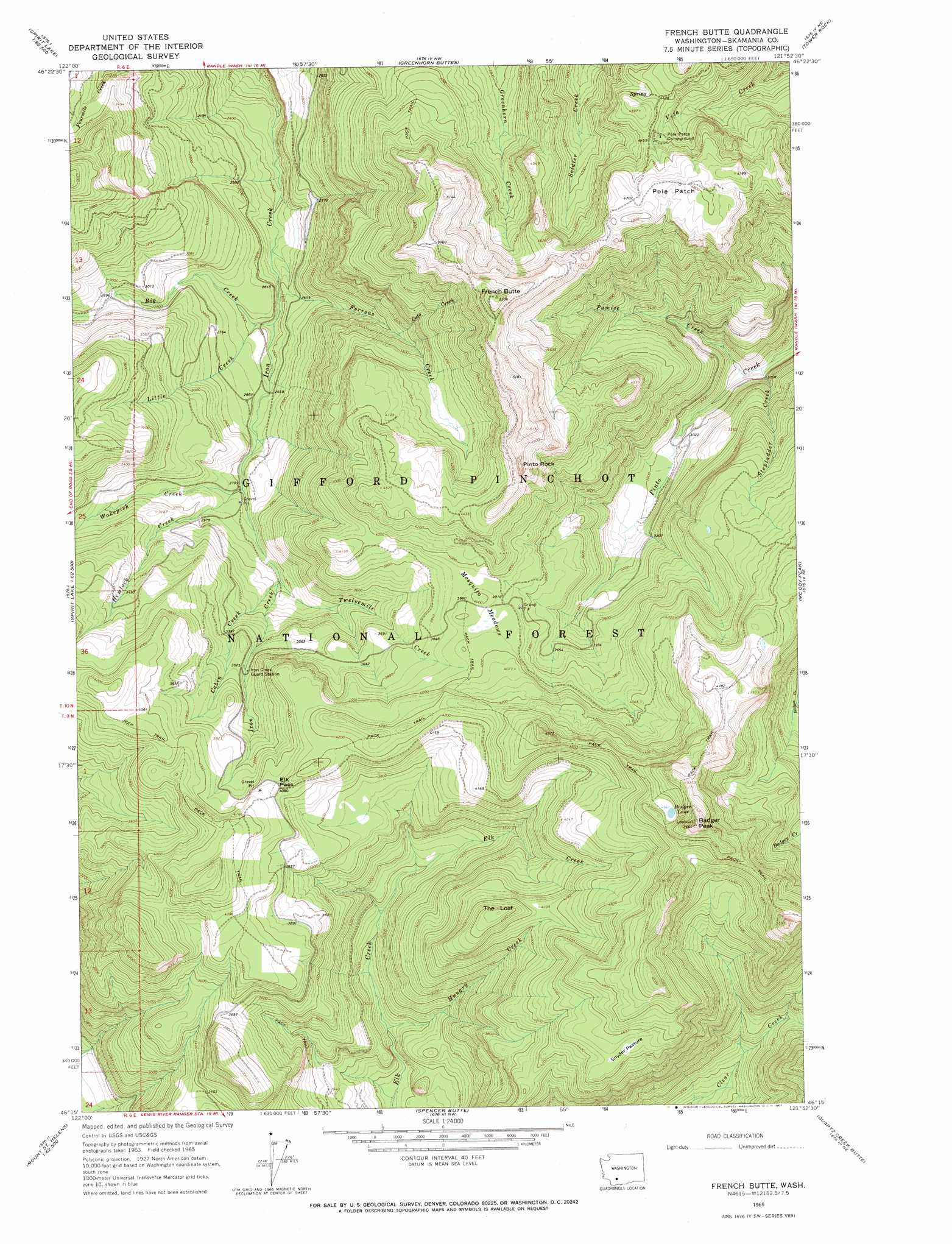
USGS Topo Quad 46121c8 - 1:24,000 scale
| Topo Map Name: | French Butte |
| USGS Topo Quad ID: | 46121c8 |
| Print Size: | ca. 21 1/4" wide x 27" high |
| Southeast Coordinates: | 46.25° N latitude / 121.875° W longitude |
| Map Center Coordinates: | 46.3125° N latitude / 121.9375° W longitude |
| U.S. State: | WA |
| Filename: | o46121c8.jpg |
| Download Map JPG Image: | French Butte topo map 1:24,000 scale |
| Map Type: | Topographic |
| Topo Series: | 7.5´ |
| Map Scale: | 1:24,000 |
| Source of Map Images: | United States Geological Survey (USGS) |
| Alternate Map Versions: |
French Butte WA 1965, updated 1967 Download PDF Buy paper map French Butte WA 1994, updated 1996 Download PDF Buy paper map French Butte WA 2011 Download PDF Buy paper map French Butte WA 2014 Download PDF Buy paper map |
| FStopo: | US Forest Service topo French Butte is available: Download FStopo PDF Download FStopo TIF |
1:24,000 Topo Quads surrounding French Butte
Glenoma |
Kiona Peak |
Randle |
Purcell Mountain |
Packwood |
Vanson Peak |
Cowlitz Falls |
Greenhorn Buttes |
Tower Rock |
Blue Lake |
Spirit Lake West |
Spirit Lake East |
French Butte |
Mccoy Peak |
East Canyon Ridge |
Mount Sainte Helens |
Smith Creek Butte |
Spencer Butte |
Quartz Creek Butte |
Steamboat Mountain |
Mount Mitchell |
Cedar Flats |
Burnt Peak |
Lone Butte |
Sleeping Beauty |
> Back to 46121a1 at 1:100,000 scale
> Back to 46120a1 at 1:250,000 scale
> Back to U.S. Topo Maps home
French Butte topo map: Gazetteer
French Butte: Areas
Pole Patch elevation 1439m 4721′French Butte: Flats
Mosquito Meadows elevation 1207m 3959′Snyder Pasture elevation 1370m 4494′
French Butte: Gaps
Elk Pass elevation 1248m 4094′French Butte: Lakes
Badger Lake elevation 1509m 4950′French Butte: Streams
Big Creek elevation 772m 2532′Cabin Creek elevation 906m 2972′
Cato Creek elevation 745m 2444′
Ferrous Creek elevation 746m 2447′
Hemlock Creek elevation 855m 2805′
Hungry Creek elevation 798m 2618′
Little Creek elevation 781m 2562′
Pumice Creek elevation 829m 2719′
Stepladder Creek elevation 823m 2700′
Twelvemile Creek elevation 904m 2965′
Wakepish Creek elevation 845m 2772′
French Butte: Summits
Badger Peak elevation 1713m 5620′Ferrous Point elevation 1562m 5124′
French Butte elevation 1616m 5301′
Kirk Rock elevation 1645m 5396′
Pinto Rock elevation 1558m 5111′
The Loaf elevation 1373m 4504′
French Butte digital topo map on disk
Buy this French Butte topo map showing relief, roads, GPS coordinates and other geographical features, as a high-resolution digital map file on DVD: