Greenhorn Buttes Topo Map Washington
To zoom in, hover over the map of Greenhorn Buttes
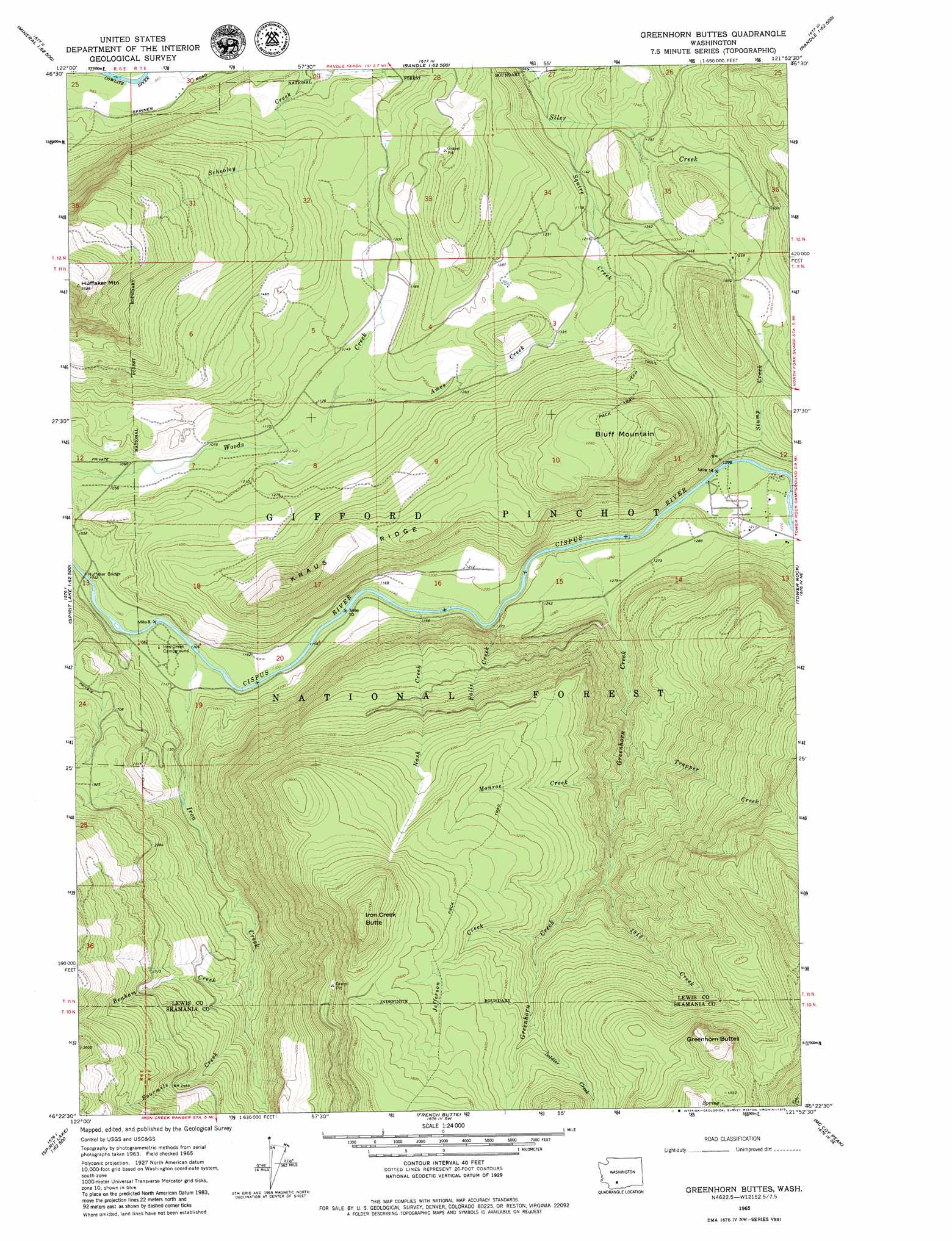
USGS Topo Quad 46121d8 - 1:24,000 scale
| Topo Map Name: | Greenhorn Buttes |
| USGS Topo Quad ID: | 46121d8 |
| Print Size: | ca. 21 1/4" wide x 27" high |
| Southeast Coordinates: | 46.375° N latitude / 121.875° W longitude |
| Map Center Coordinates: | 46.4375° N latitude / 121.9375° W longitude |
| U.S. State: | WA |
| Filename: | o46121d8.jpg |
| Download Map JPG Image: | Greenhorn Buttes topo map 1:24,000 scale |
| Map Type: | Topographic |
| Topo Series: | 7.5´ |
| Map Scale: | 1:24,000 |
| Source of Map Images: | United States Geological Survey (USGS) |
| Alternate Map Versions: |
Greenhorn Buttes WA 1965, updated 1967 Download PDF Buy paper map Greenhorn Buttes WA 1994, updated 1996 Download PDF Buy paper map Greenhorn Buttes WA 2011 Download PDF Buy paper map Greenhorn Buttes WA 2014 Download PDF Buy paper map |
| FStopo: | US Forest Service topo Greenhorn Buttes is available: Download FStopo PDF Download FStopo TIF |
1:24,000 Topo Quads surrounding Greenhorn Buttes
Mineral |
Anderson Lake |
Sawtooth Ridge |
Wahpenayo Peak |
Tatoosh Lakes |
Glenoma |
Kiona Peak |
Randle |
Purcell Mountain |
Packwood |
Vanson Peak |
Cowlitz Falls |
Greenhorn Buttes |
Tower Rock |
Blue Lake |
Spirit Lake West |
Spirit Lake East |
French Butte |
Mccoy Peak |
East Canyon Ridge |
Mount Sainte Helens |
Smith Creek Butte |
Spencer Butte |
Quartz Creek Butte |
Steamboat Mountain |
> Back to 46121a1 at 1:100,000 scale
> Back to 46120a1 at 1:250,000 scale
> Back to U.S. Topo Maps home
Greenhorn Buttes topo map: Gazetteer
Greenhorn Buttes: Bridges
Huffaker Bridge elevation 312m 1023′Greenhorn Buttes: Ridges
Kraus Ridge elevation 641m 2103′Greenhorn Buttes: Streams
1918 Creek elevation 756m 2480′Ames Creek elevation 343m 1125′
Benham Creek elevation 503m 1650′
Falls Creek elevation 357m 1171′
Fourmile Creek elevation 551m 1807′
Greenhorn Creek elevation 349m 1145′
Iron Creek elevation 324m 1062′
Jefferson Creek elevation 891m 2923′
Monroe Creek elevation 578m 1896′
Nash Creek elevation 342m 1122′
Soldier Creek elevation 993m 3257′
Squire Creek elevation 308m 1010′
Stump Creek elevation 366m 1200′
Trapper Creek elevation 534m 1751′
Greenhorn Buttes: Summits
Bluff Mountain elevation 797m 2614′Greenhorn Buttes elevation 1466m 4809′
Huffaker Mountain elevation 1071m 3513′
Iron Creek Butte elevation 1309m 4294′
Greenhorn Buttes digital topo map on disk
Buy this Greenhorn Buttes topo map showing relief, roads, GPS coordinates and other geographical features, as a high-resolution digital map file on DVD: