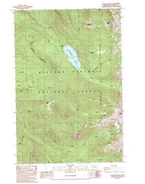
Packwood Lake Topo Map Washington
To zoom in, hover over the map of Packwood Lake
USGS Topo Quad 46121e5 - 1:24,000 scale
| Topo Map Name: | Packwood Lake |
| USGS Topo Quad ID: | 46121e5 |
| Print Size: | ca. 21 1/4" wide x 27" high |
| Southeast Coordinates: | 46.5° N latitude / 121.5° W longitude |
| Map Center Coordinates: | 46.5625° N latitude / 121.5625° W longitude |
| U.S. State: | WA |
| Filename: | o46121e5.jpg |
| Download Map JPG Image: | Packwood Lake topo map 1:24,000 scale |
| Map Type: | Topographic |
| Topo Series: | 7.5´ |
| Map Scale: | 1:24,000 |
| Source of Map Images: | United States Geological Survey (USGS) |
| Alternate Map Versions: |
Packwood Lake WA 1989, updated 1989 Download PDF Buy paper map Packwood Lake WA 1998, updated 2003 Download PDF Buy paper map Packwood Lake WA 2011 Download PDF Buy paper map Packwood Lake WA 2014 Download PDF Buy paper map |
| FStopo: | US Forest Service topo Packwood Lake is available: Download FStopo PDF Download FStopo TIF |
1:24,000 Topo Quads surrounding Packwood Lake
> Back to 46121e1 at 1:100,000 scale
> Back to 46120a1 at 1:250,000 scale
> Back to U.S. Topo Maps home
Packwood Lake topo map: Gazetteer
Packwood Lake: Basins
Jordan Basin elevation 1760m 5774′Lily Basin elevation 1317m 4320′
Packwood Lake: Dams
Packwood Dam elevation 872m 2860′Packwood Lake: Islands
Agnes Island elevation 880m 2887′Packwood Lake: Lakes
Art Lake elevation 1170m 3838′Beaver Lake elevation 1317m 4320′
Glacier Lake elevation 887m 2910′
Heart Lake elevation 1736m 5695′
Lost Hat Lake elevation 1704m 5590′
Lost Lake elevation 1575m 5167′
Mosquito Lake elevation 1426m 4678′
Packwood Lake: Reservoirs
Packwood Lake elevation 872m 2860′Packwood Lake: Streams
Beaver Bill Creek elevation 899m 2949′Deception Creek elevation 639m 2096′
Glacier Creek elevation 554m 1817′
Middle Fork Johnson Creek elevation 700m 2296′
Mission Creek elevation 756m 2480′
Upper Lake Creek elevation 874m 2867′
Packwood Lake: Summits
Angry Mountain elevation 1843m 6046′Beargrass Butte elevation 1767m 5797′
Johnson Peak elevation 2212m 7257′
Snyder Mountain elevation 1467m 4812′
Packwood Lake: Trails
Angry Mountain Trail elevation 1495m 4904′Five Thousand Thirty Trail elevation 1421m 4662′
Glacier Lake Trail elevation 704m 2309′
Jordan Creek Trail elevation 1133m 3717′
Packwood Lake Trail elevation 962m 3156′
Three Peaks Trail elevation 1229m 4032′
Packwood Lake digital topo map on disk
Buy this Packwood Lake topo map showing relief, roads, GPS coordinates and other geographical features, as a high-resolution digital map file on DVD:


