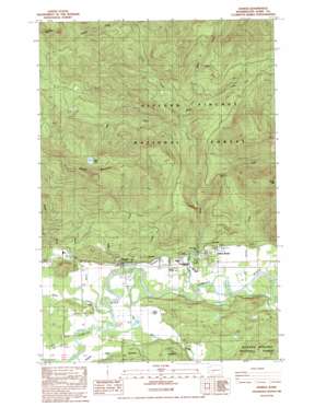
Randle Topo Map Washington
To zoom in, hover over the map of Randle
USGS Topo Quad 46121e8 - 1:24,000 scale
| Topo Map Name: | Randle |
| USGS Topo Quad ID: | 46121e8 |
| Print Size: | ca. 21 1/4" wide x 27" high |
| Southeast Coordinates: | 46.5° N latitude / 121.875° W longitude |
| Map Center Coordinates: | 46.5625° N latitude / 121.9375° W longitude |
| U.S. State: | WA |
| Filename: | o46121e8.jpg |
| Download Map JPG Image: | Randle topo map 1:24,000 scale |
| Map Type: | Topographic |
| Topo Series: | 7.5´ |
| Map Scale: | 1:24,000 |
| Source of Map Images: | United States Geological Survey (USGS) |
| Alternate Map Versions: |
Randle WA 1989, updated 1989 Download PDF Buy paper map Randle WA 1994, updated 1996 Download PDF Buy paper map Randle WA 2011 Download PDF Buy paper map Randle WA 2014 Download PDF Buy paper map |
| FStopo: | US Forest Service topo Randle is available: Download FStopo PDF Download FStopo TIF |
1:24,000 Topo Quads surrounding Randle
> Back to 46121e1 at 1:100,000 scale
> Back to 46120a1 at 1:250,000 scale
> Back to U.S. Topo Maps home
Randle topo map: Gazetteer
Randle: Dams
Mount Adams Veneer Company Mill Pond Dam elevation 269m 882′Stud Log Pond Dam elevation 276m 905′
Randle: Lakes
Gibbs Lake elevation 269m 882′Watch Lake elevation 1086m 3562′
Randle: Pillars
Harrington Rock elevation 1271m 4169′Randle: Populated Places
Randle elevation 273m 895′Siler elevation 280m 918′
Silver Brook elevation 280m 918′
Vance (not official) elevation 275m 902′
Randle: Reservoirs
Mount Adams Veneer Company Mill Pond elevation 269m 882′Randle: Streams
East Fork Silver Creek elevation 328m 1076′Hampton Creek elevation 268m 879′
Kiona Creek elevation 266m 872′
Lake Creek elevation 443m 1453′
Lynx Creek elevation 463m 1519′
Martin Creek elevation 662m 2171′
Miller Creek elevation 269m 882′
Oliver Creek elevation 269m 882′
Peters Creek elevation 268m 879′
Schooley Creek elevation 263m 862′
Sethe Creek elevation 273m 895′
Siler Creek elevation 264m 866′
Silver Creek elevation 270m 885′
Spears Creek elevation 279m 915′
Surrey Creek elevation 271m 889′
Willie Creek elevation 499m 1637′
Randle: Summits
Grassy Mountain elevation 1427m 4681′Kehoe Mountain elevation 747m 2450′
Watch Mountain elevation 1403m 4603′
Randle digital topo map on disk
Buy this Randle topo map showing relief, roads, GPS coordinates and other geographical features, as a high-resolution digital map file on DVD:


