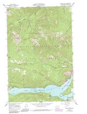
Rimrock Lake Topo Map Washington
To zoom in, hover over the map of Rimrock Lake
USGS Topo Quad 46121f2 - 1:24,000 scale
| Topo Map Name: | Rimrock Lake |
| USGS Topo Quad ID: | 46121f2 |
| Print Size: | ca. 21 1/4" wide x 27" high |
| Southeast Coordinates: | 46.625° N latitude / 121.125° W longitude |
| Map Center Coordinates: | 46.6875° N latitude / 121.1875° W longitude |
| U.S. State: | WA |
| Filename: | o46121f2.jpg |
| Download Map JPG Image: | Rimrock Lake topo map 1:24,000 scale |
| Map Type: | Topographic |
| Topo Series: | 7.5´ |
| Map Scale: | 1:24,000 |
| Source of Map Images: | United States Geological Survey (USGS) |
| Alternate Map Versions: |
Rimrock Lake WA 1967, updated 1969 Download PDF Buy paper map Rimrock Lake WA 1967, updated 1978 Download PDF Buy paper map Rimrock Lake WA 1967, updated 1987 Download PDF Buy paper map Rimrock Lake WA 1992, updated 1996 Download PDF Buy paper map Rimrock Lake WA 2000, updated 2001 Download PDF Buy paper map Rimrock Lake WA 2011 Download PDF Buy paper map Rimrock Lake WA 2014 Download PDF Buy paper map |
| FStopo: | US Forest Service topo Rimrock Lake is available: Download FStopo PDF Download FStopo TIF |
1:24,000 Topo Quads surrounding Rimrock Lake
> Back to 46121e1 at 1:100,000 scale
> Back to 46120a1 at 1:250,000 scale
> Back to U.S. Topo Maps home
Rimrock Lake topo map: Gazetteer
Rimrock Lake: Bays
Lonesome Cove elevation 892m 2926′Silver Salmon Cove elevation 892m 2926′
Rimrock Lake: Cliffs
Wildcat Post Piles elevation 1122m 3681′Rimrock Lake: Dams
Tieton Dam elevation 892m 2926′Rimrock Lake: Flats
Cash Prairie elevation 1828m 5997′McAllister Meadow (historical) elevation 892m 2926′
Rattlesnake Meadows elevation 1180m 3871′
Strawberry Meadows elevation 1156m 3792′
Rimrock Lake: Lakes
Lightning Lake elevation 1036m 3398′Thunder Lake elevation 1053m 3454′
Rimrock Lake: Pillars
Westfall Rocks elevation 1229m 4032′Rimrock Lake: Populated Places
Rimrock elevation 832m 2729′Silver Beach elevation 902m 2959′
Rimrock Lake: Reservoirs
Rimrock Lake elevation 892m 2926′Rimrock Lake: Ridges
Russell Ridge elevation 1757m 5764′Rimrock Lake: Streams
Andy Creek elevation 892m 2926′Bear Creek elevation 897m 2942′
Elkhorn Creek elevation 1111m 3645′
Hart Creek elevation 894m 2933′
Indian Creek elevation 892m 2926′
Kitten Creek elevation 1194m 3917′
Little Wildcat Creek elevation 1177m 3861′
Russell Creek elevation 892m 2926′
Shell Creek elevation 1163m 3815′
Thunder Creek elevation 967m 3172′
Rimrock Lake: Summits
Burnt Mountain elevation 1974m 6476′Rattlesnake Peaks elevation 1986m 6515′
Shellrock Peak elevation 2069m 6788′
Rimrock Lake digital topo map on disk
Buy this Rimrock Lake topo map showing relief, roads, GPS coordinates and other geographical features, as a high-resolution digital map file on DVD:


