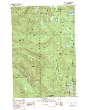
White Pass Topo Map Washington
To zoom in, hover over the map of White Pass
USGS Topo Quad 46121f4 - 1:24,000 scale
| Topo Map Name: | White Pass |
| USGS Topo Quad ID: | 46121f4 |
| Print Size: | ca. 21 1/4" wide x 27" high |
| Southeast Coordinates: | 46.625° N latitude / 121.375° W longitude |
| Map Center Coordinates: | 46.6875° N latitude / 121.4375° W longitude |
| U.S. State: | WA |
| Filename: | o46121f4.jpg |
| Download Map JPG Image: | White Pass topo map 1:24,000 scale |
| Map Type: | Topographic |
| Topo Series: | 7.5´ |
| Map Scale: | 1:24,000 |
| Source of Map Images: | United States Geological Survey (USGS) |
| Alternate Map Versions: |
White Pass WA 1988, updated 1988 Download PDF Buy paper map White Pass WA 1988, updated 1988 Download PDF Buy paper map White Pass WA 1998, updated 2003 Download PDF Buy paper map White Pass WA 2011 Download PDF Buy paper map White Pass WA 2014 Download PDF Buy paper map |
| FStopo: | US Forest Service topo White Pass is available: Download FStopo PDF Download FStopo TIF |
1:24,000 Topo Quads surrounding White Pass
> Back to 46121e1 at 1:100,000 scale
> Back to 46120a1 at 1:250,000 scale
> Back to U.S. Topo Maps home
White Pass topo map: Gazetteer
White Pass: Capes
Cortright Point elevation 1758m 5767′White Pass: Gaps
Cowlitz Pass elevation 1582m 5190′White Pass elevation 1365m 4478′
White Pass: Lakes
Benchmark Lake elevation 1590m 5216′Beusch Lake elevation 1554m 5098′
Bill Lake elevation 1560m 5118′
Chain Lakes elevation 1454m 4770′
Deer Lake elevation 1593m 5226′
Deerhead Lake elevation 1583m 5193′
Dumbbell Lake elevation 1553m 5095′
Fryingpan Lake elevation 1469m 4819′
Ginnette Lake elevation 1653m 5423′
Henry Lake elevation 1573m 5160′
Jess Lake elevation 1560m 5118′
Jug Lake elevation 1345m 4412′
Kincaid Lake elevation 1623m 5324′
Knuppenburg Lake elevation 1252m 4107′
Leech Lake elevation 1346m 4416′
Lily Lake elevation 1115m 3658′
Little Snow Lake elevation 1474m 4835′
Penoyer Lake elevation 1523m 4996′
Pipe Lake elevation 1583m 5193′
Sand Lake elevation 1617m 5305′
Snow Lake elevation 1505m 4937′
Twin Sisters Lakes elevation 1572m 5157′
White Pass: Ridges
Carlton Ridge elevation 1499m 4917′White Pass: Springs
Log Spring elevation 1472m 4829′White Pass: Streams
Allred Creek elevation 999m 3277′Millridge Creek elevation 964m 3162′
Pony Creek elevation 1000m 3280′
White Pass: Summits
Cramer Mountain elevation 1795m 5889′Fryingpan Mountain elevation 1733m 5685′
White Pass: Trails
Clear Fork Trail elevation 1136m 3727′Cortright Creek Trail elevation 1584m 5196′
Cowlitz Trail elevation 1340m 4396′
Dark Meadows Trail elevation 1454m 4770′
Jug Lake Trail elevation 1471m 4826′
Kincaid Trail elevation 1662m 5452′
Lake Trail elevation 1476m 4842′
Sand Lake Trail elevation 1652m 5419′
White Pass digital topo map on disk
Buy this White Pass topo map showing relief, roads, GPS coordinates and other geographical features, as a high-resolution digital map file on DVD:


