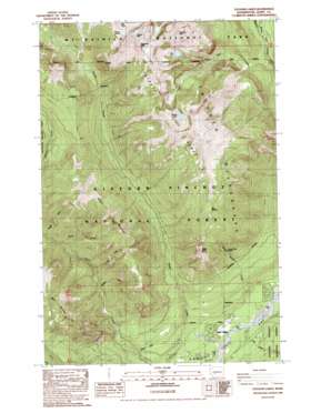
Tatoosh Lakes Topo Map Washington
To zoom in, hover over the map of Tatoosh Lakes
USGS Topo Quad 46121f6 - 1:24,000 scale
| Topo Map Name: | Tatoosh Lakes |
| USGS Topo Quad ID: | 46121f6 |
| Print Size: | ca. 21 1/4" wide x 27" high |
| Southeast Coordinates: | 46.625° N latitude / 121.625° W longitude |
| Map Center Coordinates: | 46.6875° N latitude / 121.6875° W longitude |
| U.S. State: | WA |
| Filename: | o46121f6.jpg |
| Download Map JPG Image: | Tatoosh Lakes topo map 1:24,000 scale |
| Map Type: | Topographic |
| Topo Series: | 7.5´ |
| Map Scale: | 1:24,000 |
| Source of Map Images: | United States Geological Survey (USGS) |
| Alternate Map Versions: |
Tatoosh Lakes WA 1989, updated 1989 Download PDF Buy paper map Tatoosh Lakes WA 1989, updated 1989 Download PDF Buy paper map Tatoosh Lakes WA 1998, updated 2003 Download PDF Buy paper map Tatoosh Lakes WA 2011 Download PDF Buy paper map Tatoosh Lakes WA 2014 Download PDF Buy paper map |
| FStopo: | US Forest Service topo Tatoosh Lakes is available: Download FStopo PDF Download FStopo TIF |
1:24,000 Topo Quads surrounding Tatoosh Lakes
> Back to 46121e1 at 1:100,000 scale
> Back to 46120a1 at 1:250,000 scale
> Back to U.S. Topo Maps home
Tatoosh Lakes topo map: Gazetteer
Tatoosh Lakes: Areas
Butter Creek Research Natural Area elevation 1036m 3398′The Burn elevation 732m 2401′
Tatoosh Lakes: Glaciers
Unicorn Glacier elevation 1921m 6302′Tatoosh Lakes: Lakes
Blue Lake elevation 1345m 4412′Tatoosh Lakes elevation 1534m 5032′
Tatoosh Lakes: Ridges
Tatoosh Ridge elevation 1677m 5501′Tatoosh Lakes: Springs
Bum Springs elevation 1544m 5065′Tatoosh Lakes: Streams
Boulder Creek elevation 514m 1686′Butler Creek elevation 330m 1082′
Butter Creek elevation 333m 1092′
Dixon Creek elevation 381m 1250′
Hinkle Tinkle Creek elevation 346m 1135′
Lake Creek elevation 337m 1105′
Maggie Creek elevation 632m 2073′
Rock Creek elevation 607m 1991′
Stevens Creek elevation 739m 2424′
Taos Creek elevation 675m 2214′
Teardrop Creek elevation 556m 1824′
Tatoosh Lakes: Summits
Boundary Peak elevation 2037m 6683′Butter Peak elevation 1436m 4711′
Dixon Mountain elevation 1486m 4875′
Stevens Peak elevation 2002m 6568′
Unicorn Peak elevation 2102m 6896′
Tatoosh Lakes: Trails
Hinkle Tinkle Trail elevation 952m 3123′Tatoosh Trail elevation 1541m 5055′
Tatoosh Lakes digital topo map on disk
Buy this Tatoosh Lakes topo map showing relief, roads, GPS coordinates and other geographical features, as a high-resolution digital map file on DVD:


