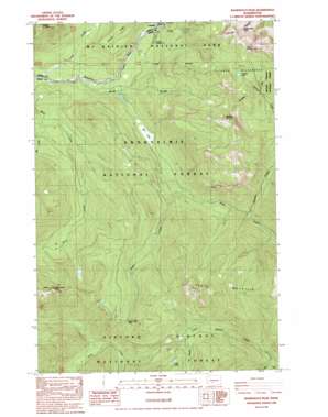
Wahpenayo Peak Topo Map Washington
To zoom in, hover over the map of Wahpenayo Peak
USGS Topo Quad 46121f7 - 1:24,000 scale
| Topo Map Name: | Wahpenayo Peak |
| USGS Topo Quad ID: | 46121f7 |
| Print Size: | ca. 21 1/4" wide x 27" high |
| Southeast Coordinates: | 46.625° N latitude / 121.75° W longitude |
| Map Center Coordinates: | 46.6875° N latitude / 121.8125° W longitude |
| U.S. State: | WA |
| Filename: | o46121f7.jpg |
| Download Map JPG Image: | Wahpenayo Peak topo map 1:24,000 scale |
| Map Type: | Topographic |
| Topo Series: | 7.5´ |
| Map Scale: | 1:24,000 |
| Source of Map Images: | United States Geological Survey (USGS) |
| Alternate Map Versions: |
Wahpenayo Peak WA 1989, updated 1989 Download PDF Buy paper map Wahpenayo Peak WA 1998, updated 2003 Download PDF Buy paper map Wahpenayo Peak WA 2011 Download PDF Buy paper map Wahpenayo Peak WA 2014 Download PDF Buy paper map |
| FStopo: | US Forest Service topo Wahpenayo Peak is available: Download FStopo PDF Download FStopo TIF |
1:24,000 Topo Quads surrounding Wahpenayo Peak
> Back to 46121e1 at 1:100,000 scale
> Back to 46120a1 at 1:250,000 scale
> Back to U.S. Topo Maps home
Wahpenayo Peak topo map: Gazetteer
Wahpenayo Peak: Flats
Bear Prairie elevation 779m 2555′Wahpenayo Peak: Gaps
Silver Creek Pass elevation 1135m 3723′Wahpenayo Peak: Lakes
Johnson Lake elevation 1291m 4235′Lake Fizrenken elevation 1201m 3940′
Long Lake elevation 1165m 3822′
Upper Johnson Lake elevation 1538m 5045′
Wahpenayo Peak: Populated Places
Longmire elevation 838m 2749′Wahpenayo Peak: Post Offices
Longmire Post Office (historical) elevation 838m 2749′Wahpenayo Peak: Streams
Horse Creek elevation 714m 2342′Johnson Creek elevation 649m 2129′
Kautz Creek elevation 671m 2201′
North Fork Willame Creek elevation 732m 2401′
Wahpenayo Peak: Summits
Allen Mountain elevation 1499m 4917′Lookout Mountain elevation 1617m 5305′
Skate Mountain elevation 1442m 4730′
Tumtum Peak elevation 1345m 4412′
Wahpenayo Peak elevation 1885m 6184′
Wahpenayo Peak: Trails
Silver Creek Trail elevation 1387m 4550′Wahpenayo Peak digital topo map on disk
Buy this Wahpenayo Peak topo map showing relief, roads, GPS coordinates and other geographical features, as a high-resolution digital map file on DVD:


