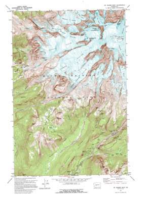
Mount Rainier West Topo Map Washington
To zoom in, hover over the map of Mount Rainier West
USGS Topo Quad 46121g7 - 1:24,000 scale
| Topo Map Name: | Mount Rainier West |
| USGS Topo Quad ID: | 46121g7 |
| Print Size: | ca. 21 1/4" wide x 27" high |
| Southeast Coordinates: | 46.75° N latitude / 121.75° W longitude |
| Map Center Coordinates: | 46.8125° N latitude / 121.8125° W longitude |
| U.S. State: | WA |
| Filename: | o46121g7.jpg |
| Download Map JPG Image: | Mount Rainier West topo map 1:24,000 scale |
| Map Type: | Topographic |
| Topo Series: | 7.5´ |
| Map Scale: | 1:24,000 |
| Source of Map Images: | United States Geological Survey (USGS) |
| Alternate Map Versions: |
Mt Rainier West WA 1971, updated 1974 Download PDF Buy paper map Mt Rainier West WA 1971, updated 1974 Download PDF Buy paper map Mt Rainier West WA 1971, updated 1996 Download PDF Buy paper map Mt Rainier West WA 1971, updated 1996 Download PDF Buy paper map Mount Rainier West WA 2011 Download PDF Buy paper map Mount Rainier West WA 2014 Download PDF Buy paper map |
1:24,000 Topo Quads surrounding Mount Rainier West
> Back to 46121e1 at 1:100,000 scale
> Back to 46120a1 at 1:250,000 scale
> Back to U.S. Topo Maps home
Mount Rainier West topo map: Gazetteer
Mount Rainier West: Areas
Indian Henrys Hunting Ground elevation 1674m 5492′Mount Rainier West: Basins
Sunset Amphitheater elevation 3646m 11961′Mount Rainier West: Cliffs
Basalt Cliff elevation 1840m 6036′Colonnade elevation 1848m 6062′
Jeanette Heights elevation 1872m 6141′
Kautz Ice Cliff elevation 3665m 12024′
Mowich Face elevation 3399m 11151′
Russell Cliff elevation 3950m 12959′
The Ramparts elevation 1035m 3395′
Willis Wall elevation 3364m 11036′
Wilson Headwall elevation 3563m 11689′
Mount Rainier West: Craters
East Crater elevation 4336m 14225′West Crater elevation 4377m 14360′
Mount Rainier West: Falls
Carter Falls elevation 1124m 3687′Christine Falls elevation 1123m 3684′
Comet Falls elevation 1493m 4898′
Madcap Falls elevation 1165m 3822′
Nahunta Falls elevation 1207m 3959′
Pearl Falls elevation 1728m 5669′
Tato Falls elevation 1307m 4288′
Mount Rainier West: Flats
Longmire Meadow elevation 844m 2769′Pyramid Park elevation 1834m 6017′
Saint Andrews Park elevation 1760m 5774′
Van Trump Park elevation 1630m 5347′
Mount Rainier West: Glaciers
Edmunds Glacier elevation 2609m 8559′Kautz Glacier elevation 2706m 8877′
Liberty Gap Glacier elevation 3871m 12700′
Nisqually Icefall elevation 3551m 11650′
Puyallup Glacier elevation 2456m 8057′
Pyramid Glacier elevation 2034m 6673′
Pyramid Glaciers elevation 2382m 7814′
South Mowich Glacier elevation 2227m 7306′
South Tahoma Glacier elevation 2498m 8195′
Success Glacier elevation 2834m 9297′
Tahoma Glacier elevation 2616m 8582′
The Turtle elevation 3047m 9996′
Van Trump Glacier elevation 2434m 7985′
Mount Rainier West: Lakes
Frog Heaven elevation 1351m 4432′Mirror Lakes elevation 1649m 5410′
Saint Andrews Lake elevation 1795m 5889′
Squaw Lake elevation 1547m 5075′
Mount Rainier West: Parks
Aurora Park elevation 1469m 4819′Klapatche Park elevation 1723m 5652′
Mount Rainier West: Pillars
Register Rock elevation 4367m 14327′Mount Rainier West: Ranges
Cascade Range elevation 4395m 14419′Mount Rainier West: Ridges
Columbia Crest elevation 4394m 14416′Cushman Crest elevation 1750m 5741′
Emerald Ridge elevation 1679m 5508′
Kautz Cleaver elevation 2996m 9829′
Liberty Ridge elevation 3293m 10803′
Puyallup Cleaver elevation 2794m 9166′
Rampart Ridge elevation 1160m 3805′
Success Cleaver elevation 3034m 9954′
Success Divide elevation 2243m 7358′
Sunset Ridge elevation 3561m 11683′
Tahoma Cleaver elevation 2880m 9448′
Wapowety Cleaver elevation 3049m 10003′
Mount Rainier West: Streams
Dead Horse Creek elevation 1233m 4045′Devils Dream Creek elevation 1091m 3579′
Fish Creek elevation 793m 2601′
Fishers Hornpipe Creek elevation 1113m 3651′
Paradise River elevation 959m 3146′
Pearl Creek elevation 1286m 4219′
Pyramid Creek elevation 856m 2808′
Tatoosh Creek elevation 1163m 3815′
Van Trump Creek elevation 1029m 3375′
Mount Rainier West: Summits
Aurora Peak elevation 1852m 6076′Chutla Peak elevation 1803m 5915′
Copper Mountain elevation 1905m 6250′
Cougar Rock elevation 1148m 3766′
Eagle Peak elevation 1798m 5898′
Glacier Island elevation 1860m 6102′
Iron Mountain elevation 1910m 6266′
Lane Peak elevation 1831m 6007′
Liberty Cap elevation 4297m 14097′
Mildred Point elevation 1810m 5938′
Mount Ararat elevation 1829m 6000′
Mount Rainier elevation 4394m 14416′
Point Success elevation 4302m 14114′
Pyramid Peak elevation 2108m 6916′
Saint Andrews Rock elevation 3520m 11548′
Satulick Mountain elevation 1699m 5574′
Tokaloo Rock elevation 2337m 7667′
Tokaloo Spire elevation 2271m 7450′
Mount Rainier West: Valleys
Fuhrer Finger elevation 2932m 9619′Fuhrer Thumb elevation 3159m 10364′
Kautz Chute elevation 3415m 11204′
Van Trump Canyon elevation 1439m 4721′
Mount Rainier West digital topo map on disk
Buy this Mount Rainier West topo map showing relief, roads, GPS coordinates and other geographical features, as a high-resolution digital map file on DVD:


