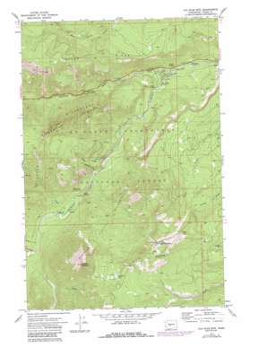
Old Scab Mountain Topo Map Washington
To zoom in, hover over the map of Old Scab Mountain
USGS Topo Quad 46121h2 - 1:24,000 scale
| Topo Map Name: | Old Scab Mountain |
| USGS Topo Quad ID: | 46121h2 |
| Print Size: | ca. 21 1/4" wide x 27" high |
| Southeast Coordinates: | 46.875° N latitude / 121.125° W longitude |
| Map Center Coordinates: | 46.9375° N latitude / 121.1875° W longitude |
| U.S. State: | WA |
| Filename: | o46121h2.jpg |
| Download Map JPG Image: | Old Scab Mountain topo map 1:24,000 scale |
| Map Type: | Topographic |
| Topo Series: | 7.5´ |
| Map Scale: | 1:24,000 |
| Source of Map Images: | United States Geological Survey (USGS) |
| Alternate Map Versions: |
Old Scab Mtn. WA 1971, updated 1974 Download PDF Buy paper map Old Scab Mtn. WA 1971, updated 1987 Download PDF Buy paper map Old Scab Mtn WA 1992, updated 1996 Download PDF Buy paper map Old Scab Mountain WA 2000, updated 2001 Download PDF Buy paper map Old Scab Mountain WA 2011 Download PDF Buy paper map Old Scab Mountain WA 2014 Download PDF Buy paper map |
| FStopo: | US Forest Service topo Old Scab Mountain is available: Download FStopo PDF Download FStopo TIF |
1:24,000 Topo Quads surrounding Old Scab Mountain
> Back to 46121e1 at 1:100,000 scale
> Back to 46120a1 at 1:250,000 scale
> Back to U.S. Topo Maps home
Old Scab Mountain topo map: Gazetteer
Old Scab Mountain: Flats
Indian Flat elevation 826m 2709′Old Scab Mountain: Lakes
Flat Iron Lake elevation 1705m 5593′Old Scab Mountain: Populated Places
American River elevation 857m 2811′Old Scab Mountain: Ridges
Fifes Ridge elevation 1648m 5406′Old Scab Mountain: Springs
Cedar Springs elevation 852m 2795′Little Bald Mountain Spring elevation 1812m 5944′
Soda Springs elevation 931m 3054′
Willow Springs elevation 869m 2851′
Old Scab Mountain: Streams
American River elevation 834m 2736′Cedar Creek elevation 899m 2949′
Chipmunk Creek elevation 908m 2979′
Fifes Creek elevation 886m 2906′
Goat Creek elevation 928m 3044′
Scab Creek elevation 964m 3162′
Sunrise Creek elevation 955m 3133′
Old Scab Mountain: Summits
Little Bald Mountain elevation 1858m 6095′Old Scab Mountain elevation 1995m 6545′
Old Scab Mountain: Trails
Goat Creek Trail elevation 1282m 4206′Nile Ridge Trail elevation 1218m 3996′
Old Scab Mountain digital topo map on disk
Buy this Old Scab Mountain topo map showing relief, roads, GPS coordinates and other geographical features, as a high-resolution digital map file on DVD:


