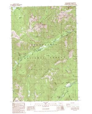
Goose Prairie Topo Map Washington
To zoom in, hover over the map of Goose Prairie
USGS Topo Quad 46121h3 - 1:24,000 scale
| Topo Map Name: | Goose Prairie |
| USGS Topo Quad ID: | 46121h3 |
| Print Size: | ca. 21 1/4" wide x 27" high |
| Southeast Coordinates: | 46.875° N latitude / 121.25° W longitude |
| Map Center Coordinates: | 46.9375° N latitude / 121.3125° W longitude |
| U.S. State: | WA |
| Filename: | o46121h3.jpg |
| Download Map JPG Image: | Goose Prairie topo map 1:24,000 scale |
| Map Type: | Topographic |
| Topo Series: | 7.5´ |
| Map Scale: | 1:24,000 |
| Source of Map Images: | United States Geological Survey (USGS) |
| Alternate Map Versions: |
Goose Prairie WA 1988, updated 1988 Download PDF Buy paper map Goose Prairie WA 2000, updated 2001 Download PDF Buy paper map Goose Prairie WA 2011 Download PDF Buy paper map Goose Prairie WA 2014 Download PDF Buy paper map |
| FStopo: | US Forest Service topo Goose Prairie is available: Download FStopo PDF Download FStopo TIF |
1:24,000 Topo Quads surrounding Goose Prairie
> Back to 46121e1 at 1:100,000 scale
> Back to 46120a1 at 1:250,000 scale
> Back to U.S. Topo Maps home
Goose Prairie topo map: Gazetteer
Goose Prairie: Falls
Union Creek Falls elevation 1140m 3740′Goose Prairie: Lakes
Crow Creek Lake elevation 1387m 4550′Kettle Lake elevation 1753m 5751′
Pleasant Valley Lake elevation 1288m 4225′
Sheepherder Lake elevation 1513m 4963′
Goose Prairie: Populated Places
Goose Prairie elevation 990m 3248′Goose Prairie: Post Offices
Gooseprairie Post Office (historical) elevation 990m 3248′Goose Prairie: Ridges
American Ridge elevation 1854m 6082′Goose Prairie: Streams
Hall Creek elevation 998m 3274′Kettle Creek elevation 1020m 3346′
Miner Creek elevation 1009m 3310′
Parker Creek elevation 1010m 3313′
Pinus Creek elevation 1001m 3284′
Survey Creek elevation 1021m 3349′
Thunder Creek elevation 999m 3277′
Union Creek elevation 1038m 3405′
Wash Creek elevation 1003m 3290′
Goose Prairie: Summits
Fifes Peaks elevation 1865m 6118′Goat Peak elevation 1943m 6374′
Goose Prairie: Trails
American Ridge Trail elevation 1747m 5731′Crow Lake Trail elevation 1693m 5554′
Fifes Ridge Trail elevation 1135m 3723′
Goose Prairie Trail elevation 1503m 4931′
Goose Prairie: Valleys
Pleasant Valley elevation 1001m 3284′Goose Prairie digital topo map on disk
Buy this Goose Prairie topo map showing relief, roads, GPS coordinates and other geographical features, as a high-resolution digital map file on DVD:


