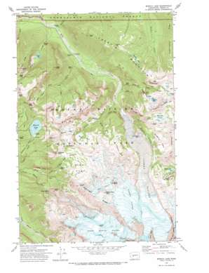
Mowich Lake Topo Map Washington
To zoom in, hover over the map of Mowich Lake
USGS Topo Quad 46121h7 - 1:24,000 scale
| Topo Map Name: | Mowich Lake |
| USGS Topo Quad ID: | 46121h7 |
| Print Size: | ca. 21 1/4" wide x 27" high |
| Southeast Coordinates: | 46.875° N latitude / 121.75° W longitude |
| Map Center Coordinates: | 46.9375° N latitude / 121.8125° W longitude |
| U.S. State: | WA |
| Filename: | o46121h7.jpg |
| Download Map JPG Image: | Mowich Lake topo map 1:24,000 scale |
| Map Type: | Topographic |
| Topo Series: | 7.5´ |
| Map Scale: | 1:24,000 |
| Source of Map Images: | United States Geological Survey (USGS) |
| Alternate Map Versions: |
Mowich Lake WA 1971, updated 1974 Download PDF Buy paper map Mowich Lake WA 1971, updated 1974 Download PDF Buy paper map Mowich Lake WA 2011 Download PDF Buy paper map Mowich Lake WA 2014 Download PDF Buy paper map |
| FStopo: | US Forest Service topo Mowich Lake is available: Download FStopo PDF Download FStopo TIF |
1:24,000 Topo Quads surrounding Mowich Lake
> Back to 46121e1 at 1:100,000 scale
> Back to 46120a1 at 1:250,000 scale
> Back to U.S. Topo Maps home
Mowich Lake topo map: Gazetteer
Mowich Lake: Cliffs
Eagle Cliff elevation 1370m 4494′Echo Cliffs elevation 1239m 4064′
Northern Crags elevation 1693m 5554′
Yellowstone Cliffs elevation 1781m 5843′
Mowich Lake: Falls
Alice Falls elevation 1023m 3356′Cataract Falls elevation 1229m 4032′
Chenuis Falls elevation 684m 2244′
Cress Falls elevation 1567m 5141′
Giant Falls elevation 1377m 4517′
Ipsut Falls elevation 796m 2611′
Ranger Falls elevation 843m 2765′
Spray Falls elevation 1585m 5200′
Mowich Lake: Flats
Bee Flat elevation 1350m 4429′Elysian Fields elevation 1742m 5715′
Mist Park elevation 1580m 5183′
Moraine Park elevation 1811m 5941′
Seattle Park elevation 1809m 5935′
Spray Park elevation 1825m 5987′
Mowich Lake: Gaps
Ipsut Pass elevation 1552m 5091′Knapsack Pass elevation 1890m 6200′
Windy Gap elevation 1768m 5800′
Mowich Lake: Glaciers
Carbon Glacier elevation 1603m 5259′Flett Glacier elevation 2273m 7457′
North Mowich Glacier elevation 2453m 8047′
Russell Glacier elevation 2337m 7667′
Mowich Lake: Lakes
Chenuis Lakes elevation 1514m 4967′Crescent Lake elevation 1697m 5567′
Green Lake elevation 972m 3188′
Lake Tom elevation 1341m 4399′
Mowich Lake elevation 1504m 4934′
Mystic Lake elevation 1739m 5705′
Mowich Lake: Pillars
Division Rock elevation 1483m 4865′Echo Rock elevation 2386m 7828′
Goat Island Rock elevation 1580m 5183′
Needle Rock elevation 2258m 7408′
Mowich Lake: Ridges
Curtis Ridge elevation 3019m 9904′Independence Ridge elevation 1586m 5203′
Ptarmigan Ridge elevation 2378m 7801′
Rust Ridge elevation 1617m 5305′
Mowich Lake: Streams
Cataract Creek elevation 969m 3179′Cayada Creek elevation 611m 2004′
Chenuis Creek elevation 661m 2168′
Crescent Creek elevation 1368m 4488′
Dick Creek elevation 1241m 4071′
Doe Creek elevation 939m 3080′
Falls Creek elevation 602m 1975′
Grant Creek elevation 1443m 4734′
Ipsut Creek elevation 704m 2309′
Lee Creek elevation 1191m 3907′
Marmot Creek elevation 1204m 3950′
Moraine Creek elevation 1203m 3946′
Ranger Creek elevation 634m 2080′
Spukwush Creek elevation 918m 3011′
Mowich Lake: Summits
Arthur Peak elevation 1661m 5449′Castle Peak elevation 1838m 6030′
Chenuis Mountain elevation 1686m 5531′
Crescent Mountain elevation 2041m 6696′
Fay Peak elevation 1922m 6305′
Gove Peak elevation 1558m 5111′
Hessong Rock elevation 1945m 6381′
Mineral Mountain elevation 1985m 6512′
Mother Mountain elevation 1871m 6138′
Mount Pleasant elevation 1939m 6361′
Observation Rock elevation 2508m 8228′
Old Desolate elevation 2071m 6794′
Pacific Point elevation 1883m 6177′
Tillicum Point elevation 2034m 6673′
Tirzah Peak elevation 1521m 4990′
Tyee Peak elevation 1793m 5882′
Wallace Peak elevation 1686m 5531′
Mowich Lake: Trails
Ipsut Creek Trail elevation 1033m 3389′Northern Loop Trail elevation 1742m 5715′
Mowich Lake digital topo map on disk
Buy this Mowich Lake topo map showing relief, roads, GPS coordinates and other geographical features, as a high-resolution digital map file on DVD:


