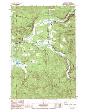
Toutle Topo Map Washington
To zoom in, hover over the map of Toutle
USGS Topo Quad 46122c6 - 1:24,000 scale
| Topo Map Name: | Toutle |
| USGS Topo Quad ID: | 46122c6 |
| Print Size: | ca. 21 1/4" wide x 27" high |
| Southeast Coordinates: | 46.25° N latitude / 122.625° W longitude |
| Map Center Coordinates: | 46.3125° N latitude / 122.6875° W longitude |
| U.S. State: | WA |
| Filename: | o46122c6.jpg |
| Download Map JPG Image: | Toutle topo map 1:24,000 scale |
| Map Type: | Topographic |
| Topo Series: | 7.5´ |
| Map Scale: | 1:24,000 |
| Source of Map Images: | United States Geological Survey (USGS) |
| Alternate Map Versions: |
Toutle WA 1985, updated 1985 Download PDF Buy paper map Toutle WA 1985, updated 1994 Download PDF Buy paper map Toutle WA 2011 Download PDF Buy paper map Toutle WA 2013 Download PDF Buy paper map |
1:24,000 Topo Quads surrounding Toutle
> Back to 46122a1 at 1:100,000 scale
> Back to 46122a1 at 1:250,000 scale
> Back to U.S. Topo Maps home
Toutle topo map: Gazetteer
Toutle: Bridges
Coal Bank Bridge elevation 129m 423′Toutle: Dams
Silver Lake Dam elevation 153m 501′South Fork Toutle Debris Dam elevation 179m 587′
Toutle: Parks
Kid Valley Park elevation 183m 600′Toutle: Populated Places
Sightly elevation 211m 692′Toutle elevation 152m 498′
Toutle: Streams
Brownell Creek elevation 188m 616′Hemlock Creek elevation 152m 498′
Johnson Creek elevation 161m 528′
Jordan Creek elevation 223m 731′
Noble Creek elevation 193m 633′
North Fork Toutle River elevation 134m 439′
Outlet Creek elevation 127m 416′
South Fork Toutle River elevation 134m 439′
Studebaker Creek elevation 137m 449′
Wyant Creek elevation 139m 456′
Toutle: Summits
Beigle Mountain elevation 292m 958′Toutle digital topo map on disk
Buy this Toutle topo map showing relief, roads, GPS coordinates and other geographical features, as a high-resolution digital map file on DVD:


