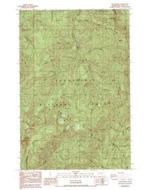
The Rockies Topo Map Washington
To zoom in, hover over the map of The Rockies
USGS Topo Quad 46122f3 - 1:24,000 scale
| Topo Map Name: | The Rockies |
| USGS Topo Quad ID: | 46122f3 |
| Print Size: | ca. 21 1/4" wide x 27" high |
| Southeast Coordinates: | 46.625° N latitude / 122.25° W longitude |
| Map Center Coordinates: | 46.6875° N latitude / 122.3125° W longitude |
| U.S. State: | WA |
| Filename: | o46122f3.jpg |
| Download Map JPG Image: | The Rockies topo map 1:24,000 scale |
| Map Type: | Topographic |
| Topo Series: | 7.5´ |
| Map Scale: | 1:24,000 |
| Source of Map Images: | United States Geological Survey (USGS) |
| Alternate Map Versions: |
The Rockies WA 1987, updated 1987 Download PDF Buy paper map The Rockies WA 1987, updated 1993 Download PDF Buy paper map The Rockies WA 1998, updated 2003 Download PDF Buy paper map The Rockies WA 2011 Download PDF Buy paper map The Rockies WA 2014 Download PDF Buy paper map |
| FStopo: | US Forest Service topo The Rockies is available: Download FStopo PDF Download FStopo TIF |
1:24,000 Topo Quads surrounding The Rockies
> Back to 46122e1 at 1:100,000 scale
> Back to 46122a1 at 1:250,000 scale
> Back to U.S. Topo Maps home
The Rockies topo map: Gazetteer
The Rockies: Lakes
Duck Lake elevation 967m 3172′Goose Lake elevation 877m 2877′
Petite Lake elevation 698m 2290′
The Rockies: Streams
Buck Creek elevation 677m 2221′Eagle Creek elevation 527m 1729′
Fly Creek elevation 635m 2083′
Hiawatha Creek elevation 532m 1745′
Lake Creek elevation 604m 1981′
Lewis Creek elevation 401m 1315′
Lincoln Creek elevation 363m 1190′
Scatter Creek elevation 514m 1686′
Soap Creek elevation 457m 1499′
Soos Creek elevation 572m 1876′
Spencer Creek elevation 496m 1627′
Trap Creek elevation 606m 1988′
Trout Creek elevation 453m 1486′
West Fork Little Nisqually River elevation 546m 1791′
Wildcat Creek elevation 443m 1453′
Winston Creek elevation 546m 1791′
The Rockies: Summits
Cougar Mountain elevation 1154m 3786′Ladd Mountain elevation 1198m 3930′
Stahl Mountain elevation 1124m 3687′
The Rockies elevation 1226m 4022′
The Rockies digital topo map on disk
Buy this The Rockies topo map showing relief, roads, GPS coordinates and other geographical features, as a high-resolution digital map file on DVD:


