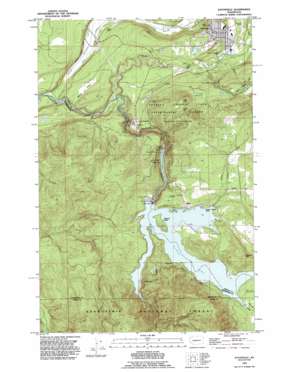
Eatonville Topo Map Washington
To zoom in, hover over the map of Eatonville
USGS Topo Quad 46122g3 - 1:24,000 scale
| Topo Map Name: | Eatonville |
| USGS Topo Quad ID: | 46122g3 |
| Print Size: | ca. 21 1/4" wide x 27" high |
| Southeast Coordinates: | 46.75° N latitude / 122.25° W longitude |
| Map Center Coordinates: | 46.8125° N latitude / 122.3125° W longitude |
| U.S. State: | WA |
| Filename: | o46122g3.jpg |
| Download Map JPG Image: | Eatonville topo map 1:24,000 scale |
| Map Type: | Topographic |
| Topo Series: | 7.5´ |
| Map Scale: | 1:24,000 |
| Source of Map Images: | United States Geological Survey (USGS) |
| Alternate Map Versions: |
Eatonville WA 1959, updated 1967 Download PDF Buy paper map Eatonville WA 1959, updated 1976 Download PDF Buy paper map Eatonville WA 1990, updated 1995 Download PDF Buy paper map Eatonville WA 1998, updated 2003 Download PDF Buy paper map Eatonville WA 2011 Download PDF Buy paper map Eatonville WA 2014 Download PDF Buy paper map |
| FStopo: | US Forest Service topo Eatonville is available: Download FStopo PDF Download FStopo TIF |
1:24,000 Topo Quads surrounding Eatonville
> Back to 46122e1 at 1:100,000 scale
> Back to 46122a1 at 1:250,000 scale
> Back to U.S. Topo Maps home
Eatonville topo map: Gazetteer
Eatonville: Airports
Swanson Airport elevation 266m 872′Eatonville: Dams
Alder Dam elevation 295m 967′Eatonville Mill Pond Dam elevation 237m 777′
La Grande Dam elevation 286m 938′
Eatonville: Falls
Little Mashel Falls elevation 281m 921′Eatonville: Flats
Mashel Prairie elevation 203m 666′Eatonville: Gaps
Kirkland Pass elevation 490m 1607′Eatonville: Islands
Bogucki Island elevation 411m 1348′Eatonville: Parks
Charles Lathrop Pack Experimental and Demonstration Forest elevation 509m 1669′Glacier View Park elevation 253m 830′
Eatonville: Populated Places
Alder elevation 377m 1236′Eatonville elevation 244m 800′
La Grande elevation 289m 948′
New Reliance elevation 427m 1400′
Ohop Bob elevation 150m 492′
Reliance elevation 373m 1223′
Eatonville: Reservoirs
Alder Lake elevation 295m 967′Eatonville Mill Pond elevation 237m 777′
La Grande Reservoir elevation 286m 938′
Twentyseven Creek Reservoir elevation 359m 1177′
Eatonville: Streams
Little Mashel River elevation 219m 718′Little Nisqually River elevation 362m 1187′
Mashel River elevation 147m 482′
Mona Creek elevation 390m 1279′
Ohop Creek elevation 138m 452′
Eatonville: Summits
Hugo Peak elevation 532m 1745′Reliance Hill elevation 570m 1870′
Eatonville: Valleys
Ohop Valley elevation 141m 462′Pleasant Valley elevation 374m 1227′
Eatonville digital topo map on disk
Buy this Eatonville topo map showing relief, roads, GPS coordinates and other geographical features, as a high-resolution digital map file on DVD:


