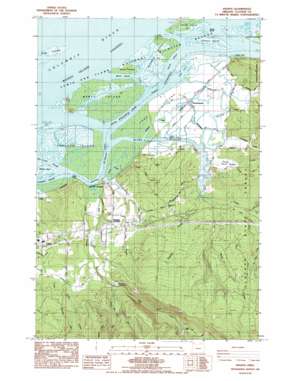
Knappa Topo Map Oregon
To zoom in, hover over the map of Knappa
USGS Topo Quad 46123b5 - 1:24,000 scale
| Topo Map Name: | Knappa |
| USGS Topo Quad ID: | 46123b5 |
| Print Size: | ca. 21 1/4" wide x 27" high |
| Southeast Coordinates: | 46.125° N latitude / 123.5° W longitude |
| Map Center Coordinates: | 46.1875° N latitude / 123.5625° W longitude |
| U.S. State: | OR |
| Filename: | o46123b5.jpg |
| Download Map JPG Image: | Knappa topo map 1:24,000 scale |
| Map Type: | Topographic |
| Topo Series: | 7.5´ |
| Map Scale: | 1:24,000 |
| Source of Map Images: | United States Geological Survey (USGS) |
| Alternate Map Versions: |
Knappa OR 1986, updated 1986 Download PDF Buy paper map Knappa OR 2011 Download PDF Buy paper map Knappa OR 2014 Download PDF Buy paper map |
1:24,000 Topo Quads surrounding Knappa
> Back to 46123a1 at 1:100,000 scale
> Back to 46122a1 at 1:250,000 scale
> Back to U.S. Topo Maps home
Knappa topo map: Gazetteer
Knappa: Bars
Jim Crow Sands elevation 0m 0′Knappa: Bends
Devils Elbow elevation 0m 0′Knappa: Dams
Snag Island Jetty elevation 0m 0′Knappa: Guts
Marsh Island Creek elevation 0m 0′Knappa: Islands
Brush Island elevation 3m 9′Goose Island elevation 3m 9′
Horseshoe Island elevation 3m 9′
Karlson Island elevation 3m 9′
Long Island elevation 2m 6′
Marsh Island elevation 3m 9′
Marsh Island Light elevation 0m 0′
Minaker Island elevation 3m 9′
Quinns Island elevation 2m 6′
Snag Islands elevation 1m 3′
Tronson Island elevation 1m 3′
Woody Island elevation 3m 9′
Knappa: Parks
Aldrich Point Boat Ramp elevation 2m 6′Big Creek County Park elevation 15m 49′
Gnat Creek Campground elevation 35m 114′
Knappa: Populated Places
Blind Slough (historical) elevation 2m 6′Brownsmead elevation 4m 13′
Knappa elevation 4m 13′
Knappa: Post Offices
Albert Post Office (historical) elevation 4m 13′Brownsmead Post Office (historical) elevation 4m 13′
Knappa Post Office (historical) elevation 4m 13′
Knappa: Streams
Barrow Creek elevation 48m 157′Big Creek elevation 2m 6′
Big Noise Creek elevation 10m 32′
Blind Slough elevation 0m 0′
Carmen Creek elevation 38m 124′
Dogwood Creek elevation 21m 68′
Fertile Valley Creek elevation 4m 13′
Gnat Creek elevation -2m -7′
Grizzly Slough elevation 1m 3′
Knappa Slough elevation 0m 0′
Little Creek elevation 2m 6′
Mill Creek elevation 76m 249′
Rock Creek elevation 10m 32′
Supply Creek elevation 1m 3′
Warren Slough elevation 3m 9′
Knappa digital topo map on disk
Buy this Knappa topo map showing relief, roads, GPS coordinates and other geographical features, as a high-resolution digital map file on DVD:


