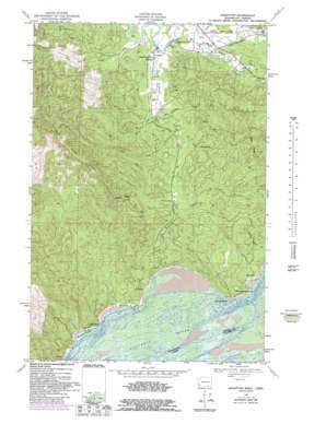
Knappton Topo Map Washington
To zoom in, hover over the map of Knappton
USGS Topo Quad 46123c7 - 1:24,000 scale
| Topo Map Name: | Knappton |
| USGS Topo Quad ID: | 46123c7 |
| Print Size: | ca. 21 1/4" wide x 27" high |
| Southeast Coordinates: | 46.25° N latitude / 123.75° W longitude |
| Map Center Coordinates: | 46.3125° N latitude / 123.8125° W longitude |
| U.S. States: | WA, OR |
| Filename: | o46123c7.jpg |
| Download Map JPG Image: | Knappton topo map 1:24,000 scale |
| Map Type: | Topographic |
| Topo Series: | 7.5´ |
| Map Scale: | 1:24,000 |
| Source of Map Images: | United States Geological Survey (USGS) |
| Alternate Map Versions: |
Knappton WA 1949, updated 1954 Download PDF Buy paper map Knappton WA 1949, updated 1965 Download PDF Buy paper map Knappton WA 1949, updated 1971 Download PDF Buy paper map Knappton WA 1949, updated 1976 Download PDF Buy paper map Knappton WA 1949, updated 1985 Download PDF Buy paper map Knappton WA 2011 Download PDF Buy paper map Knappton WA 2014 Download PDF Buy paper map |
1:24,000 Topo Quads surrounding Knappton
> Back to 46123a1 at 1:100,000 scale
> Back to 46122a1 at 1:250,000 scale
> Back to U.S. Topo Maps home
Knappton topo map: Gazetteer
Knappton: Airports
Wirkkala Airport elevation 14m 45′Knappton: Capes
Cliff Point elevation 28m 91′Grays Point elevation 46m 150′
Portuguese Point elevation 42m 137′
Knappton: Dams
Wirkkala Dam Number Three elevation 22m 72′Knappton: Harbors
Hungry Harbor elevation 0m 0′Knappton: Populated Places
Frankfort elevation 3m 9′Knappton elevation 6m 19′
Megler elevation 1m 3′
Naselle elevation 10m 32′
Knappton: Reservoirs
Wirkkala Lake elevation 22m 72′Knappton: Ridges
Bald Ridge elevation 142m 465′Naselle Ridge elevation 189m 620′
Knappton: Streams
Bean Creek elevation 24m 78′Burnham Creek elevation 16m 52′
Cement Creek elevation 16m 52′
Davis Creek elevation 10m 32′
Dell Creek elevation 0m 0′
Johnson Creek elevation 25m 82′
Johnson Creek elevation 13m 42′
Lane Creek elevation 9m 29′
O'Conner Creek elevation 3m 9′
Salmon Creek elevation 7m 22′
South Burnham Creek elevation 21m 68′
South Naselle River elevation 4m 13′
Knappton: Summits
Bear Mountain elevation 309m 1013′Knappton digital topo map on disk
Buy this Knappton topo map showing relief, roads, GPS coordinates and other geographical features, as a high-resolution digital map file on DVD:


