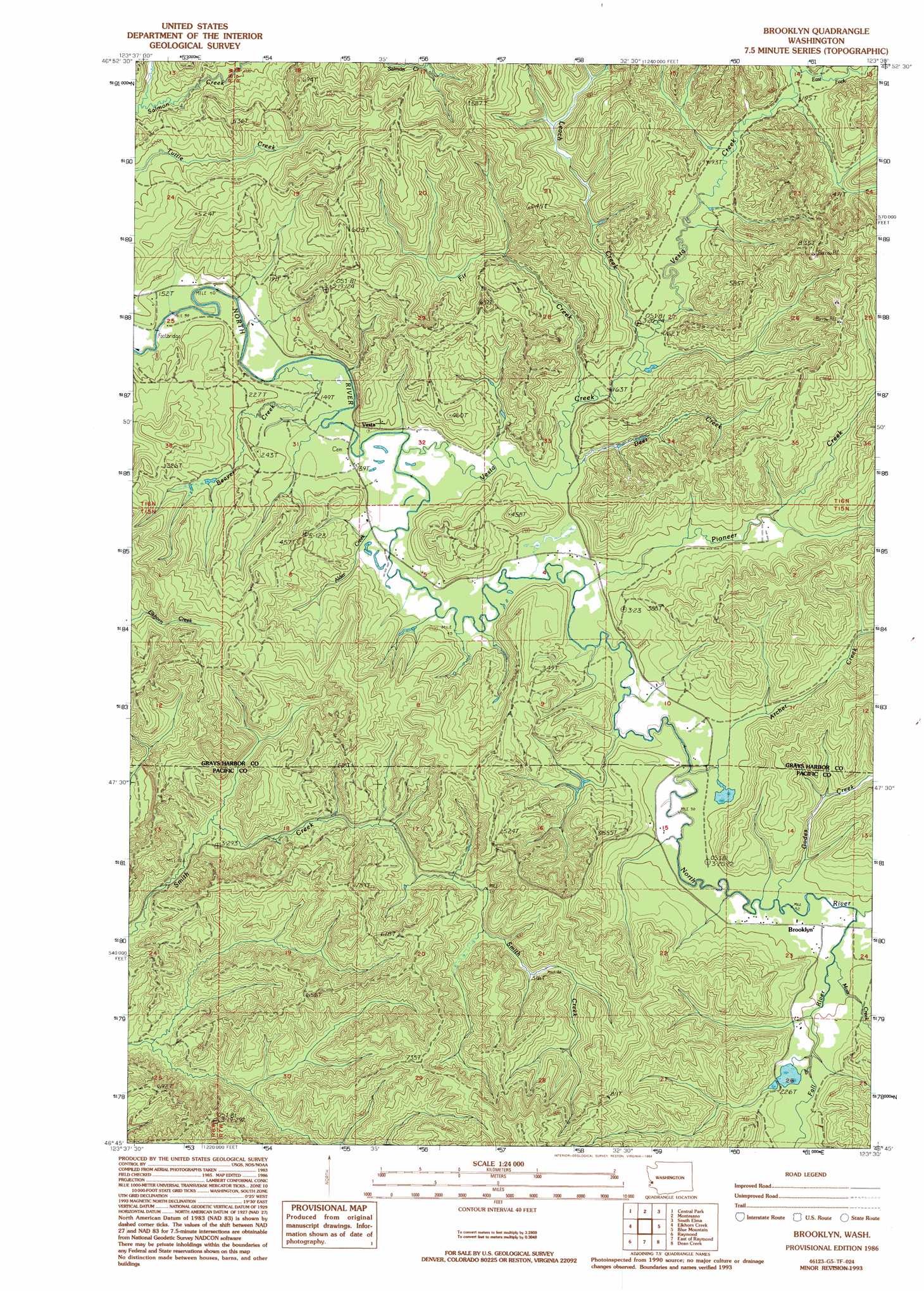
Brooklyn Topo Map Washington
To zoom in, hover over the map of Brooklyn
USGS Topo Quad 46123g5 - 1:24,000 scale
| Topo Map Name: | Brooklyn |
| USGS Topo Quad ID: | 46123g5 |
| Print Size: | ca. 21 1/4" wide x 27" high |
| Southeast Coordinates: | 46.75° N latitude / 123.5° W longitude |
| Map Center Coordinates: | 46.8125° N latitude / 123.5625° W longitude |
| U.S. State: | WA |
| Filename: | o46123g5.jpg |
| Download Map JPG Image: | Brooklyn topo map 1:24,000 scale |
| Map Type: | Topographic |
| Topo Series: | 7.5´ |
| Map Scale: | 1:24,000 |
| Source of Map Images: | United States Geological Survey (USGS) |
| Alternate Map Versions: |
Brooklyn WA 1986, updated 1986 Download PDF Buy paper map Brooklyn WA 1986, updated 1994 Download PDF Buy paper map Brooklyn WA 2011 Download PDF Buy paper map Brooklyn WA 2013 Download PDF Buy paper map |
1:24,000 Topo Quads surrounding Brooklyn
Aberdeen Gardens |
Wynoochee Valley Sw |
Prices Peak |
Elma |
Mccleary |
Aberdeen |
Central Park |
Montesano |
South Elma |
Malone |
Aberdeen Se |
Elkhorn Creek |
Brooklyn |
Blue Mountain |
Cedarville |
South Bend |
Raymond |
East Of Raymond |
Dean Creek |
Doty |
North Nemah |
Menlo |
Lebam |
Pluvius |
Pe Ell |
> Back to 46123e1 at 1:100,000 scale
> Back to 46122a1 at 1:250,000 scale
> Back to U.S. Topo Maps home
Brooklyn topo map: Gazetteer
Brooklyn: Populated Places
Brooklyn elevation 54m 177′Vesta elevation 48m 157′
Brooklyn: Streams
Alder Creek elevation 47m 154′Archer Creek elevation 51m 167′
Beaver Creek elevation 46m 150′
Deer Creek elevation 47m 154′
East Fork Vesta Creek elevation 56m 183′
Fall River elevation 59m 193′
Fir Creek elevation 50m 164′
Godes Creek elevation 54m 177′
Leach Creek elevation 50m 164′
Moss Creek elevation 60m 196′
Pioneer Creek elevation 47m 154′
Vesta Creek elevation 47m 154′
West Fork Vesta Creek elevation 56m 183′
Brooklyn digital topo map on disk
Buy this Brooklyn topo map showing relief, roads, GPS coordinates and other geographical features, as a high-resolution digital map file on DVD: