Elkhorn Creek Topo Map Washington
To zoom in, hover over the map of Elkhorn Creek
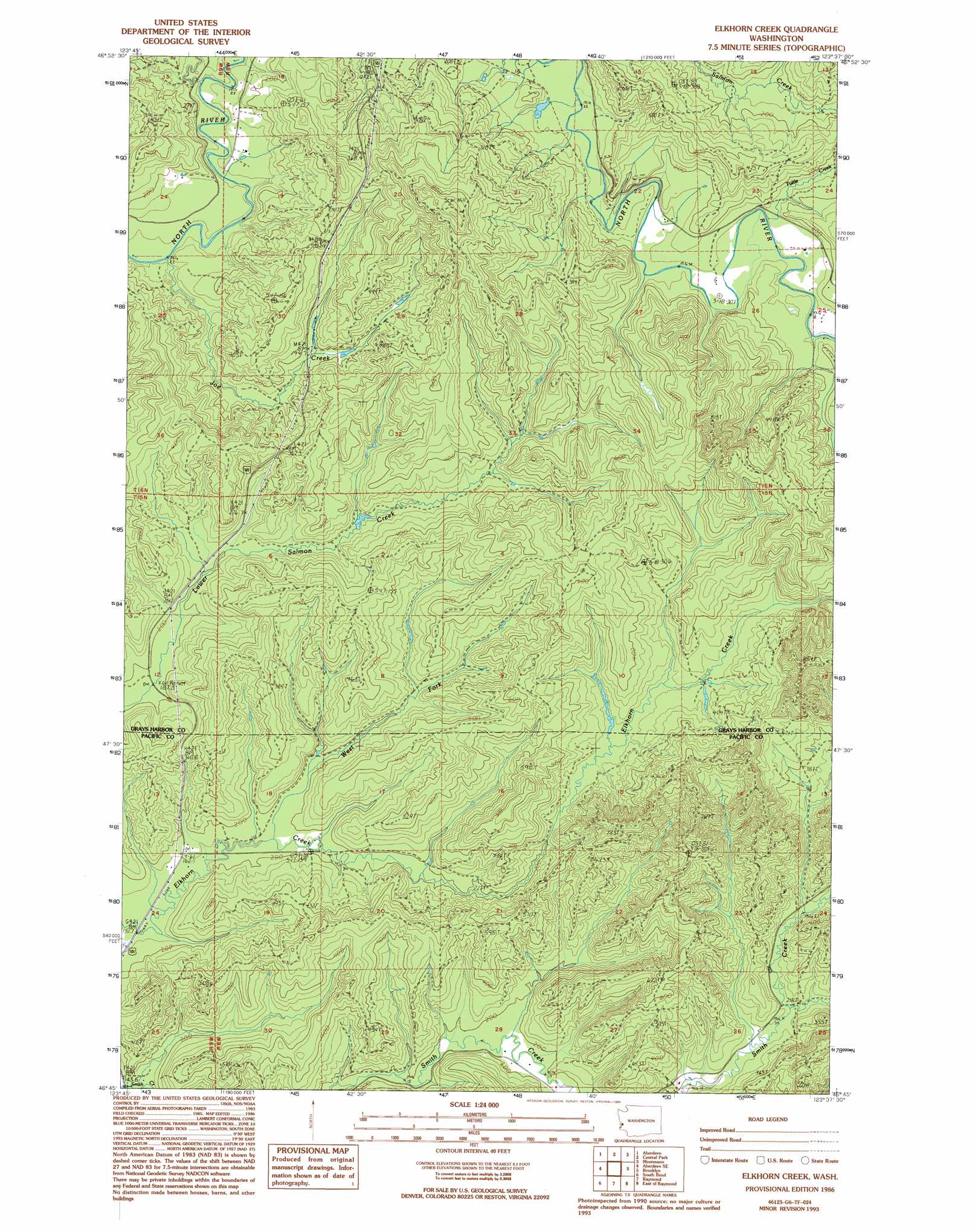
USGS Topo Quad 46123g6 - 1:24,000 scale
| Topo Map Name: | Elkhorn Creek |
| USGS Topo Quad ID: | 46123g6 |
| Print Size: | ca. 21 1/4" wide x 27" high |
| Southeast Coordinates: | 46.75° N latitude / 123.625° W longitude |
| Map Center Coordinates: | 46.8125° N latitude / 123.6875° W longitude |
| U.S. State: | WA |
| Filename: | o46123g6.jpg |
| Download Map JPG Image: | Elkhorn Creek topo map 1:24,000 scale |
| Map Type: | Topographic |
| Topo Series: | 7.5´ |
| Map Scale: | 1:24,000 |
| Source of Map Images: | United States Geological Survey (USGS) |
| Alternate Map Versions: |
Elkhorn Creek WA 1986, updated 1986 Download PDF Buy paper map Elkhorn Creek WA 1986, updated 1994 Download PDF Buy paper map Elkhorn Creek WA 2011 Download PDF Buy paper map Elkhorn Creek WA 2013 Download PDF Buy paper map |
1:24,000 Topo Quads surrounding Elkhorn Creek
New London |
Aberdeen Gardens |
Wynoochee Valley Sw |
Prices Peak |
Elma |
Hoquiam |
Aberdeen |
Central Park |
Montesano |
South Elma |
Western |
Aberdeen Se |
Elkhorn Creek |
Brooklyn |
Blue Mountain |
Bay Center |
South Bend |
Raymond |
East Of Raymond |
Dean Creek |
Nemah |
North Nemah |
Menlo |
Lebam |
Pluvius |
> Back to 46123e1 at 1:100,000 scale
> Back to 46122a1 at 1:250,000 scale
> Back to U.S. Topo Maps home
Elkhorn Creek topo map: Gazetteer
Elkhorn Creek: Streams
Joe Creek elevation 22m 72′Tuttle Creek elevation 36m 118′
West Fork Elkhorn Creek elevation 53m 173′
Elkhorn Creek: Summits
Scar Hill elevation 273m 895′Elkhorn Creek digital topo map on disk
Buy this Elkhorn Creek topo map showing relief, roads, GPS coordinates and other geographical features, as a high-resolution digital map file on DVD: