Western Topo Map Washington
To zoom in, hover over the map of Western
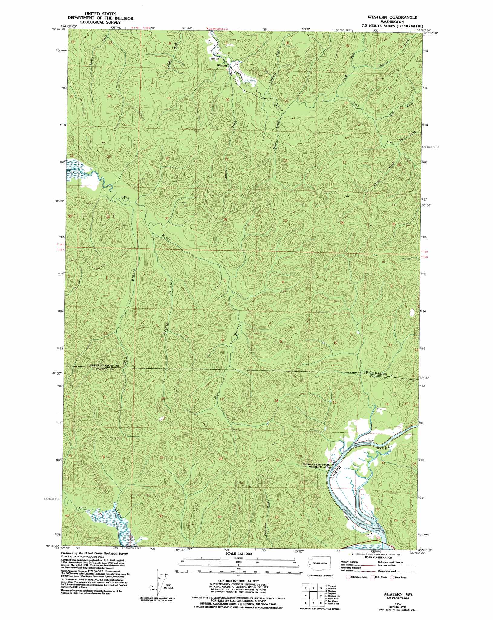
USGS Topo Quad 46123g8 - 1:24,000 scale
| Topo Map Name: | Western |
| USGS Topo Quad ID: | 46123g8 |
| Print Size: | ca. 21 1/4" wide x 27" high |
| Southeast Coordinates: | 46.75° N latitude / 123.875° W longitude |
| Map Center Coordinates: | 46.8125° N latitude / 123.9375° W longitude |
| U.S. State: | WA |
| Filename: | o46123g8.jpg |
| Download Map JPG Image: | Western topo map 1:24,000 scale |
| Map Type: | Topographic |
| Topo Series: | 7.5´ |
| Map Scale: | 1:24,000 |
| Source of Map Images: | United States Geological Survey (USGS) |
| Alternate Map Versions: |
Western WA 1956, updated 1960 Download PDF Buy paper map Western WA 1956, updated 1968 Download PDF Buy paper map Western WA 1956, updated 1985 Download PDF Buy paper map Western WA 1956, updated 1995 Download PDF Buy paper map Western WA 2011 Download PDF Buy paper map Western WA 2013 Download PDF Buy paper map |
1:24,000 Topo Quads surrounding Western
Copalis Beach |
Copalis Crossing |
New London |
Aberdeen Gardens |
Wynoochee Valley Sw |
Point Brown |
Westport |
Hoquiam |
Aberdeen |
Central Park |
Grayland |
Western |
Aberdeen Se |
Elkhorn Creek |
|
North Cove |
Bay Center |
South Bend |
Raymond |
|
Oysterville |
Nemah |
North Nemah |
Menlo |
> Back to 46123e1 at 1:100,000 scale
> Back to 46122a1 at 1:250,000 scale
> Back to U.S. Topo Maps home
Western topo map: Gazetteer
Western: Streams
Archer Creek elevation 32m 104′Atwood Creek elevation 5m 16′
Ballon Creek elevation 19m 62′
Big Creek elevation 32m 104′
Big Creek elevation 32m 104′
Crawford Ditch elevation 10m 32′
East Branch Elk River elevation 23m 75′
Florence Creek elevation 20m 65′
Hall Creek elevation 24m 78′
Middle Branch Elk River elevation 9m 29′
North Fork Johns River elevation 20m 65′
South Fork Johns River elevation 20m 65′
West Branch Elk River elevation 3m 9′
Western digital topo map on disk
Buy this Western topo map showing relief, roads, GPS coordinates and other geographical features, as a high-resolution digital map file on DVD: