Oysterville Topo Map Washington
To zoom in, hover over the map of Oysterville
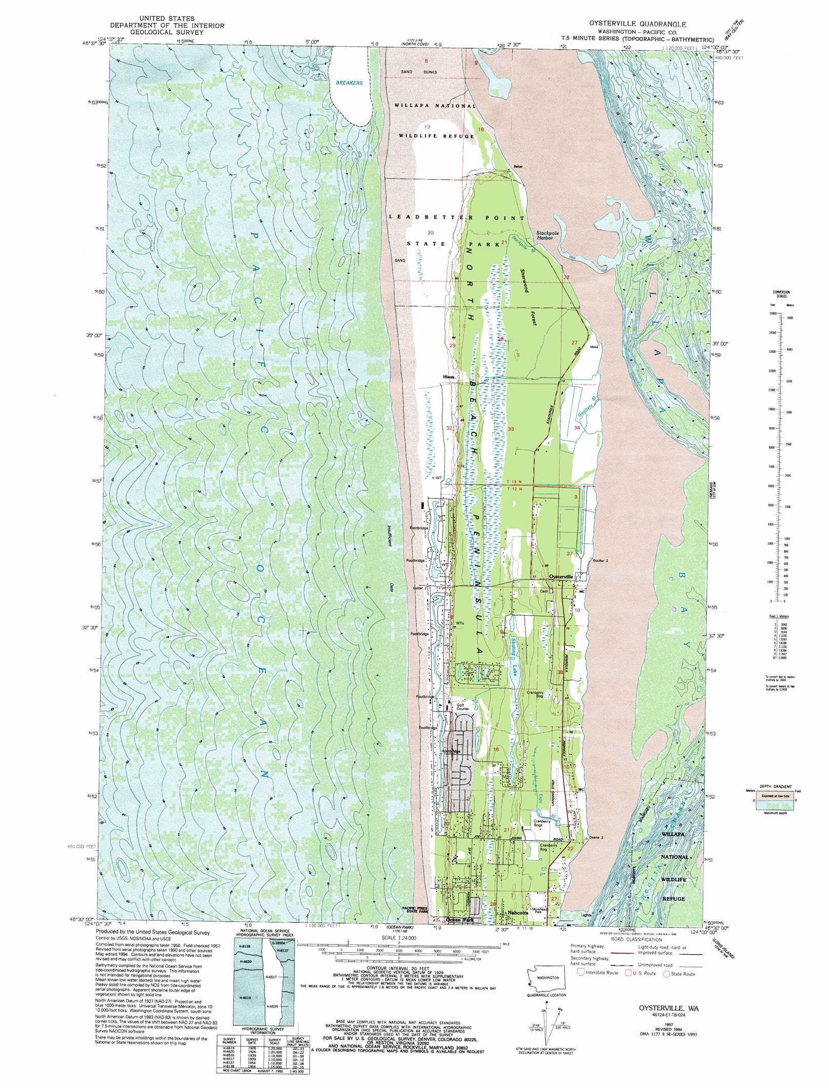
USGS Topo Quad 46124e1 - 1:24,000 scale
| Topo Map Name: | Oysterville |
| USGS Topo Quad ID: | 46124e1 |
| Print Size: | ca. 21 1/4" wide x 27" high |
| Southeast Coordinates: | 46.5° N latitude / 124° W longitude |
| Map Center Coordinates: | 46.5625° N latitude / 124.0625° W longitude |
| U.S. State: | WA |
| Filename: | o46124e1.jpg |
| Download Map JPG Image: | Oysterville topo map 1:24,000 scale |
| Map Type: | Topographic |
| Topo Series: | 7.5´ |
| Map Scale: | 1:24,000 |
| Source of Map Images: | United States Geological Survey (USGS) |
| Alternate Map Versions: |
Oysterville WA 1957, updated 1959 Download PDF Buy paper map Oysterville WA 1957, updated 1977 Download PDF Buy paper map Oysterville WA 1957, updated 1985 Download PDF Buy paper map Oysterville WA 1957, updated 1995 Download PDF Buy paper map Oysterville WA 2011 Download PDF Buy paper map Oysterville WA 2014 Download PDF Buy paper map |
1:24,000 Topo Quads surrounding Oysterville
Grayland |
Western |
Aberdeen Se |
||
North Cove |
Bay Center |
South Bend |
||
Oysterville |
Nemah |
North Nemah |
||
Ocean Park |
Long Island |
Oman Ranch |
||
Cape Disappointment |
Chinook |
Knappton |
> Back to 46124e1 at 1:100,000 scale
> Back to 46124a1 at 1:250,000 scale
> Back to U.S. Topo Maps home
Oysterville topo map: Gazetteer
Oysterville: Airports
Martin Airport elevation 6m 19′Oysterville: Bays
Stackpole Harbor elevation 1m 3′Oysterville: Forests
Sherwood Forest elevation 4m 13′Oysterville: Lakes
Skating Lake elevation 6m 19′Oysterville: Parks
Leadbetter Point State Park elevation 13m 42′Pacific Pines State Park elevation 6m 19′
Oysterville: Populated Places
Hines elevation 9m 29′Oysterville elevation 6m 19′
Oysterville: Streams
Espy Slough elevation 0m 0′Goulters Slough elevation 0m 0′
Stackpole Slough elevation 4m 13′
Oysterville: Trails
Elliot Trail elevation 7m 22′Oysterville digital topo map on disk
Buy this Oysterville topo map showing relief, roads, GPS coordinates and other geographical features, as a high-resolution digital map file on DVD: