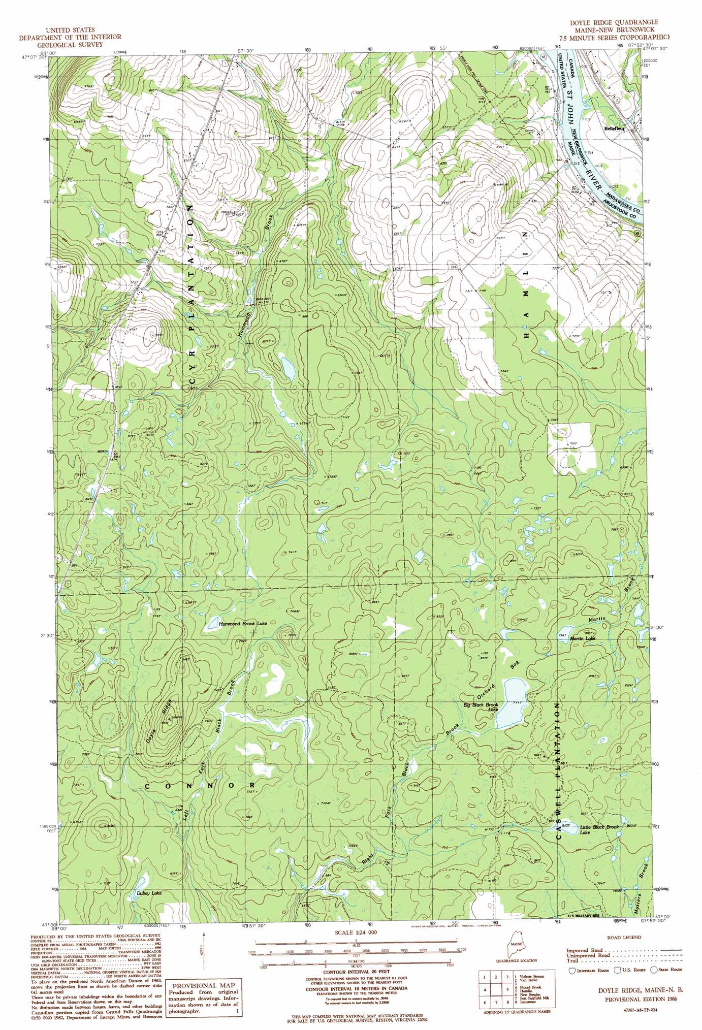
Doyle Ridge Topo Map Maine
To zoom in, hover over the map of Doyle Ridge
USGS Topo Quad 47067a8 - 1:24,000 scale
| Topo Map Name: | Doyle Ridge |
| USGS Topo Quad ID: | 47067a8 |
| Print Size: | ca. 21 1/4" wide x 27" high |
| Southeast Coordinates: | 47° N latitude / 67.875° W longitude |
| Map Center Coordinates: | 47.0625° N latitude / 67.9375° W longitude |
| U.S. State: | ME |
| Filename: | o47067a8.jpg |
| Download Map JPG Image: | Doyle Ridge topo map 1:24,000 scale |
| Map Type: | Topographic |
| Topo Series: | 7.5´ |
| Map Scale: | 1:24,000 |
| Source of Map Images: | United States Geological Survey (USGS) |
| Alternate Map Versions: |
Van Buren SW ME 1975, updated 1981 Download PDF Buy paper map Doyle Ridge ME 1986, updated 1986 Download PDF Buy paper map Doyle Ridge ME 2011 Download PDF Buy paper map Doyle Ridge ME 2014 Download PDF Buy paper map |
1:24,000 Topo Quads surrounding Doyle Ridge
Grand Isle |
Lille |
|||
Paulette Brook |
Violette Stream |
Van Buren |
||
Stockholm |
Picard Brook |
Doyle Ridge |
Hamlin |
|
Mud Lake |
New Sweden |
Fort Fairfield Nw |
Limestone |
|
Washburn |
Caribou |
Goodwin |
Fort Fairfield |
> Back to 47067a1 at 1:100,000 scale
> Back to 47066a1 at 1:250,000 scale
> Back to U.S. Topo Maps home
Doyle Ridge topo map: Gazetteer
Doyle Ridge: Lakes
Big Black Brook Lake elevation 243m 797′Dubay Lake elevation 196m 643′
Hammond Brook Lake elevation 223m 731′
Little Black Brook Lake elevation 246m 807′
Martin Lake elevation 243m 797′
Doyle Ridge: Ridges
Doyle Ridge elevation 281m 921′Doyle Ridge: Swamps
Orchard Bog elevation 244m 800′Doyle Ridge digital topo map on disk
Buy this Doyle Ridge topo map showing relief, roads, GPS coordinates and other geographical features, as a high-resolution digital map file on DVD:
Maine, New Hampshire, Rhode Island & Eastern Massachusetts
Buy digital topo maps: Maine, New Hampshire, Rhode Island & Eastern Massachusetts