Saint Agatha Topo Map Maine
To zoom in, hover over the map of Saint Agatha
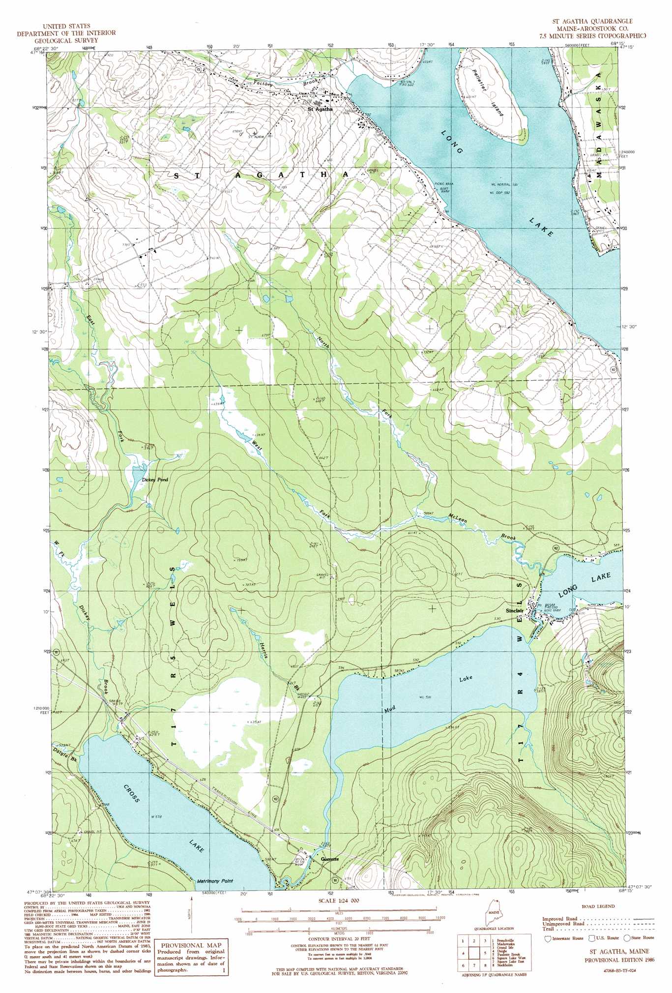
USGS Topo Quad 47068b3 - 1:24,000 scale
| Topo Map Name: | Saint Agatha |
| USGS Topo Quad ID: | 47068b3 |
| Print Size: | ca. 21 1/4" wide x 27" high |
| Southeast Coordinates: | 47.125° N latitude / 68.25° W longitude |
| Map Center Coordinates: | 47.1875° N latitude / 68.3125° W longitude |
| U.S. State: | ME |
| Filename: | o47068b3.jpg |
| Download Map JPG Image: | Saint Agatha topo map 1:24,000 scale |
| Map Type: | Topographic |
| Topo Series: | 7.5´ |
| Map Scale: | 1:24,000 |
| Source of Map Images: | United States Geological Survey (USGS) |
| Alternate Map Versions: |
Square Lake NE ME 1975, updated 1981 Download PDF Buy paper map St. Agatha ME 1986, updated 1986 Download PDF Buy paper map Saint Agatha ME 2011 Download PDF Buy paper map Saint Agatha ME 2014 Download PDF Buy paper map |
1:24,000 Topo Quads surrounding Saint Agatha
Fort Kent North |
Frenchville |
Madawaska |
Grand Isle |
Lille |
Fort Kent South |
Daigle |
Saint Agatha |
Paulette Brook |
Violette Stream |
Eagle Lake |
Square Lake West |
Square Lake East |
Stockholm |
Picard Brook |
Winterville |
Mcclusky Lake |
Hanford |
Mud Lake |
New Sweden |
> Back to 47068a1 at 1:100,000 scale
> Back to 47068a1 at 1:250,000 scale
> Back to U.S. Topo Maps home
Saint Agatha topo map: Gazetteer
Saint Agatha: Airports
Cross Lake Seaplane Base elevation 183m 600′Saint Agatha: Capes
Matrimony Point elevation 176m 577′Saint Agatha: Lakes
Dickey Pond elevation 180m 590′Long Lake elevation 177m 580′
Mud Lake elevation 177m 580′
Saint Agatha: Populated Places
Carriveau Mill elevation 195m 639′Guerette elevation 179m 587′
Saint Agatha elevation 198m 649′
Sinclair elevation 180m 590′
Saint Agatha: Post Offices
Saint Agatha Post Office elevation 201m 659′Sinclair Post Office (historical) elevation 183m 600′
Saint Agatha: Streams
Daigle Brook elevation 176m 577′Dickey Brook elevation 177m 580′
East Fork Dickey Brook elevation 179m 587′
Factory Brook elevation 177m 580′
Harris Brook elevation 177m 580′
McLean Brook elevation 177m 580′
North Fork McLean Brook elevation 180m 590′
West Fork Dickey Brook elevation 179m 587′
West Fork McLean Brook elevation 180m 590′
Saint Agatha digital topo map on disk
Buy this Saint Agatha topo map showing relief, roads, GPS coordinates and other geographical features, as a high-resolution digital map file on DVD:
Maine, New Hampshire, Rhode Island & Eastern Massachusetts
Buy digital topo maps: Maine, New Hampshire, Rhode Island & Eastern Massachusetts