Daigle Topo Map Maine
To zoom in, hover over the map of Daigle
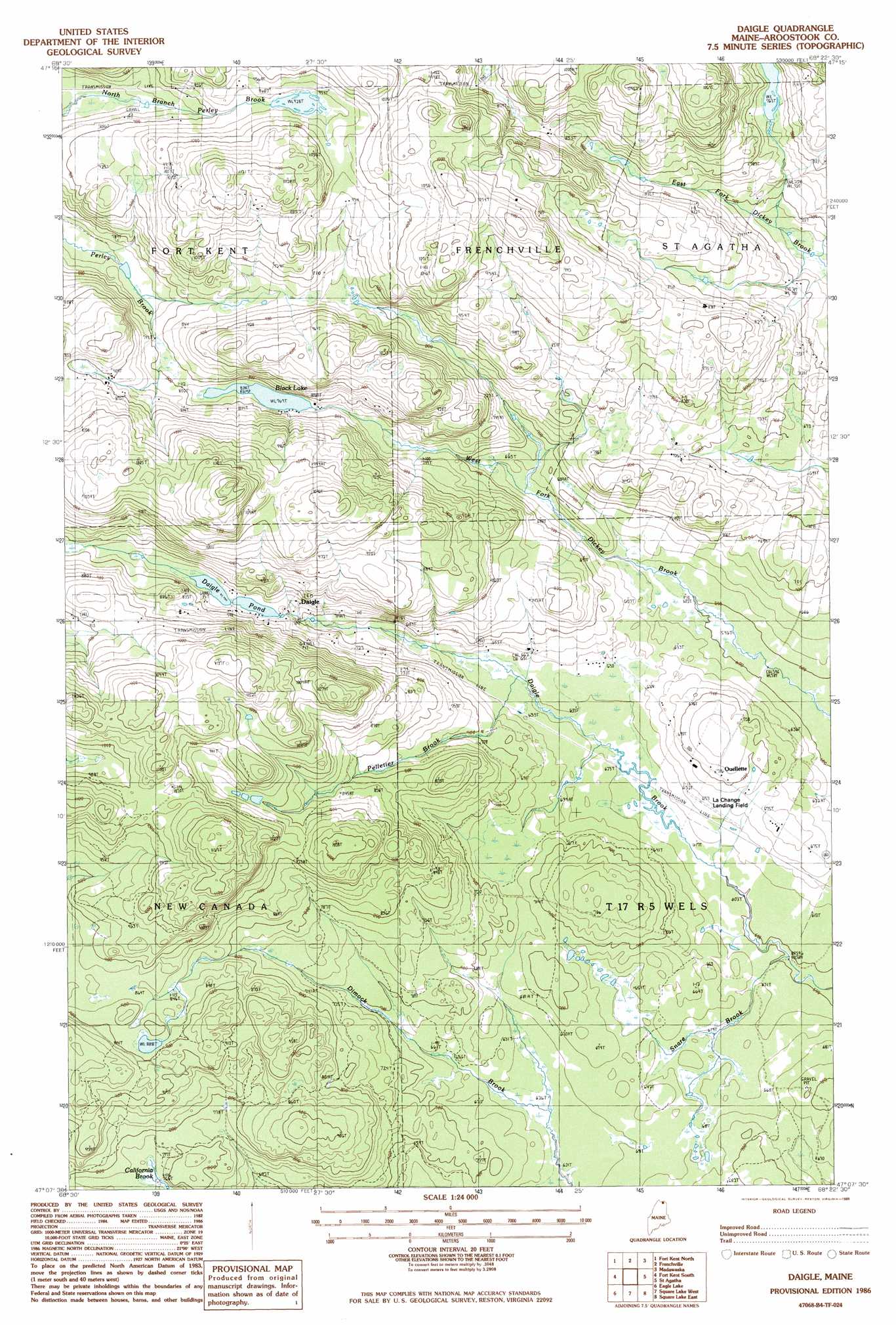
USGS Topo Quad 47068b4 - 1:24,000 scale
| Topo Map Name: | Daigle |
| USGS Topo Quad ID: | 47068b4 |
| Print Size: | ca. 21 1/4" wide x 27" high |
| Southeast Coordinates: | 47.125° N latitude / 68.375° W longitude |
| Map Center Coordinates: | 47.1875° N latitude / 68.4375° W longitude |
| U.S. State: | ME |
| Filename: | o47068b4.jpg |
| Download Map JPG Image: | Daigle topo map 1:24,000 scale |
| Map Type: | Topographic |
| Topo Series: | 7.5´ |
| Map Scale: | 1:24,000 |
| Source of Map Images: | United States Geological Survey (USGS) |
| Alternate Map Versions: |
Square Lake NW ME 1975, updated 1981 Download PDF Buy paper map Daigle ME 1986, updated 1986 Download PDF Buy paper map Daigle ME 2011 Download PDF Buy paper map Daigle ME 2014 Download PDF Buy paper map |
1:24,000 Topo Quads surrounding Daigle
Fort Kent North |
Frenchville |
Madawaska |
Grand Isle |
|
Wheelock |
Fort Kent South |
Daigle |
Saint Agatha |
Paulette Brook |
Wallacrass Lakes |
Eagle Lake |
Square Lake West |
Square Lake East |
Stockholm |
Island Pond |
Winterville |
Mcclusky Lake |
Hanford |
Mud Lake |
> Back to 47068a1 at 1:100,000 scale
> Back to 47068a1 at 1:250,000 scale
> Back to U.S. Topo Maps home
Daigle topo map: Gazetteer
Daigle: Airports
La Change Landing Field elevation 199m 652′Sunrise Farms Airport elevation 198m 649′
Daigle: Dams
Daigle Pond Dam elevation 226m 741′Daigle: Lakes
Black Lake elevation 234m 767′Daigle: Populated Places
Daigle elevation 217m 711′Ouellette elevation 216m 708′
Daigle: Reservoirs
Daigle Pond elevation 226m 741′Daigle: Streams
Pelletier Brook elevation 185m 606′Snare Brook elevation 182m 597′
Daigle digital topo map on disk
Buy this Daigle topo map showing relief, roads, GPS coordinates and other geographical features, as a high-resolution digital map file on DVD:
Maine, New Hampshire, Rhode Island & Eastern Massachusetts
Buy digital topo maps: Maine, New Hampshire, Rhode Island & Eastern Massachusetts