Saint Francis Topo Map Maine
To zoom in, hover over the map of Saint Francis
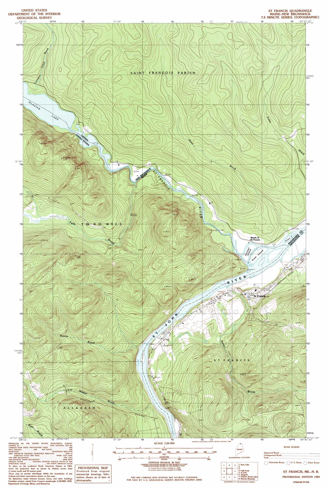
USGS Topo Quad 47068b8 - 1:24,000 scale
| Topo Map Name: | Saint Francis |
| USGS Topo Quad ID: | 47068b8 |
| Print Size: | ca. 21 1/4" wide x 27" high |
| Southeast Coordinates: | 47.125° N latitude / 68.875° W longitude |
| Map Center Coordinates: | 47.1875° N latitude / 68.9375° W longitude |
| U.S. State: | ME |
| Filename: | o47068b8.jpg |
| Download Map JPG Image: | Saint Francis topo map 1:24,000 scale |
| Map Type: | Topographic |
| Topo Series: | 7.5´ |
| Map Scale: | 1:24,000 |
| Source of Map Images: | United States Geological Survey (USGS) |
| Alternate Map Versions: |
St Francis NW ME 1975, updated 1981 Download PDF Buy paper map St. Francis ME 1985, updated 1986 Download PDF Buy paper map Saint Francis ME 2011 Download PDF Buy paper map Saint Francis ME 2014 Download PDF Buy paper map |
1:24,000 Topo Quads surrounding Saint Francis
Estcourt |
Landry |
|||
Hafey Pond |
Beau Lake |
|||
Johnson Brook Mountain |
Falls Brook Lake |
Saint Francis |
Saint John |
Wheelock |
Big Rapids |
Allagash |
Second Lake |
Mclean Mountain |
Wallacrass Lakes |
Allagash Falls |
Mckeen Lake |
Gardner Pond |
Deboullie Pond |
Island Pond |
> Back to 47068a1 at 1:100,000 scale
> Back to 47068a1 at 1:250,000 scale
> Back to U.S. Topo Maps home
Saint Francis topo map: Gazetteer
Saint Francis: Islands
Grew Island elevation 163m 534′Saint Francis: Lakes
Glazier Lake elevation 169m 554′McKeon Pond elevation 168m 551′
Saint Francis: Populated Places
Saint Francis elevation 183m 600′Saint Francis: Rapids
Rankin Rapids elevation 167m 547′Saint Francis: Streams
Falls Brook elevation 169m 554′Musket Brook elevation 172m 564′
Petite Brook elevation 165m 541′
Rankin Brook elevation 169m 554′
Saint Francis River elevation 163m 534′
Saint Francis digital topo map on disk
Buy this Saint Francis topo map showing relief, roads, GPS coordinates and other geographical features, as a high-resolution digital map file on DVD:
Maine, New Hampshire, Rhode Island & Eastern Massachusetts
Buy digital topo maps: Maine, New Hampshire, Rhode Island & Eastern Massachusetts