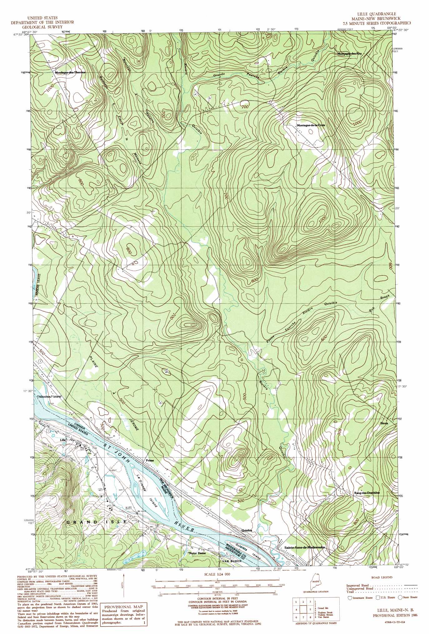
Lille Topo Map Maine
To zoom in, hover over the map of Lille
USGS Topo Quad 47068c1 - 1:24,000 scale
| Topo Map Name: | Lille |
| USGS Topo Quad ID: | 47068c1 |
| Print Size: | ca. 21 1/4" wide x 27" high |
| Southeast Coordinates: | 47.25° N latitude / 68° W longitude |
| Map Center Coordinates: | 47.3125° N latitude / 68.0625° W longitude |
| U.S. State: | ME |
| Filename: | o47068c1.jpg |
| Download Map JPG Image: | Lille topo map 1:24,000 scale |
| Map Type: | Topographic |
| Topo Series: | 7.5´ |
| Map Scale: | 1:24,000 |
| Source of Map Images: | United States Geological Survey (USGS) |
| Alternate Map Versions: |
Grand Isle SE ME 1975, updated 1981 Download PDF Buy paper map Lille ME 1986, updated 1986 Download PDF Buy paper map Lille ME 2011 Download PDF Buy paper map Lille ME 2014 Download PDF Buy paper map |
1:24,000 Topo Quads surrounding Lille
Madawaska |
Grand Isle |
Lille |
||
Saint Agatha |
Paulette Brook |
Violette Stream |
Van Buren |
|
Square Lake East |
Stockholm |
Picard Brook |
Doyle Ridge |
Hamlin |
> Back to 47068a1 at 1:100,000 scale
> Back to 47068a1 at 1:250,000 scale
> Back to U.S. Topo Maps home
Lille topo map: Gazetteer
Lille: Islands
La Grande Island elevation 133m 436′Lille: Populated Places
Lille elevation 147m 482′Notre Dame elevation 142m 465′
Lille: Post Offices
Lille Post Office (historical) elevation 148m 485′Lille digital topo map on disk
Buy this Lille topo map showing relief, roads, GPS coordinates and other geographical features, as a high-resolution digital map file on DVD:
Maine, New Hampshire, Rhode Island & Eastern Massachusetts
Buy digital topo maps: Maine, New Hampshire, Rhode Island & Eastern Massachusetts