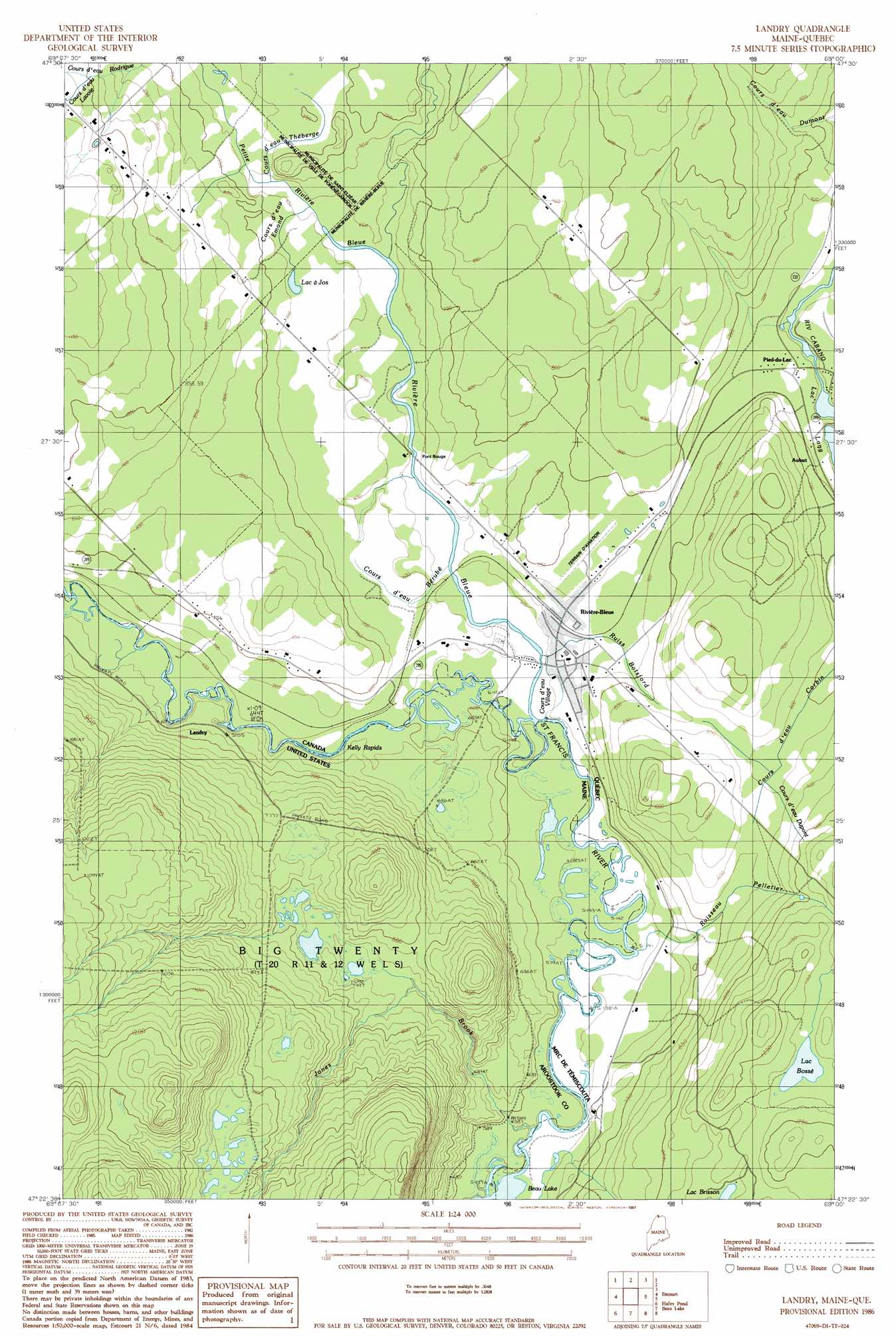
Landry Topo Map Maine
To zoom in, hover over the map of Landry
USGS Topo Quad 47069d1 - 1:24,000 scale
| Topo Map Name: | Landry |
| USGS Topo Quad ID: | 47069d1 |
| Print Size: | ca. 21 1/4" wide x 27" high |
| Southeast Coordinates: | 47.375° N latitude / 69° W longitude |
| Map Center Coordinates: | 47.4375° N latitude / 69.0625° W longitude |
| U.S. State: | ME |
| Filename: | o47069d1.jpg |
| Download Map JPG Image: | Landry topo map 1:24,000 scale |
| Map Type: | Topographic |
| Topo Series: | 7.5´ |
| Map Scale: | 1:24,000 |
| Source of Map Images: | United States Geological Survey (USGS) |
| Alternate Map Versions: |
Landry ME 1986, updated 1987 Download PDF Buy paper map Landry ME 2011 Download PDF Buy paper map Landry ME 2014 Download PDF Buy paper map |
1:24,000 Topo Quads surrounding Landry
Saint Eleuthere |
Estcourt |
Landry |
||
Rocky Brook |
Hafey Pond |
Beau Lake |
||
Rocky Mountain |
Johnson Brook Mountain |
Falls Brook Lake |
Saint Francis |
Saint John |
> Back to 47069a1 at 1:100,000 scale
> Back to 47068a1 at 1:250,000 scale
> Back to U.S. Topo Maps home
Landry topo map: Gazetteer
Landry: Rapids
Kelly Rapids elevation 187m 613′Landry: Streams
Jones Brook elevation 175m 574′Landry digital topo map on disk
Buy this Landry topo map showing relief, roads, GPS coordinates and other geographical features, as a high-resolution digital map file on DVD:
Maine, New Hampshire, Rhode Island & Eastern Massachusetts
Buy digital topo maps: Maine, New Hampshire, Rhode Island & Eastern Massachusetts