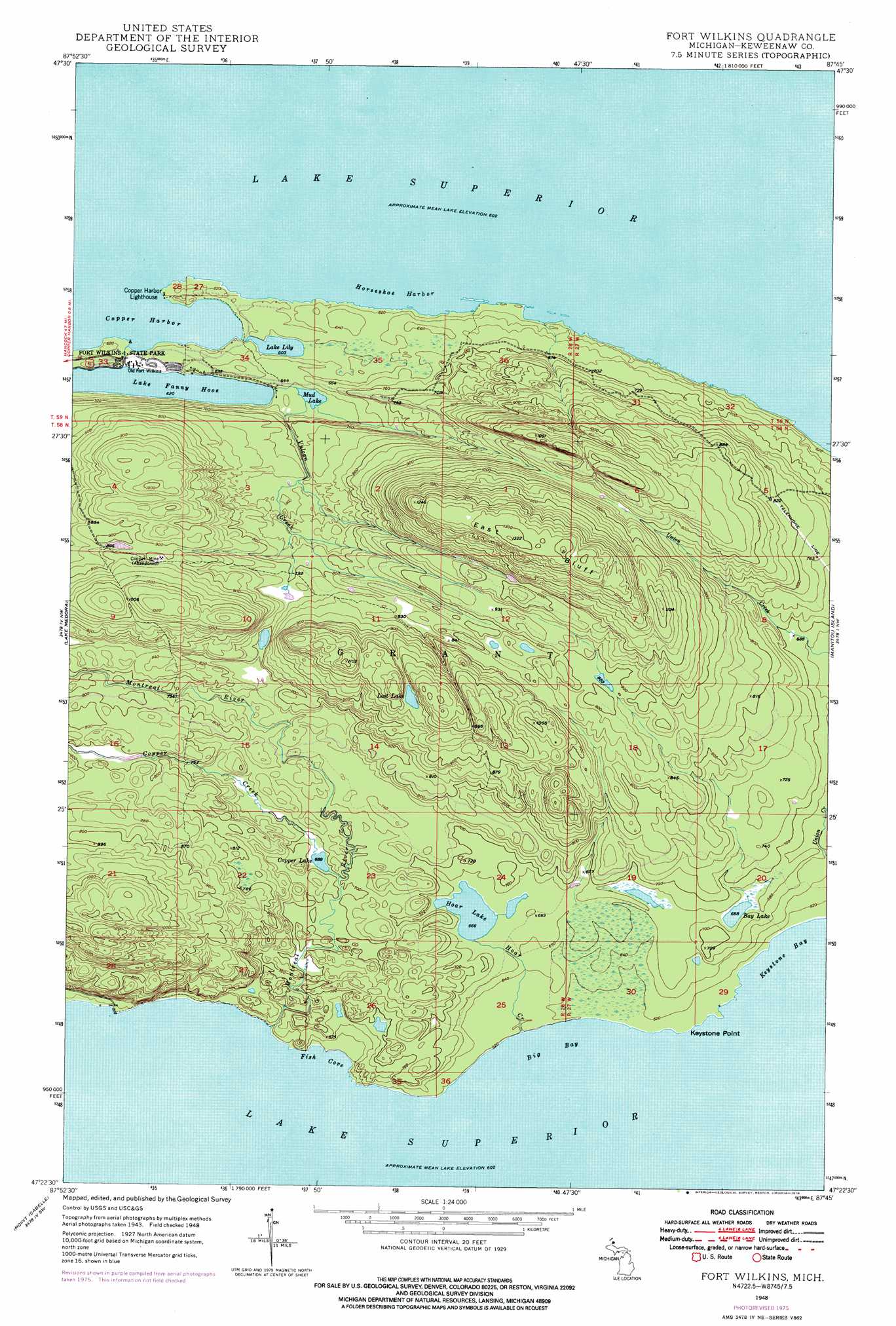
Fort Wilkins Topo Map Michigan
To zoom in, hover over the map of Fort Wilkins
USGS Topo Quad 47087d7 - 1:24,000 scale
| Topo Map Name: | Fort Wilkins |
| USGS Topo Quad ID: | 47087d7 |
| Print Size: | ca. 21 1/4" wide x 27" high |
| Southeast Coordinates: | 47.375° N latitude / 87.75° W longitude |
| Map Center Coordinates: | 47.4375° N latitude / 87.8125° W longitude |
| U.S. State: | MI |
| Filename: | o47087d7.jpg |
| Download Map JPG Image: | Fort Wilkins topo map 1:24,000 scale |
| Map Type: | Topographic |
| Topo Series: | 7.5´ |
| Map Scale: | 1:24,000 |
| Source of Map Images: | United States Geological Survey (USGS) |
| Alternate Map Versions: |
Fort Wilkins MI 1948, updated 1964 Download PDF Buy paper map Fort Wilkins MI 1948, updated 1976 Download PDF Buy paper map Fort Wilkins MI 1948, updated 1976 Download PDF Buy paper map Fort Wilkins MI 1949, updated 1949 Download PDF Buy paper map Fort Wilkins MI 2011 Download PDF Buy paper map Fort Wilkins MI 2014 Download PDF Buy paper map Fort Wilkins MI 2017 Download PDF Buy paper map |
1:24,000 Topo Quads surrounding Fort Wilkins
Delaware |
Lake Medora |
Fort Wilkins |
Manitou Island |
|
Deer Lake |
Point Isabelle |
|||
> Back to 47087a1 at 1:100,000 scale
> Back to 47086a1 at 1:250,000 scale
> Back to U.S. Topo Maps home
Fort Wilkins topo map: Gazetteer
Fort Wilkins: Bays
Big Bay elevation 183m 600′Copper Harbor elevation 183m 600′
Fish Cove elevation 183m 600′
Horseshoe Harbor elevation 183m 600′
Fort Wilkins: Capes
Keystone Point elevation 186m 610′Fort Wilkins: Falls
Lower Falls elevation 195m 639′Upper Falls elevation 213m 698′
Fort Wilkins: Lakes
Bay Lake elevation 204m 669′Copper Lake elevation 210m 688′
Hoar Lake elevation 203m 666′
Lake Fanny Hooe elevation 186m 610′
Lily Lake elevation 184m 603′
Lost Lake elevation 293m 961′
Mud Lake elevation 186m 610′
Fort Wilkins: Parks
Fort Wilkins Historical Marker (historical) elevation 183m 600′Fort Wilkins State Park elevation 188m 616′
Fort Wilkins: Ridges
East Bluff elevation 396m 1299′Fort Wilkins: Streams
Copper Creek elevation 213m 698′Hoar Creek elevation 185m 606′
Montreal River elevation 183m 600′
Vulcan Creek elevation 187m 613′
Fort Wilkins digital topo map on disk
Buy this Fort Wilkins topo map showing relief, roads, GPS coordinates and other geographical features, as a high-resolution digital map file on DVD: