Rockhouse Point Topo Map Michigan
To zoom in, hover over the map of Rockhouse Point
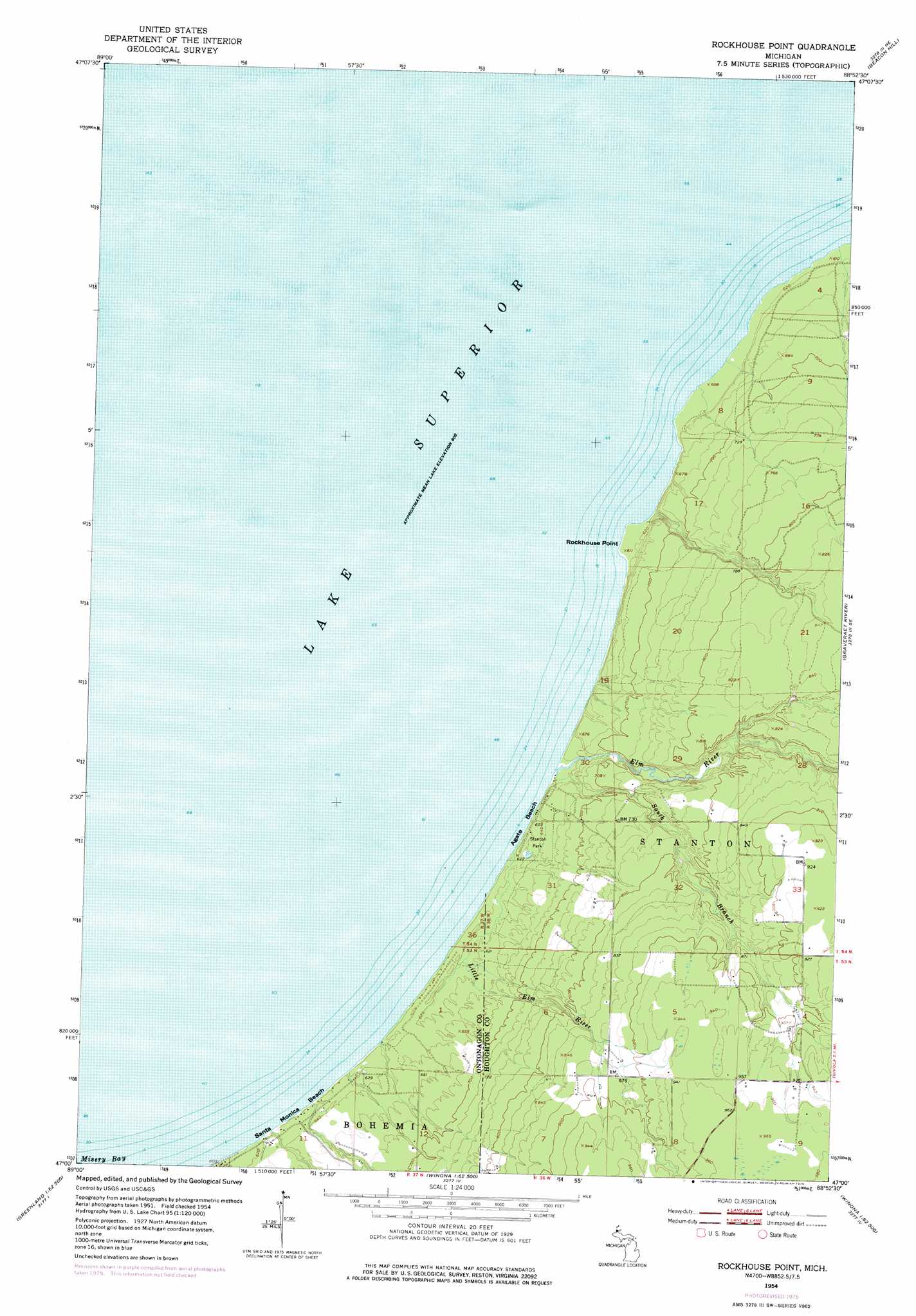
USGS Topo Quad 47088a8 - 1:24,000 scale
| Topo Map Name: | Rockhouse Point |
| USGS Topo Quad ID: | 47088a8 |
| Print Size: | ca. 21 1/4" wide x 27" high |
| Southeast Coordinates: | 47° N latitude / 88.875° W longitude |
| Map Center Coordinates: | 47.0625° N latitude / 88.9375° W longitude |
| U.S. State: | MI |
| Filename: | o47088a8.jpg |
| Download Map JPG Image: | Rockhouse Point topo map 1:24,000 scale |
| Map Type: | Topographic |
| Topo Series: | 7.5´ |
| Map Scale: | 1:24,000 |
| Source of Map Images: | United States Geological Survey (USGS) |
| Alternate Map Versions: |
Rockhouse Point MI 1954, updated 1956 Download PDF Buy paper map Rockhouse Point MI 1954, updated 1976 Download PDF Buy paper map Rockhouse Point MI 2011 Download PDF Buy paper map Rockhouse Point MI 2014 Download PDF Buy paper map Rockhouse Point MI 2017 Download PDF Buy paper map |
1:24,000 Topo Quads surrounding Rockhouse Point
Beacon Hill |
Oskar |
|||
Rockhouse Point |
Graveraet River |
South Range |
||
Tenmile Point |
Four Corners |
Winona North |
Donken |
Pine Lake |
Firesteel |
Greenland |
Winona South |
Nisula |
Pelkie |
> Back to 47088a1 at 1:100,000 scale
> Back to 47088a1 at 1:250,000 scale
> Back to U.S. Topo Maps home
Rockhouse Point topo map: Gazetteer
Rockhouse Point: Bays
Misery Bay elevation 183m 600′Rockhouse Point: Beaches
Agate Beach elevation 190m 623′Santa Monica Beach elevation 191m 626′
Rockhouse Point: Capes
Rockhouse Point elevation 186m 610′Rockhouse Point: Parks
Stanton Park elevation 196m 643′Rockhouse Point: Streams
Elm River elevation 184m 603′Little Elm River elevation 185m 606′
South Branch Elm River elevation 185m 606′
Rockhouse Point digital topo map on disk
Buy this Rockhouse Point topo map showing relief, roads, GPS coordinates and other geographical features, as a high-resolution digital map file on DVD: