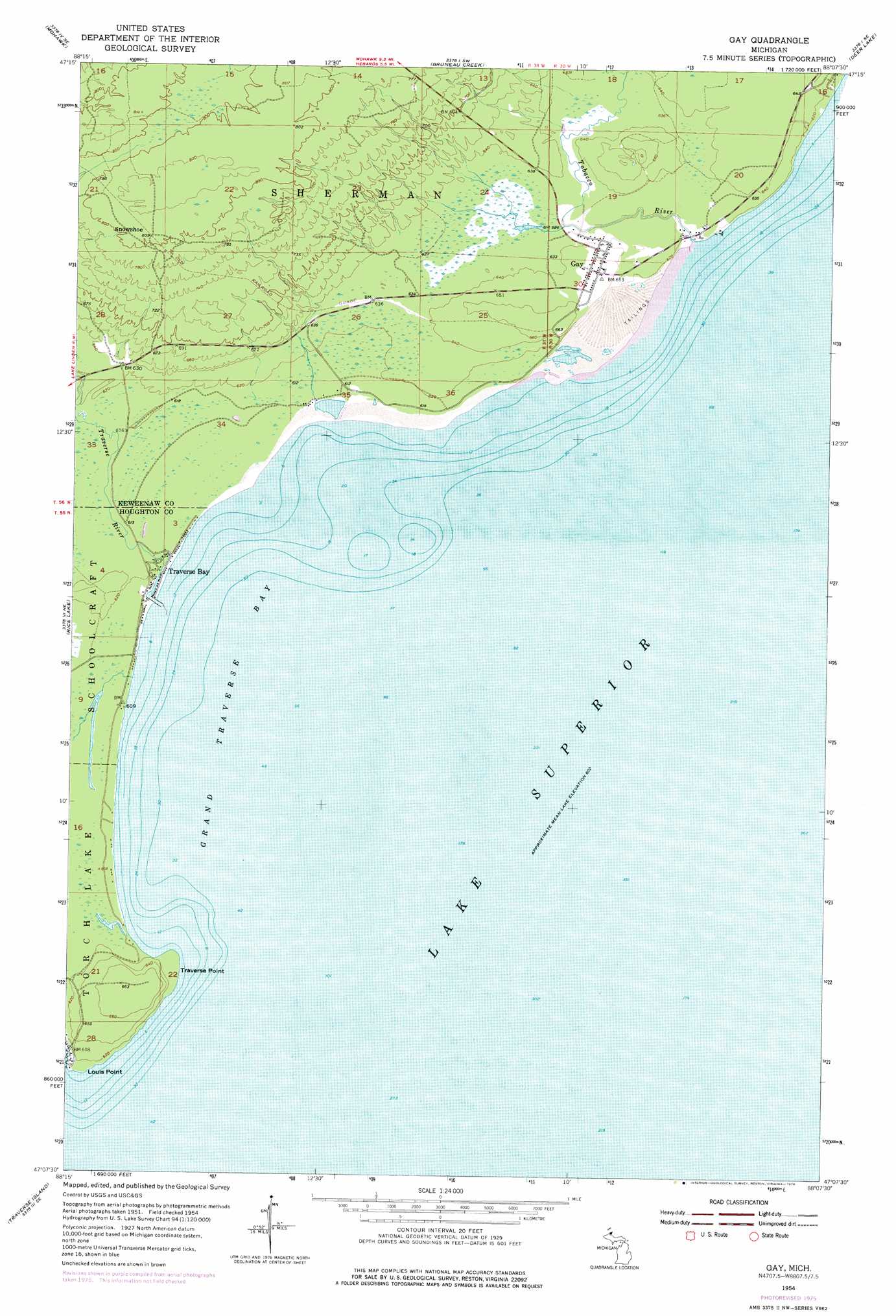
Gay Topo Map Michigan
To zoom in, hover over the map of Gay
USGS Topo Quad 47088b2 - 1:24,000 scale
| Topo Map Name: | Gay |
| USGS Topo Quad ID: | 47088b2 |
| Print Size: | ca. 21 1/4" wide x 27" high |
| Southeast Coordinates: | 47.125° N latitude / 88.125° W longitude |
| Map Center Coordinates: | 47.1875° N latitude / 88.1875° W longitude |
| U.S. State: | MI |
| Filename: | o47088b2.jpg |
| Download Map JPG Image: | Gay topo map 1:24,000 scale |
| Map Type: | Topographic |
| Topo Series: | 7.5´ |
| Map Scale: | 1:24,000 |
| Source of Map Images: | United States Geological Survey (USGS) |
| Alternate Map Versions: |
Gay MI 1954, updated 1955 Download PDF Buy paper map Gay MI 1954, updated 1972 Download PDF Buy paper map Gay MI 1954, updated 1976 Download PDF Buy paper map Gay MI 2011 Download PDF Buy paper map Gay MI 2014 Download PDF Buy paper map Gay MI 2017 Download PDF Buy paper map |
1:24,000 Topo Quads surrounding Gay
Phoenix |
Eagle Harbor |
Delaware |
Lake Medora |
|
Ahmeek |
Mohawk |
Bruneau Creek |
Deer Lake |
Point Isabelle |
Laurium |
Rice Lake |
Gay |
||
Point Mills |
Traverse Island |
|||
Portage Entry |
Keweenaw Bay Ne |
Skanee North |
Glovers Corner |
Howe Lake |
> Back to 47088a1 at 1:100,000 scale
> Back to 47088a1 at 1:250,000 scale
> Back to U.S. Topo Maps home
Gay topo map: Gazetteer
Gay: Bays
Grand Traverse Bay elevation 184m 603′Gay: Capes
Louis Point elevation 185m 606′Traverse Point elevation 187m 613′
Gay: Populated Places
Gay elevation 190m 623′Snowshoe elevation 245m 803′
Traverse Bay elevation 188m 616′
Gay: Post Offices
Gay Post Office (historical) elevation 190m 623′Gay: Streams
Tobacco River elevation 188m 616′Traverse River elevation 184m 603′
Gay digital topo map on disk
Buy this Gay topo map showing relief, roads, GPS coordinates and other geographical features, as a high-resolution digital map file on DVD: