Beacon Hill Topo Map Michigan
To zoom in, hover over the map of Beacon Hill
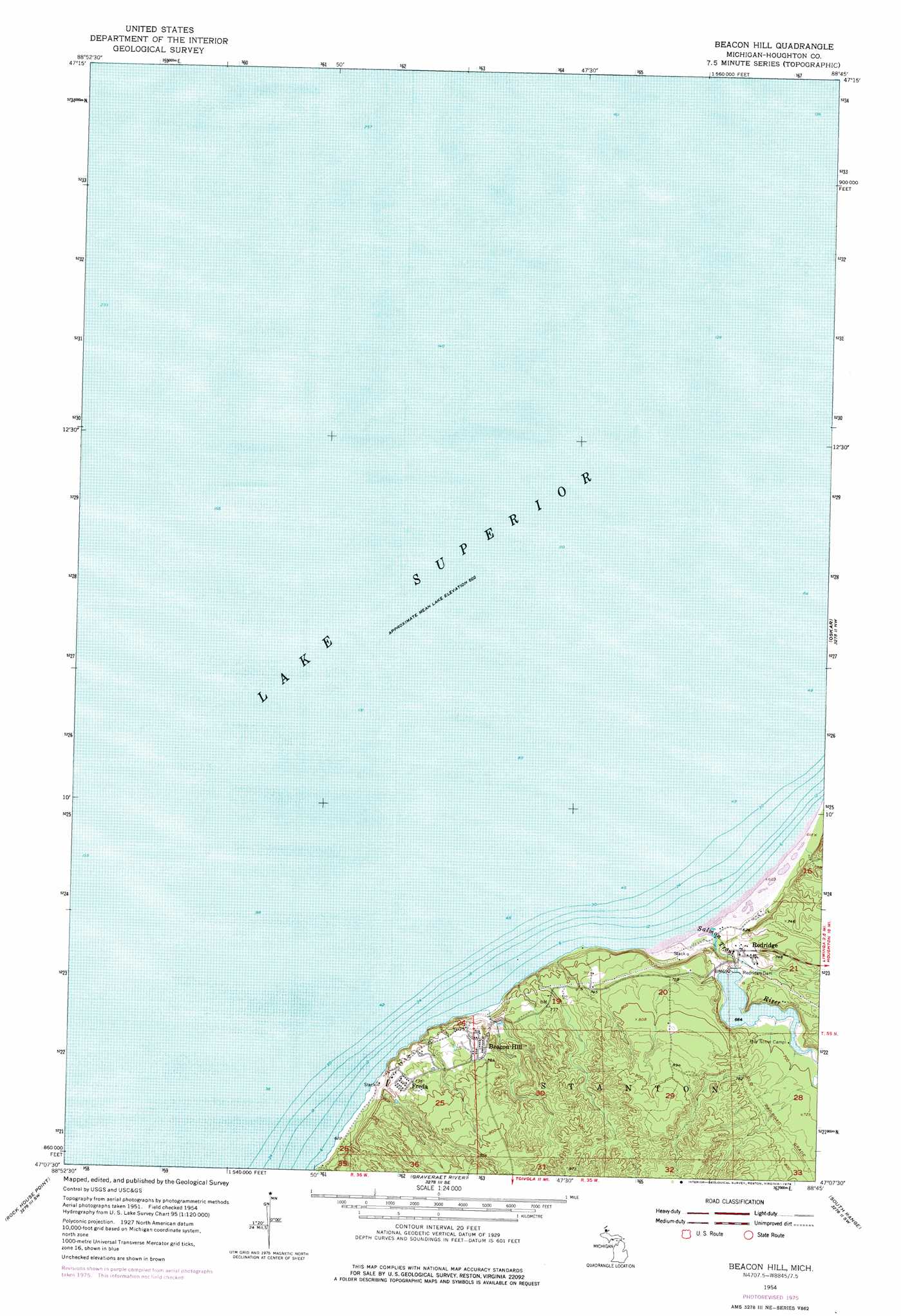
USGS Topo Quad 47088b7 - 1:24,000 scale
| Topo Map Name: | Beacon Hill |
| USGS Topo Quad ID: | 47088b7 |
| Print Size: | ca. 21 1/4" wide x 27" high |
| Southeast Coordinates: | 47.125° N latitude / 88.75° W longitude |
| Map Center Coordinates: | 47.1875° N latitude / 88.8125° W longitude |
| U.S. State: | MI |
| Filename: | o47088b7.jpg |
| Download Map JPG Image: | Beacon Hill topo map 1:24,000 scale |
| Map Type: | Topographic |
| Topo Series: | 7.5´ |
| Map Scale: | 1:24,000 |
| Source of Map Images: | United States Geological Survey (USGS) |
| Alternate Map Versions: |
Beacon Hill MI 1954, updated 1956 Download PDF Buy paper map Beacon Hill MI 1954, updated 1972 Download PDF Buy paper map Beacon Hill MI 1954, updated 1976 Download PDF Buy paper map Beacon Hill MI 2011 Download PDF Buy paper map Beacon Hill MI 2014 Download PDF Buy paper map Beacon Hill MI 2017 Download PDF Buy paper map |
1:24,000 Topo Quads surrounding Beacon Hill
Muggun Creek |
||||
Beacon Hill |
Oskar |
Hancock |
||
Rockhouse Point |
Graveraet River |
South Range |
Chassell |
|
Four Corners |
Winona North |
Donken |
Pine Lake |
Otter Lake |
> Back to 47088a1 at 1:100,000 scale
> Back to 47088a1 at 1:250,000 scale
> Back to U.S. Topo Maps home
Beacon Hill topo map: Gazetteer
Beacon Hill: Dams
Redridge Dam elevation 202m 662′Beacon Hill: Populated Places
Beacon Hill elevation 229m 751′Freda elevation 225m 738′
Redridge elevation 209m 685′
Beacon Hill: Post Offices
Beacon Hill Post Office (historical) elevation 229m 751′Freda Post Office (historical) elevation 225m 738′
Redridge Post Office (historical) elevation 209m 685′
Beacon Hill: Streams
Salmon Trout River elevation 183m 600′Beacon Hill digital topo map on disk
Buy this Beacon Hill topo map showing relief, roads, GPS coordinates and other geographical features, as a high-resolution digital map file on DVD: