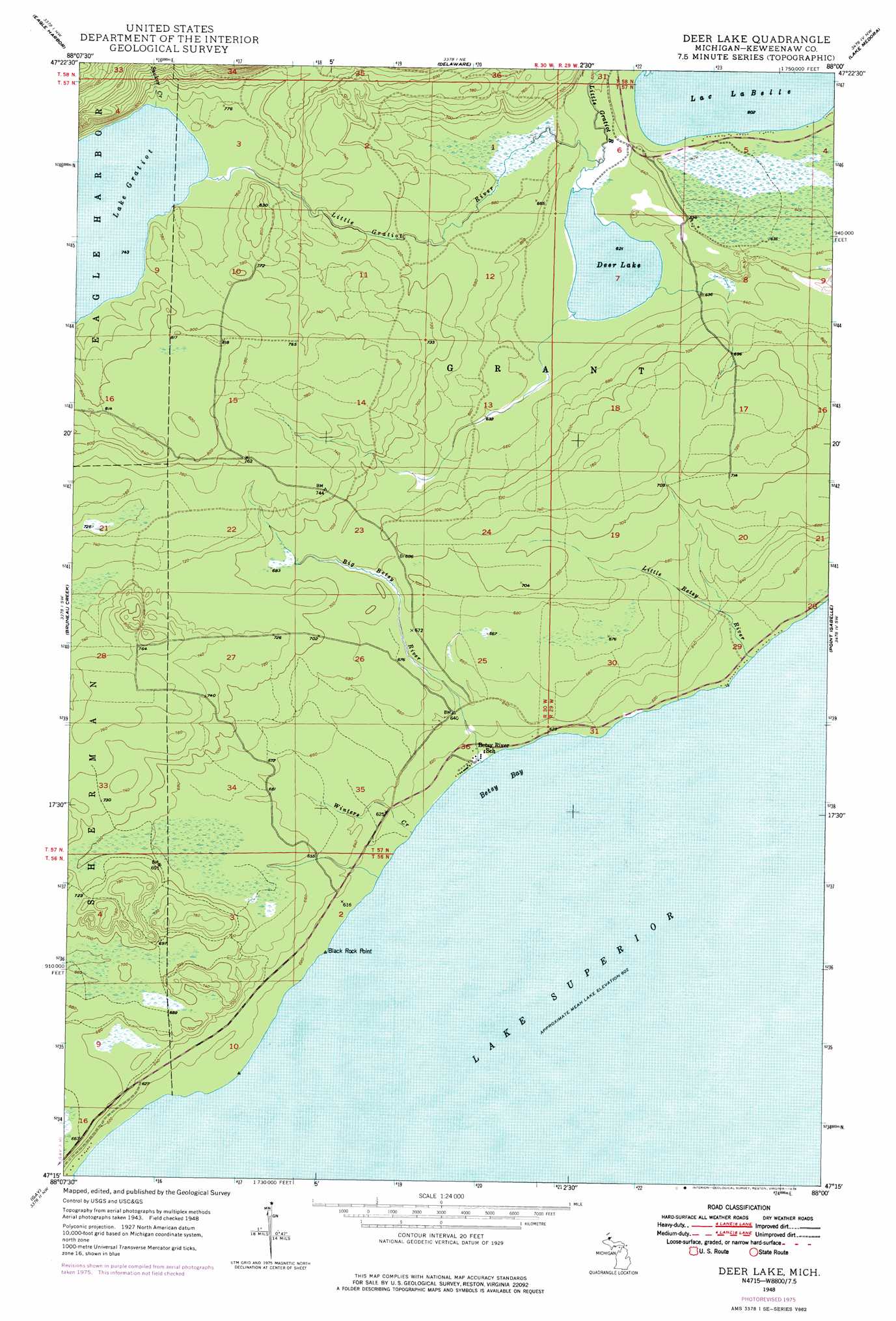
Deer Lake Topo Map Michigan
To zoom in, hover over the map of Deer Lake
USGS Topo Quad 47088c1 - 1:24,000 scale
| Topo Map Name: | Deer Lake |
| USGS Topo Quad ID: | 47088c1 |
| Print Size: | ca. 21 1/4" wide x 27" high |
| Southeast Coordinates: | 47.25° N latitude / 88° W longitude |
| Map Center Coordinates: | 47.3125° N latitude / 88.0625° W longitude |
| U.S. State: | MI |
| Filename: | o47088c1.jpg |
| Download Map JPG Image: | Deer Lake topo map 1:24,000 scale |
| Map Type: | Topographic |
| Topo Series: | 7.5´ |
| Map Scale: | 1:24,000 |
| Source of Map Images: | United States Geological Survey (USGS) |
| Alternate Map Versions: |
Deer Lake MI 1948, updated 1965 Download PDF Buy paper map Deer Lake MI 1948, updated 1976 Download PDF Buy paper map Deer Lake MI 1949, updated 1949 Download PDF Buy paper map Deer Lake MI 2011 Download PDF Buy paper map Deer Lake MI 2014 Download PDF Buy paper map Deer Lake MI 2017 Download PDF Buy paper map |
1:24,000 Topo Quads surrounding Deer Lake
Phoenix |
Eagle Harbor |
Delaware |
Lake Medora |
Fort Wilkins |
Mohawk |
Bruneau Creek |
Deer Lake |
Point Isabelle |
|
Rice Lake |
Gay |
|||
Traverse Island |
> Back to 47088a1 at 1:100,000 scale
> Back to 47088a1 at 1:250,000 scale
> Back to U.S. Topo Maps home
Deer Lake topo map: Gazetteer
Deer Lake: Bays
Betsy Bay elevation 183m 600′Deer Lake: Capes
Black Rock Point elevation 185m 606′Deer Lake: Lakes
Deer Lake elevation 189m 620′Deer Lake: Populated Places
Betsy elevation 186m 610′Deer Lake: Streams
Big Betsy River elevation 186m 610′Little Betsy River elevation 184m 603′
Sucker Creek elevation 226m 741′
Winters Creek elevation 185m 606′
Deer Lake digital topo map on disk
Buy this Deer Lake topo map showing relief, roads, GPS coordinates and other geographical features, as a high-resolution digital map file on DVD: