Lake Richie Topo Map Michigan
To zoom in, hover over the map of Lake Richie
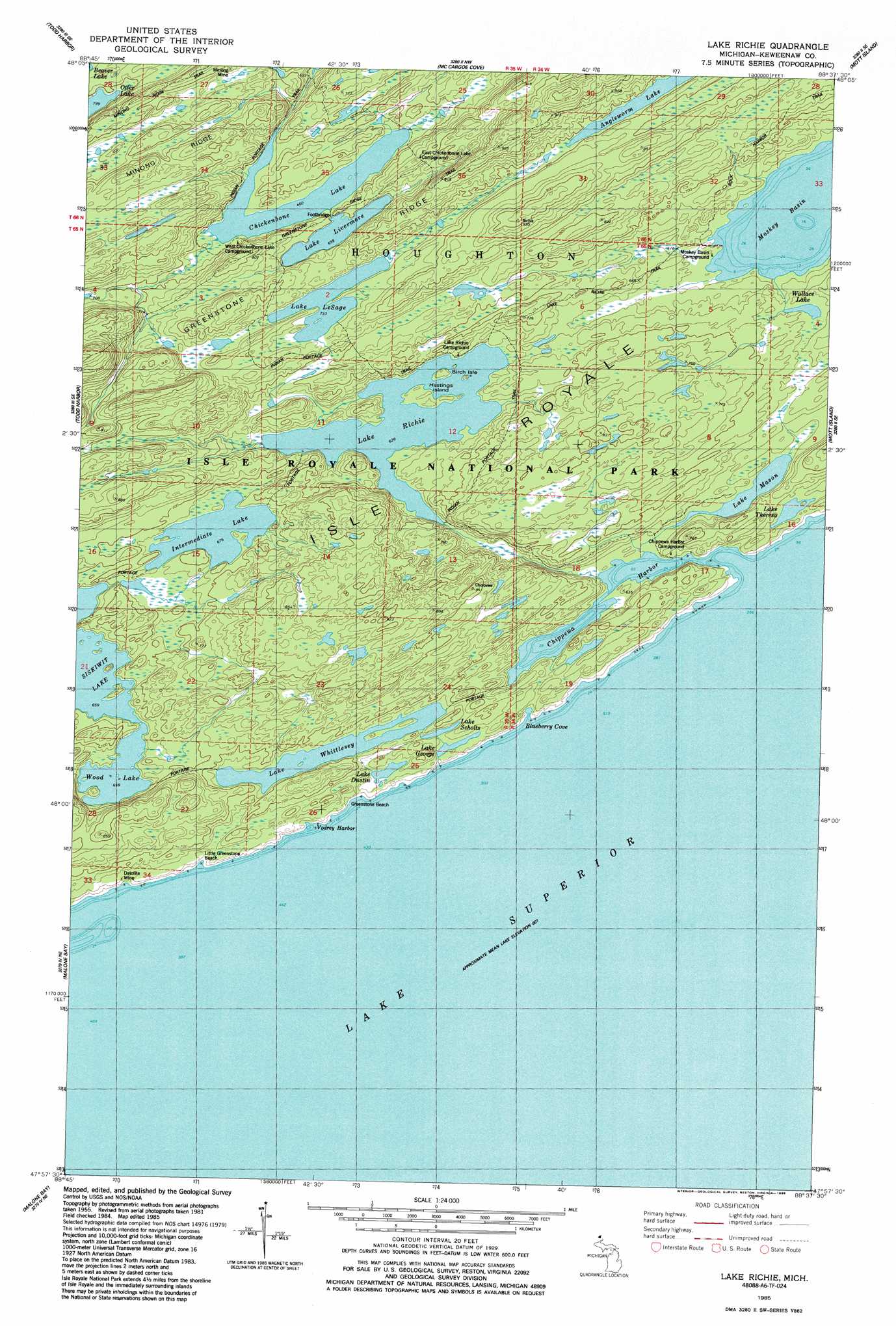
USGS Topo Quad 47088h6 - 1:24,000 scale
| Topo Map Name: | Lake Richie |
| USGS Topo Quad ID: | 47088h6 |
| Print Size: | ca. 21 1/4" wide x 27" high |
| Southeast Coordinates: | 47.875° N latitude / 88.625° W longitude |
| Map Center Coordinates: | 47.9375° N latitude / 88.6875° W longitude |
| U.S. State: | MI |
| Filename: | o47088h6.jpg |
| Download Map JPG Image: | Lake Richie topo map 1:24,000 scale |
| Map Type: | Topographic |
| Topo Series: | 7.5´ |
| Map Scale: | 1:24,000 |
| Source of Map Images: | United States Geological Survey (USGS) |
| Alternate Map Versions: |
Lake Richie OE S MI 2011 Download PDF Buy paper map Lake Richie OE S MI 2014 Download PDF Buy paper map Lake Richie OE S MI 2017 Download PDF Buy paper map |
1:24,000 Topo Quads surrounding Lake Richie
Belle Harbor |
Rock Harbor Lodge |
|||
Todd Harbor |
McCargoe Cove |
Mott Island |
||
Point Houghton |
Malone Bay |
Lake Richie |
||
Point Houghton |
||||
> Back to 47088e1 at 1:100,000 scale
> Back to 47088a1 at 1:250,000 scale
> Back to U.S. Topo Maps home
Lake Richie topo map: Gazetteer
Lake Richie: Bars
Glenlyon Shoal elevation 183m 600′Lake Richie: Bays
Vodrey Harbor elevation 183m 600′Lake Richie: Beaches
Little Greenstone Beach elevation 186m 610′Lake Richie: Mines
Datolite Mine elevation 196m 643′Lake Richie digital topo map on disk
Buy this Lake Richie topo map showing relief, roads, GPS coordinates and other geographical features, as a high-resolution digital map file on DVD: