Tofte Topo Map Minnesota
To zoom in, hover over the map of Tofte
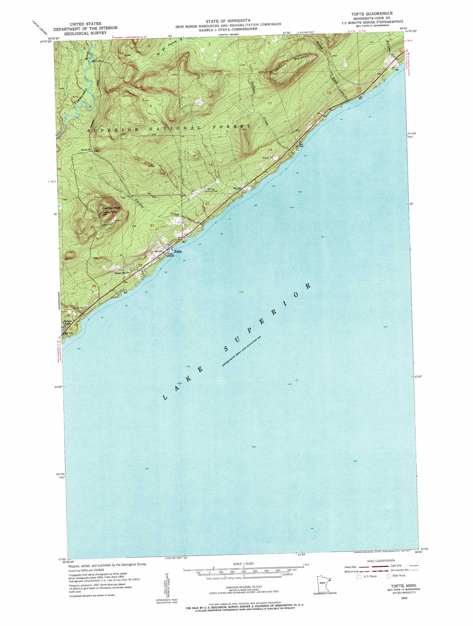
USGS Topo Quad 47090e7 - 1:24,000 scale
| Topo Map Name: | Tofte |
| USGS Topo Quad ID: | 47090e7 |
| Print Size: | ca. 21 1/4" wide x 27" high |
| Southeast Coordinates: | 47.5° N latitude / 90.75° W longitude |
| Map Center Coordinates: | 47.5625° N latitude / 90.8125° W longitude |
| U.S. State: | MN |
| Filename: | o47090e7.jpg |
| Download Map JPG Image: | Tofte topo map 1:24,000 scale |
| Map Type: | Topographic |
| Topo Series: | 7.5´ |
| Map Scale: | 1:24,000 |
| Source of Map Images: | United States Geological Survey (USGS) |
| Alternate Map Versions: |
Tofte MN 1955, updated 1957 Download PDF Buy paper map Tofte MN 2011 Download PDF Buy paper map Tofte MN 2013 Download PDF Buy paper map Tofte MN 2016 Download PDF Buy paper map |
| FStopo: | US Forest Service topo Tofte is available: Download FStopo PDF Download FStopo TIF |
1:24,000 Topo Quads surrounding Tofte
Kawishiwi Lake |
Beth Lake |
Sawbill Camp |
Tait Lake |
Mark Lake |
Wilson Lake |
Toohey Lake |
Honeymoon Mountain |
Lutsen |
Deer Yard Lake |
Cramer |
Schroeder |
Tofte |
||
Little Marais |
||||
> Back to 47090e1 at 1:100,000 scale
> Back to 47090a1 at 1:250,000 scale
> Back to U.S. Topo Maps home
Tofte topo map: Gazetteer
Tofte: Airports
Grevais Landing Field elevation 241m 790′Tofte Airport elevation 241m 790′
Tofte: Falls
Hidden Falls elevation 215m 705′Tofte: Parks
Ray Berglund Wayside and Recreation Site elevation 187m 613′Temperance River Roadside Parking Area elevation 194m 636′
Temperance River State Park elevation 202m 662′
Tofte: Populated Places
Tofte elevation 191m 626′Tofte: Post Offices
Tofte Post Office elevation 190m 623′Tofte: Streams
Carlton Creek elevation 188m 616′Leveaux Creek elevation 185m 606′
Onion River elevation 183m 600′
Rollins Creek elevation 185m 606′
Temperance River elevation 185m 606′
Tofte: Summits
Carlton Peak elevation 462m 1515′Leveaux Mountain elevation 469m 1538′
Tofte: Trails
Superior Hiking Trail elevation 190m 623′Tofte digital topo map on disk
Buy this Tofte topo map showing relief, roads, GPS coordinates and other geographical features, as a high-resolution digital map file on DVD: