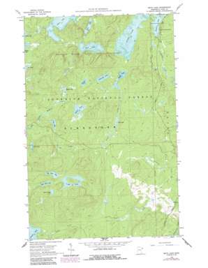
Beth Lake Topo Map Minnesota
To zoom in, hover over the map of Beth Lake
USGS Topo Quad 47090g8 - 1:24,000 scale
| Topo Map Name: | Beth Lake |
| USGS Topo Quad ID: | 47090g8 |
| Print Size: | ca. 21 1/4" wide x 27" high |
| Southeast Coordinates: | 47.75° N latitude / 90.875° W longitude |
| Map Center Coordinates: | 47.8125° N latitude / 90.9375° W longitude |
| U.S. State: | MN |
| Filename: | o47090g8.jpg |
| Download Map JPG Image: | Beth Lake topo map 1:24,000 scale |
| Map Type: | Topographic |
| Topo Series: | 7.5´ |
| Map Scale: | 1:24,000 |
| Source of Map Images: | United States Geological Survey (USGS) |
| Alternate Map Versions: |
Beth Lake MN 1960, updated 1962 Download PDF Buy paper map Beth Lake MN 1960, updated 1966 Download PDF Buy paper map Beth Lake MN 1960, updated 1986 Download PDF Buy paper map Beth Lake MN 2011 Download PDF Buy paper map Beth Lake MN 2013 Download PDF Buy paper map Beth Lake MN 2016 Download PDF Buy paper map |
| FStopo: | US Forest Service topo Beth Lake is available: Download FStopo PDF Download FStopo TIF |
1:24,000 Topo Quads surrounding Beth Lake
> Back to 47090e1 at 1:100,000 scale
> Back to 47090a1 at 1:250,000 scale
> Back to U.S. Topo Maps home
Beth Lake topo map: Gazetteer
Beth Lake: Lakes
Alton Lake elevation 549m 1801′Beth Lake elevation 563m 1847′
Big Snow Lake elevation 564m 1850′
Bollar Lake elevation 562m 1843′
Clover Lake elevation 542m 1778′
Ella Lake elevation 567m 1860′
Grace Lake elevation 542m 1778′
Hog Lake elevation 567m 1860′
Little Snow Lake elevation 570m 1870′
Maggie Lake elevation 546m 1791′
Paoli Lake elevation 540m 1771′
Retreat Lake elevation 582m 1909′
Sunhigh Lake elevation 554m 1817′
Sunlow Lake elevation 558m 1830′
Timber Lake elevation 514m 1686′
Vyre Lake elevation 535m 1755′
Wonder Lake elevation 552m 1811′
Beth Lake: Streams
Maggie Creek elevation 535m 1755′Pecore Creek elevation 481m 1578′
Timber Creek elevation 514m 1686′
Beth Lake digital topo map on disk
Buy this Beth Lake topo map showing relief, roads, GPS coordinates and other geographical features, as a high-resolution digital map file on DVD:


