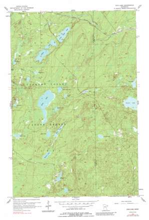
King Lake Topo Map Minnesota
To zoom in, hover over the map of King Lake
USGS Topo Quad 47091b7 - 1:24,000 scale
| Topo Map Name: | King Lake |
| USGS Topo Quad ID: | 47091b7 |
| Print Size: | ca. 21 1/4" wide x 27" high |
| Southeast Coordinates: | 47.125° N latitude / 91.75° W longitude |
| Map Center Coordinates: | 47.1875° N latitude / 91.8125° W longitude |
| U.S. State: | MN |
| Filename: | o47091b7.jpg |
| Download Map JPG Image: | King Lake topo map 1:24,000 scale |
| Map Type: | Topographic |
| Topo Series: | 7.5´ |
| Map Scale: | 1:24,000 |
| Source of Map Images: | United States Geological Survey (USGS) |
| Alternate Map Versions: |
King Lake MN 1956, updated 1958 Download PDF Buy paper map King Lake MN 1956, updated 1962 Download PDF Buy paper map King Lake MN 1956, updated 1989 Download PDF Buy paper map King Lake MN 2010 Download PDF Buy paper map King Lake MN 2013 Download PDF Buy paper map King Lake MN 2016 Download PDF Buy paper map |
1:24,000 Topo Quads surrounding King Lake
> Back to 47091a1 at 1:100,000 scale
> Back to 47090a1 at 1:250,000 scale
> Back to U.S. Topo Maps home
King Lake topo map: Gazetteer
King Lake: Dams
Heinz-Meschbach Wildlife Pond Dam elevation 509m 1669′King Lake: Lakes
Beaver Lake elevation 479m 1571′Buzz Lake elevation 457m 1499′
Chris Lake elevation 480m 1574′
Devine Lake elevation 459m 1505′
Evelyn Lake elevation 468m 1535′
Grande Lake elevation 482m 1581′
James Lake elevation 457m 1499′
King Lake elevation 475m 1558′
Kookoosh Lake elevation 475m 1558′
Little Coyote Lake elevation 475m 1558′
Little Stone Lake elevation 469m 1538′
Loaine Lake elevation 469m 1538′
Long Lake elevation 507m 1663′
Pigeon Lake elevation 485m 1591′
Ruth Lake elevation 482m 1581′
Sawmill Lake elevation 520m 1706′
Schaeffer Lake elevation 484m 1587′
Stewart Lake elevation 497m 1630′
Stone Lake elevation 466m 1528′
King Lake: Post Offices
Drummond Post Office (historical) elevation 522m 1712′King Lake: Reservoirs
Donna Lake elevation 495m 1624′King Lake digital topo map on disk
Buy this King Lake topo map showing relief, roads, GPS coordinates and other geographical features, as a high-resolution digital map file on DVD:


