Finland Topo Map Minnesota
To zoom in, hover over the map of Finland
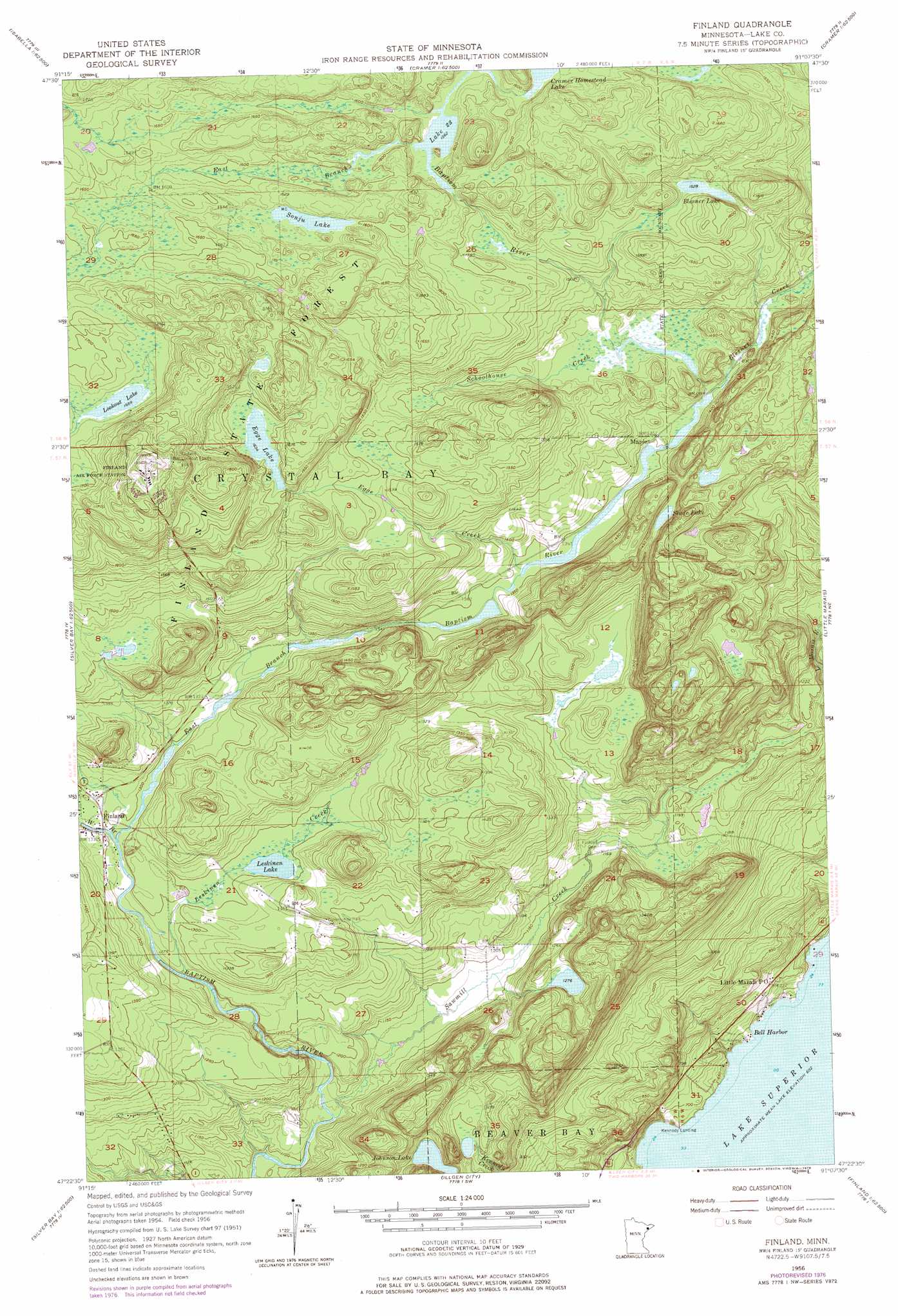
USGS Topo Quad 47091d2 - 1:24,000 scale
| Topo Map Name: | Finland |
| USGS Topo Quad ID: | 47091d2 |
| Print Size: | ca. 21 1/4" wide x 27" high |
| Southeast Coordinates: | 47.375° N latitude / 91.125° W longitude |
| Map Center Coordinates: | 47.4375° N latitude / 91.1875° W longitude |
| U.S. State: | MN |
| Filename: | o47091d2.jpg |
| Download Map JPG Image: | Finland topo map 1:24,000 scale |
| Map Type: | Topographic |
| Topo Series: | 7.5´ |
| Map Scale: | 1:24,000 |
| Source of Map Images: | United States Geological Survey (USGS) |
| Alternate Map Versions: |
Finland MN 1956, updated 1958 Download PDF Buy paper map Finland MN 1956, updated 1964 Download PDF Buy paper map Finland MN 1956, updated 1978 Download PDF Buy paper map Finland MN 2010 Download PDF Buy paper map Finland MN 2013 Download PDF Buy paper map Finland MN 2016 Download PDF Buy paper map |
1:24,000 Topo Quads surrounding Finland
Mitawan Lake |
Sawbill Landing |
Silver Island Lake |
Wilson Lake |
Toohey Lake |
Isabella Station |
Isabella |
Cabin Lake |
Cramer |
Schroeder |
Cloquet Lake |
Doyle Lake |
Finland |
Little Marais |
|
Silver Bay Sw |
Silver Bay |
Illgen City |
||
Split Rock Point |
Split Rock Point Ne |
> Back to 47091a1 at 1:100,000 scale
> Back to 47090a1 at 1:250,000 scale
> Back to U.S. Topo Maps home
Finland topo map: Gazetteer
Finland: Forests
Finland State Forest elevation 545m 1788′Finland: Lakes
Blesener Lake elevation 464m 1522′Cramer Homestead Lake elevation 479m 1571′
Egge Lake elevation 498m 1633′
Johnson Lake elevation 364m 1194′
Lake Twentythree elevation 477m 1564′
Leskinen Lake elevation 394m 1292′
Lookout Lake elevation 507m 1663′
Slade Lake elevation 440m 1443′
Sonju Lake elevation 489m 1604′
Finland: Populated Places
Bell Harbor elevation 184m 603′Finland elevation 405m 1328′
Kennedy Landing elevation 195m 639′
Little Marais Postoffice elevation 215m 705′
Maple elevation 415m 1361′
Finland: Streams
Blesener Creek elevation 415m 1361′East Branch Baptism River elevation 393m 1289′
Egge Creek elevation 410m 1345′
Leskinen Creek elevation 382m 1253′
Sawmill Creek elevation 340m 1115′
Schoolhouse Creek elevation 430m 1410′
West Branch Baptism River elevation 393m 1289′
Finland digital topo map on disk
Buy this Finland topo map showing relief, roads, GPS coordinates and other geographical features, as a high-resolution digital map file on DVD: