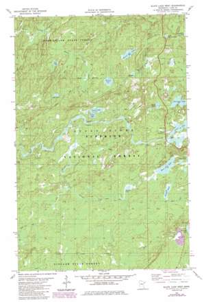
Slate Lake West Topo Map Minnesota
To zoom in, hover over the map of Slate Lake West
USGS Topo Quad 47091f6 - 1:24,000 scale
| Topo Map Name: | Slate Lake West |
| USGS Topo Quad ID: | 47091f6 |
| Print Size: | ca. 21 1/4" wide x 27" high |
| Southeast Coordinates: | 47.625° N latitude / 91.625° W longitude |
| Map Center Coordinates: | 47.6875° N latitude / 91.6875° W longitude |
| U.S. State: | MN |
| Filename: | o47091f6.jpg |
| Download Map JPG Image: | Slate Lake West topo map 1:24,000 scale |
| Map Type: | Topographic |
| Topo Series: | 7.5´ |
| Map Scale: | 1:24,000 |
| Source of Map Images: | United States Geological Survey (USGS) |
| Alternate Map Versions: |
Slate Lake West MN 1981, updated 1982 Download PDF Buy paper map Slate Lake West MN 1981, updated 1985 Download PDF Buy paper map Slate Lake West MN 2011 Download PDF Buy paper map Slate Lake West MN 2013 Download PDF Buy paper map Slate Lake West MN 2016 Download PDF Buy paper map |
| FStopo: | US Forest Service topo Slate Lake West is available: Download FStopo PDF Download FStopo TIF |
1:24,000 Topo Quads surrounding Slate Lake West
> Back to 47091e1 at 1:100,000 scale
> Back to 47090a1 at 1:250,000 scale
> Back to U.S. Topo Maps home
Slate Lake West topo map: Gazetteer
Slate Lake West: Lakes
Beaver Hut Lake elevation 490m 1607′Chow Lake elevation 492m 1614′
Denley Lake elevation 493m 1617′
Dunnigan Lake elevation 506m 1660′
Fran Lake elevation 492m 1614′
Gypsy Lake elevation 507m 1663′
Jackpot Lake elevation 507m 1663′
Little Spring Lake elevation 483m 1584′
Pear Lake elevation 487m 1597′
Pitcha Lake elevation 514m 1686′
Sun Lake elevation 481m 1578′
Tony Lake elevation 492m 1614′
West Chub Lake elevation 513m 1683′
Slate Lake West: Populated Places
Happy Wanderer elevation 497m 1630′Slate Lake West: Streams
Jackpot Creek elevation 503m 1650′Kelly Creek elevation 494m 1620′
Nip Creek elevation 487m 1597′
Nira Creek elevation 452m 1482′
Slate Lake West: Trails
Kelly Trail elevation 486m 1594′Slate Lake West digital topo map on disk
Buy this Slate Lake West topo map showing relief, roads, GPS coordinates and other geographical features, as a high-resolution digital map file on DVD:


