Bogberry Lake Topo Map Minnesota
To zoom in, hover over the map of Bogberry Lake
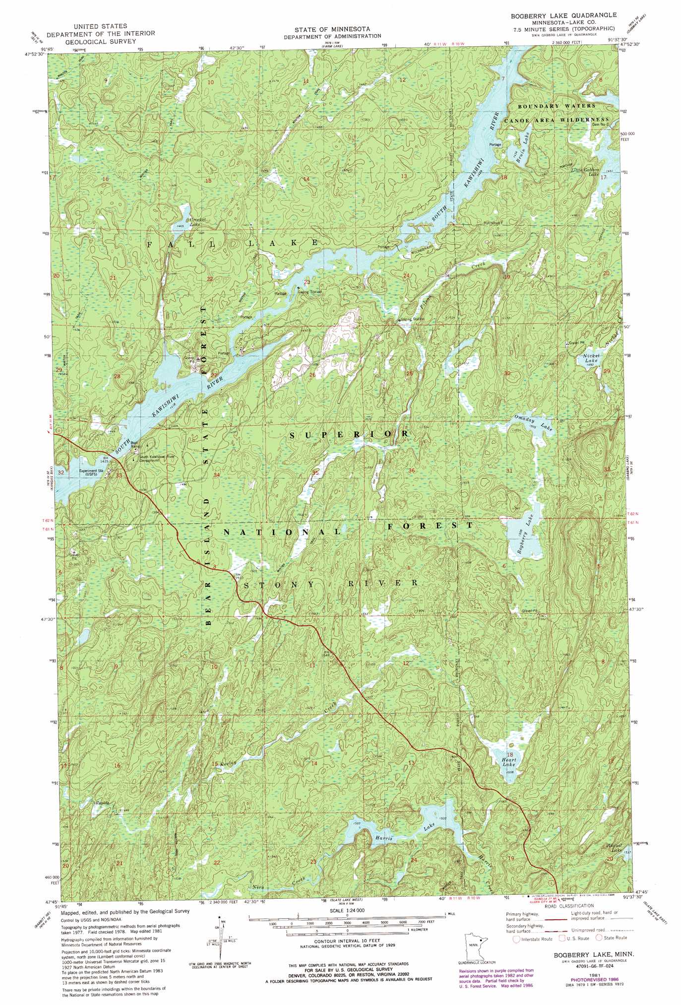
USGS Topo Quad 47091g6 - 1:24,000 scale
| Topo Map Name: | Bogberry Lake |
| USGS Topo Quad ID: | 47091g6 |
| Print Size: | ca. 21 1/4" wide x 27" high |
| Southeast Coordinates: | 47.75° N latitude / 91.625° W longitude |
| Map Center Coordinates: | 47.8125° N latitude / 91.6875° W longitude |
| U.S. State: | MN |
| Filename: | o47091g6.jpg |
| Download Map JPG Image: | Bogberry Lake topo map 1:24,000 scale |
| Map Type: | Topographic |
| Topo Series: | 7.5´ |
| Map Scale: | 1:24,000 |
| Source of Map Images: | United States Geological Survey (USGS) |
| Alternate Map Versions: |
Bogberry Lake MN 1981, updated 1982 Download PDF Buy paper map Bogberry Lake MN 1981, updated 1986 Download PDF Buy paper map Bogberry Lake MN 2011 Download PDF Buy paper map Bogberry Lake MN 2013 Download PDF Buy paper map Bogberry Lake MN 2016 Download PDF Buy paper map |
| FStopo: | US Forest Service topo Bogberry Lake is available: Download FStopo PDF Download FStopo TIF |
1:24,000 Topo Quads surrounding Bogberry Lake
Angleworm Lake |
Fourtown Lake |
Basswood Lake West |
Basswood Lake East |
Ensign Lake West |
Shagawa Lake |
Ely |
Farm Lake |
Ojibway Lake |
Snowbank Lake |
Bear Island |
Kangas Bay |
Bogberry Lake |
Gabbro Lake |
Quadga Lake |
Babbitt |
Babbitt Ne |
Slate Lake West |
Slate Lake East |
Mitawan Lake |
Babbitt Sw |
Babbitt Se |
Greenwood Lake West |
Greenwood Lake East |
Isabella Station |
> Back to 47091e1 at 1:100,000 scale
> Back to 47090a1 at 1:250,000 scale
> Back to U.S. Topo Maps home
Bogberry Lake topo map: Gazetteer
Bogberry Lake: Dams
Dam Number Two elevation 447m 1466′Bogberry Lake: Lakes
Bogberry Lake elevation 460m 1509′Bruin Lake elevation 441m 1446′
Crocket Lake elevation 447m 1466′
Harris Lake elevation 468m 1535′
Heart Lake elevation 475m 1558′
Nickel Lake elevation 455m 1492′
Omaday Lake elevation 459m 1505′
Bogberry Lake: Parks
Kawashiwi River Wayside Park elevation 439m 1440′Bogberry Lake: Reservoirs
Little Gabbro Lake elevation 443m 1453′Bogberry Lake: Streams
Filson Creek elevation 436m 1430′Harris Creek elevation 468m 1535′
Bogberry Lake digital topo map on disk
Buy this Bogberry Lake topo map showing relief, roads, GPS coordinates and other geographical features, as a high-resolution digital map file on DVD: